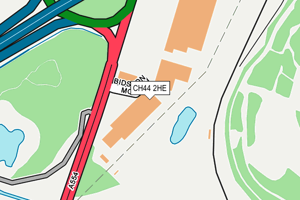
CH44 2HE is located in the Bidston and St James electoral ward, within the metropolitan district of Wirral and the English Parliamentary constituency of Birkenhead. The Sub Integrated Care Board (ICB) Location is NHS Cheshire and Merseyside ICB - 12F and the police force is Merseyside. This postcode has been in use since June 1999.


GetTheData
Source: OS OpenMap – Local (Ordnance Survey)
Source: OS VectorMap District (Ordnance Survey)
Licence: Open Government Licence (requires attribution)
| Easting | 328774 |
| Northing | 391071 |
| Latitude | 53.411639 |
| Longitude | -3.072995 |
GetTheData
Source: Open Postcode Geo
Licence: Open Government Licence
| Country | England |
| Postcode District | CH44 |
➜ See where CH44 is on a map | |
GetTheData
Source: Land Registry Price Paid Data
Licence: Open Government Licence
Elevation or altitude of CH44 2HE as distance above sea level:
| Metres | Feet | |
|---|---|---|
| Elevation | 10m | 33ft |
Elevation is measured from the approximate centre of the postcode, to the nearest point on an OS contour line from OS Terrain 50, which has contour spacing of ten vertical metres.
➜ How high above sea level am I? Find the elevation of your current position using your device's GPS.
GetTheData
Source: Open Postcode Elevation
Licence: Open Government Licence
| Ward | Bidston And St James |
| Constituency | Birkenhead |
GetTheData
Source: ONS Postcode Database
Licence: Open Government Licence
| School Lane (Fender Lane) | Bidston | 610m |
| Bidston Link Road (Fender Lane) | Bidston | 625m |
| Compton Road (Hoylake Road) | Bidston | 677m |
| Bidston Village Road (Hoylake Road) | Bidston | 722m |
| Grant Road (Ross Avenue) | Leasowe | 742m |
| Bidston Station | 0.5km |
| Wallasey Village Station | 1.3km |
| Birkenhead North Station | 1.3km |
GetTheData
Source: NaPTAN
Licence: Open Government Licence
| Median download speed | 24.3Mbps |
| Average download speed | 23.8Mbps |
| Maximum download speed | 30.98Mbps |
| Median upload speed | 4.9Mbps |
| Average upload speed | 4.5Mbps |
| Maximum upload speed | 7.00Mbps |
GetTheData
Source: Ofcom
Licence: Ofcom Terms of Use (requires attribution)
GetTheData
Source: ONS Postcode Database
Licence: Open Government Licence


➜ Get more ratings from the Food Standards Agency
GetTheData
Source: Food Standards Agency
Licence: FSA terms & conditions
| Last Collection | |||
|---|---|---|---|
| Location | Mon-Fri | Sat | Distance |
| Claremont Road | 17:43 | 12:00 | 1,339m |
| Lynhurst Road | 17:15 | 12:00 | 1,389m |
| Buccleugh Street | 17:15 | 12:00 | 1,568m |
GetTheData
Source: Dracos
Licence: Creative Commons Attribution-ShareAlike
| Risk of CH44 2HE flooding from rivers and sea | Low |
| ➜ CH44 2HE flood map | |
GetTheData
Source: Open Flood Risk by Postcode
Licence: Open Government Licence
The below table lists the International Territorial Level (ITL) codes (formerly Nomenclature of Territorial Units for Statistics (NUTS) codes) and Local Administrative Units (LAU) codes for CH44 2HE:
| ITL 1 Code | Name |
|---|---|
| TLD | North West (England) |
| ITL 2 Code | Name |
| TLD7 | Merseyside |
| ITL 3 Code | Name |
| TLD74 | Wirral |
| LAU 1 Code | Name |
| E08000015 | Wirral |
GetTheData
Source: ONS Postcode Directory
Licence: Open Government Licence
The below table lists the Census Output Area (OA), Lower Layer Super Output Area (LSOA), and Middle Layer Super Output Area (MSOA) for CH44 2HE:
| Code | Name | |
|---|---|---|
| OA | E00036063 | |
| LSOA | E01007121 | Wirral 011B |
| MSOA | E02001477 | Wirral 011 |
GetTheData
Source: ONS Postcode Directory
Licence: Open Government Licence
| CH41 7DJ | Compton Road | 653m |
| CH43 7RE | School Lane | 704m |
| CH43 7RQ | School Lane | 705m |
| CH41 7EQ | Treetops Drive | 714m |
| CH43 7XJ | Keele Close | 731m |
| CH41 7DB | Hoylake Road | 748m |
| CH46 2RZ | Grant Road | 751m |
| CH43 7RB | Lennox Lane | 757m |
| CH46 2RX | Grant Road | 783m |
| CH46 1QF | Scoresby Road | 811m |
GetTheData
Source: Open Postcode Geo; Land Registry Price Paid Data
Licence: Open Government Licence