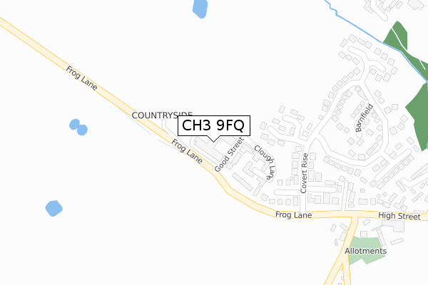
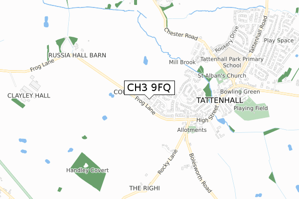
CH3 9FQ is located in the Tattenhall electoral ward, within the unitary authority of Cheshire West and Chester and the English Parliamentary constituency of Eddisbury. The Sub Integrated Care Board (ICB) Location is NHS Cheshire and Merseyside ICB - 27D and the police force is Cheshire. This postcode has been in use since June 2019.


GetTheData
Source: OS Open Zoomstack (Ordnance Survey)
Licence: Open Government Licence (requires attribution)
Attribution: Contains OS data © Crown copyright and database right 2025
Source: Open Postcode Geo
Licence: Open Government Licence (requires attribution)
Attribution: Contains OS data © Crown copyright and database right 2025; Contains Royal Mail data © Royal Mail copyright and database right 2025; Source: Office for National Statistics licensed under the Open Government Licence v.3.0
| Easting | 348058 |
| Northing | 358447 |
| Latitude | 53.120669 |
| Longitude | -2.777582 |
GetTheData
Source: Open Postcode Geo
Licence: Open Government Licence
| Country | England |
| Postcode District | CH3 |
➜ See where CH3 is on a map ➜ Where is Tattenhall? | |
GetTheData
Source: Land Registry Price Paid Data
Licence: Open Government Licence
| Ward | Tattenhall |
| Constituency | Eddisbury |
GetTheData
Source: ONS Postcode Database
Licence: Open Government Licence
| Mitchell's Wine Bar (High Street) | Tattenhall | 391m |
| Mitchell's Wine Bar (High Street) | Tattenhall | 399m |
| Rocky Lane | Tattenhall | 491m |
| Park Primary School (Chester Road) | Tattenhall | 647m |
| Post Office (High Street) | Tattenhall | 669m |
GetTheData
Source: NaPTAN
Licence: Open Government Licence
| Percentage of properties with Next Generation Access | 25.0% |
| Percentage of properties with Superfast Broadband | 25.0% |
| Percentage of properties with Ultrafast Broadband | 0.0% |
| Percentage of properties with Full Fibre Broadband | 0.0% |
Superfast Broadband is between 30Mbps and 300Mbps
Ultrafast Broadband is > 300Mbps
| Percentage of properties unable to receive 2Mbps | 0.0% |
| Percentage of properties unable to receive 5Mbps | 0.0% |
| Percentage of properties unable to receive 10Mbps | 0.0% |
| Percentage of properties unable to receive 30Mbps | 75.0% |
GetTheData
Source: Ofcom
Licence: Ofcom Terms of Use (requires attribution)
GetTheData
Source: ONS Postcode Database
Licence: Open Government Licence

➜ Get more ratings from the Food Standards Agency
GetTheData
Source: Food Standards Agency
Licence: FSA terms & conditions
| Last Collection | |||
|---|---|---|---|
| Location | Mon-Fri | Sat | Distance |
| Aldersley Handley. | 15:00 | 07:00 | 2,560m |
| Coddington, | 14:45 | 07:00 | 4,324m |
| Higher Burwardsley. | 16:30 | 08:00 | 4,641m |
GetTheData
Source: Dracos
Licence: Creative Commons Attribution-ShareAlike
The below table lists the International Territorial Level (ITL) codes (formerly Nomenclature of Territorial Units for Statistics (NUTS) codes) and Local Administrative Units (LAU) codes for CH3 9FQ:
| ITL 1 Code | Name |
|---|---|
| TLD | North West (England) |
| ITL 2 Code | Name |
| TLD6 | Cheshire |
| ITL 3 Code | Name |
| TLD63 | Cheshire West and Chester |
| LAU 1 Code | Name |
| E06000050 | Cheshire West and Chester |
GetTheData
Source: ONS Postcode Directory
Licence: Open Government Licence
The below table lists the Census Output Area (OA), Lower Layer Super Output Area (LSOA), and Middle Layer Super Output Area (MSOA) for CH3 9FQ:
| Code | Name | |
|---|---|---|
| OA | E00092680 | |
| LSOA | E01018371 | Cheshire West and Chester 046C |
| MSOA | E02003809 | Cheshire West and Chester 046 |
GetTheData
Source: ONS Postcode Directory
Licence: Open Government Licence
| CH3 9HB | Gorsefield | 158m |
| CH3 9EZ | Brockway West | 210m |
| CH3 9HA | Covert Rise | 283m |
| CH3 9EY | Brockway East | 297m |
| CH3 9HE | Barnfield | 327m |
| CH3 9QB | Rosemary Row | 343m |
| CH3 9HF | Millbrook End | 377m |
| CH3 9HD | Spinney End | 428m |
| CH3 9QA | High Street | 432m |
| CH3 9PZ | Rose Villas | 437m |
GetTheData
Source: Open Postcode Geo; Land Registry Price Paid Data
Licence: Open Government Licence