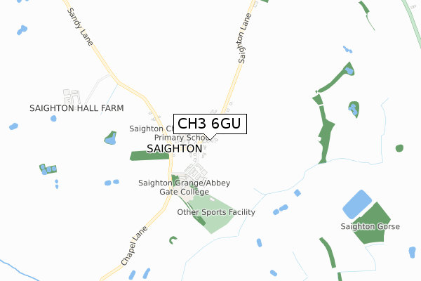
CH3 6GU is located in the Christleton & Huntington electoral ward, within the unitary authority of Cheshire West and Chester and the English Parliamentary constituency of City of Chester. The Sub Integrated Care Board (ICB) Location is NHS Cheshire and Merseyside ICB - 27D and the police force is Cheshire. This postcode has been in use since April 2020.


GetTheData
Source: OS Open Zoomstack (Ordnance Survey)
Licence: Open Government Licence (requires attribution)
Attribution: Contains OS data © Crown copyright and database right 2025
Source: Open Postcode Geo
Licence: Open Government Licence (requires attribution)
Attribution: Contains OS data © Crown copyright and database right 2025; Contains Royal Mail data © Royal Mail copyright and database right 2025; Source: Office for National Statistics licensed under the Open Government Licence v.3.0
| Easting | 344081 |
| Northing | 365202 |
| Latitude | 53.180980 |
| Longitude | -2.838183 |
GetTheData
Source: Open Postcode Geo
Licence: Open Government Licence
| Country | England |
| Postcode District | CH3 |
➜ See where CH3 is on a map ➜ Where is Christleton? | |
GetTheData
Source: Land Registry Price Paid Data
Licence: Open Government Licence
| Ward | Christleton & Huntington |
| Constituency | City Of Chester |
GetTheData
Source: ONS Postcode Database
Licence: Open Government Licence
| Bridge Drive (Whitchurch Road) | Christleton | 256m |
| Bridge Drive (Whitchurch Road) | Christleton | 275m |
| High School (Village Road) | Christleton | 304m |
| High School (Village Road) | Christleton | 320m |
| High School (Grounds) | Christleton | 425m |
| Chester Station | 3.3km |
| Bache Station | 4.7km |
GetTheData
Source: NaPTAN
Licence: Open Government Licence
GetTheData
Source: ONS Postcode Database
Licence: Open Government Licence


➜ Get more ratings from the Food Standards Agency
GetTheData
Source: Food Standards Agency
Licence: FSA terms & conditions
| Last Collection | |||
|---|---|---|---|
| Location | Mon-Fri | Sat | Distance |
| Saighton, | 17:00 | 09:00 | 794m |
| Toll Bar Road. | 17:41 | 12:28 | 1,181m |
| Sainsbury, Caldy Valley, | 17:45 | 12:15 | 1,223m |
GetTheData
Source: Dracos
Licence: Creative Commons Attribution-ShareAlike
The below table lists the International Territorial Level (ITL) codes (formerly Nomenclature of Territorial Units for Statistics (NUTS) codes) and Local Administrative Units (LAU) codes for CH3 6GU:
| ITL 1 Code | Name |
|---|---|
| TLD | North West (England) |
| ITL 2 Code | Name |
| TLD6 | Cheshire |
| ITL 3 Code | Name |
| TLD63 | Cheshire West and Chester |
| LAU 1 Code | Name |
| E06000050 | Cheshire West and Chester |
GetTheData
Source: ONS Postcode Directory
Licence: Open Government Licence
The below table lists the Census Output Area (OA), Lower Layer Super Output Area (LSOA), and Middle Layer Super Output Area (MSOA) for CH3 6GU:
| Code | Name | |
|---|---|---|
| OA | E00092414 | |
| LSOA | E01018323 | Cheshire West and Chester 039A |
| MSOA | E02003805 | Cheshire West and Chester 039 |
GetTheData
Source: ONS Postcode Directory
Licence: Open Government Licence
| CH3 7BN | Bythom Close | 109m |
| CH3 7BW | Bush Road | 122m |
| CH3 7BJ | Home Close | 164m |
| CH3 7BL | Hawthorn Road | 165m |
| CH3 7AY | Quarry Lane | 173m |
| CH3 7AZ | Rowan Park | 181m |
| CH3 7BH | Sandrock Road | 240m |
| CH3 7AX | Woodfields | 245m |
| CH3 7AU | Woodfields | 262m |
| CH3 6AW | Bridge Drive | 291m |
GetTheData
Source: Open Postcode Geo; Land Registry Price Paid Data
Licence: Open Government Licence