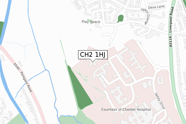
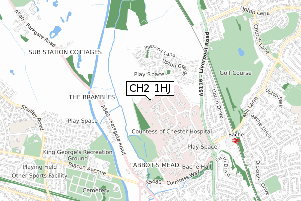
CH2 1HJ is located in the Upton electoral ward, within the unitary authority of Cheshire West and Chester and the English Parliamentary constituency of City of Chester. The Sub Integrated Care Board (ICB) Location is NHS Cheshire and Merseyside ICB - 27D and the police force is Cheshire. This postcode has been in use since October 2019.


GetTheData
Source: OS Open Zoomstack (Ordnance Survey)
Licence: Open Government Licence (requires attribution)
Attribution: Contains OS data © Crown copyright and database right 2025
Source: Open Postcode Geo
Licence: Open Government Licence (requires attribution)
Attribution: Contains OS data © Crown copyright and database right 2025; Contains Royal Mail data © Royal Mail copyright and database right 2025; Source: Office for National Statistics licensed under the Open Government Licence v.3.0
| Easting | 339839 |
| Northing | 368654 |
| Latitude | 53.211542 |
| Longitude | -2.902300 |
GetTheData
Source: Open Postcode Geo
Licence: Open Government Licence
| Country | England |
| Postcode District | CH2 |
➜ See where CH2 is on a map ➜ Where is Chester? | |
GetTheData
Source: Land Registry Price Paid Data
Licence: Open Government Licence
| Ward | Upton |
| Constituency | City Of Chester |
GetTheData
Source: ONS Postcode Database
Licence: Open Government Licence
| Countess Roundabout (Countess Health Park) | Bache | 375m |
| Parkgate Road | Mollington | 392m |
| Canal Bridge (Parkgate Road) | Mollington | 392m |
| Parkgate Road | Mollington | 397m |
| Beechway (Liverpool Road) | Bache | 401m |
| Bache Station | 0.8km |
| Chester Station | 2.2km |
GetTheData
Source: NaPTAN
Licence: Open Government Licence
GetTheData
Source: ONS Postcode Database
Licence: Open Government Licence


➜ Get more ratings from the Food Standards Agency
GetTheData
Source: Food Standards Agency
Licence: FSA terms & conditions
| Last Collection | |||
|---|---|---|---|
| Location | Mon-Fri | Sat | Distance |
| The Bache Post Office. | 17:00 | 12:15 | 685m |
| Eversley Park. | 17:45 | 11:45 | 1,004m |
| Thornton Drive, Newton. | 17:30 | 12:45 | 1,099m |
GetTheData
Source: Dracos
Licence: Creative Commons Attribution-ShareAlike
The below table lists the International Territorial Level (ITL) codes (formerly Nomenclature of Territorial Units for Statistics (NUTS) codes) and Local Administrative Units (LAU) codes for CH2 1HJ:
| ITL 1 Code | Name |
|---|---|
| TLD | North West (England) |
| ITL 2 Code | Name |
| TLD6 | Cheshire |
| ITL 3 Code | Name |
| TLD63 | Cheshire West and Chester |
| LAU 1 Code | Name |
| E06000050 | Cheshire West and Chester |
GetTheData
Source: ONS Postcode Directory
Licence: Open Government Licence
The below table lists the Census Output Area (OA), Lower Layer Super Output Area (LSOA), and Middle Layer Super Output Area (MSOA) for CH2 1HJ:
| Code | Name | |
|---|---|---|
| OA | E00092704 | |
| LSOA | E01018374 | Cheshire West and Chester 028C |
| MSOA | E02003797 | Cheshire West and Chester 028 |
GetTheData
Source: ONS Postcode Directory
Licence: Open Government Licence
| CH2 1DY | Ross Avenue | 272m |
| CH2 1BG | Upton Grange | 274m |
| CH2 1FD | Caldecott Close | 311m |
| CH2 1BF | Upton Grange | 339m |
| CH2 1BL | Upton Grange | 355m |
| CH2 1EZ | Lockwood View | 375m |
| CH2 1DZ | Vivienne Smith Lane | 387m |
| CH2 1DT | Upton Grange | 389m |
| CH2 1EY | Warren Lane | 389m |
| CH2 1FA | Mottershead Court | 426m |
GetTheData
Source: Open Postcode Geo; Land Registry Price Paid Data
Licence: Open Government Licence