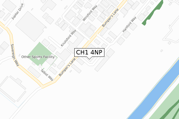
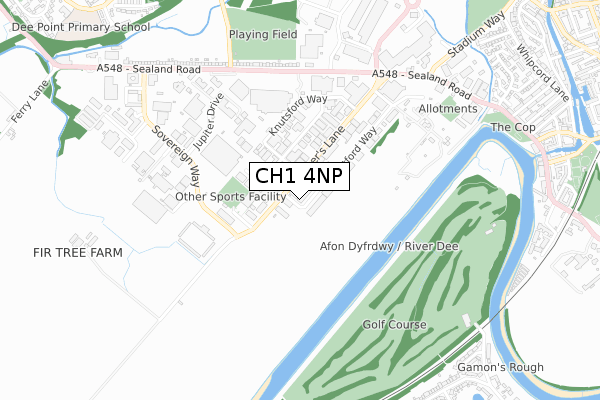
CH1 4NP is located in the Blacon electoral ward, within the unitary authority of Cheshire West and Chester and the English Parliamentary constituency of City of Chester. The Sub Integrated Care Board (ICB) Location is NHS Cheshire and Merseyside ICB - 27D and the police force is Cheshire. This postcode has been in use since March 2019.


GetTheData
Source: OS Open Zoomstack (Ordnance Survey)
Licence: Open Government Licence (requires attribution)
Attribution: Contains OS data © Crown copyright and database right 2025
Source: Open Postcode Geo
Licence: Open Government Licence (requires attribution)
Attribution: Contains OS data © Crown copyright and database right 2025; Contains Royal Mail data © Royal Mail copyright and database right 2025; Source: Office for National Statistics licensed under the Open Government Licence v.3.0
| Easting | 338832 |
| Northing | 366365 |
| Latitude | 53.190854 |
| Longitude | -2.916937 |
GetTheData
Source: Open Postcode Geo
Licence: Open Government Licence
| Country | England |
| Postcode District | CH1 |
➜ See where CH1 is on a map ➜ Where is Chester? | |
GetTheData
Source: Land Registry Price Paid Data
Licence: Open Government Licence
| Ward | Blacon |
| Constituency | City Of Chester |
GetTheData
Source: ONS Postcode Database
Licence: Open Government Licence
| B&q (Sealand Road) | Chester | 532m |
| B&q (Sealand Road) | Chester | 551m |
| Tesco (Sealand Road) | Chester | 576m |
| Tesco (Sealand Road) | Chester | 647m |
| Employment Park (Sealand Road) | Chester | 728m |
| Chester Station | 2.6km |
| Bache Station | 2.6km |
GetTheData
Source: NaPTAN
Licence: Open Government Licence
GetTheData
Source: ONS Postcode Database
Licence: Open Government Licence


➜ Get more ratings from the Food Standards Agency
GetTheData
Source: Food Standards Agency
Licence: FSA terms & conditions
| Last Collection | |||
|---|---|---|---|
| Location | Mon-Fri | Sat | Distance |
| Chester Mail Centre Jupiter Dr | 19:30 | 13:30 | 406m |
| Bumpers Lane, Business Box. | 18:30 | 519m | |
| Bumpers Lane, | 18:30 | 12:41 | 521m |
GetTheData
Source: Dracos
Licence: Creative Commons Attribution-ShareAlike
The below table lists the International Territorial Level (ITL) codes (formerly Nomenclature of Territorial Units for Statistics (NUTS) codes) and Local Administrative Units (LAU) codes for CH1 4NP:
| ITL 1 Code | Name |
|---|---|
| TLD | North West (England) |
| ITL 2 Code | Name |
| TLD6 | Cheshire |
| ITL 3 Code | Name |
| TLD63 | Cheshire West and Chester |
| LAU 1 Code | Name |
| E06000050 | Cheshire West and Chester |
GetTheData
Source: ONS Postcode Directory
Licence: Open Government Licence
The below table lists the Census Output Area (OA), Lower Layer Super Output Area (LSOA), and Middle Layer Super Output Area (MSOA) for CH1 4NP:
| Code | Name | |
|---|---|---|
| OA | E00092453 | |
| LSOA | E01018330 | Cheshire West and Chester 034D |
| MSOA | E02003803 | Cheshire West and Chester 034 |
GetTheData
Source: ONS Postcode Directory
Licence: Open Government Licence
| CH1 4LT | Bumpers Lane | 177m |
| CH1 4NS | Knutsford Way | 294m |
| CH1 4NT | Hartford Way | 381m |
| CH1 4QX | Sovereign Way | 508m |
| CH1 4LG | Sealand Road | 571m |
| CH1 4RN | Park West | 585m |
| CH1 4RJ | Park West | 635m |
| CH1 4LH | Sealand Road | 707m |
| CH1 4LD | Sealand Road | 727m |
| CH1 4LU | Stendall Road | 786m |
GetTheData
Source: Open Postcode Geo; Land Registry Price Paid Data
Licence: Open Government Licence