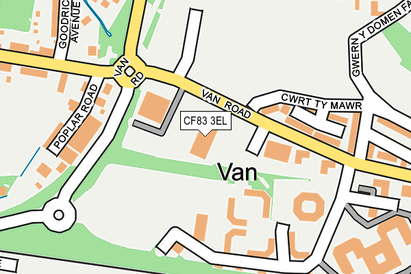
CF83 3EL is located in the Van electoral ward, within the unitary authority of Caerphilly and the Welsh Parliamentary constituency of Caerphilly. The Local Health Board is Aneurin Bevan University and the police force is Gwent. This postcode has been in use since July 1995.


GetTheData
Source: OS OpenMap – Local (Ordnance Survey)
Source: OS VectorMap District (Ordnance Survey)
Licence: Open Government Licence (requires attribution)
| Easting | 316412 |
| Northing | 186662 |
| Latitude | 51.572606 |
| Longitude | -3.207514 |
GetTheData
Source: Open Postcode Geo
Licence: Open Government Licence
| Country | Wales |
| Postcode District | CF83 |
➜ See where CF83 is on a map ➜ Where is Caerphilly? | |
GetTheData
Source: Land Registry Price Paid Data
Licence: Open Government Licence
Elevation or altitude of CF83 3EL as distance above sea level:
| Metres | Feet | |
|---|---|---|
| Elevation | 90m | 295ft |
Elevation is measured from the approximate centre of the postcode, to the nearest point on an OS contour line from OS Terrain 50, which has contour spacing of ten vertical metres.
➜ How high above sea level am I? Find the elevation of your current position using your device's GPS.
GetTheData
Source: Open Postcode Elevation
Licence: Open Government Licence
| Ward | Van |
| Constituency | Caerphilly |
GetTheData
Source: ONS Postcode Database
Licence: Open Government Licence
| Caerphilly Business Park (Van Road) | Van | 198m |
| Goodrich (Van Road) | Van | 208m |
| Goodrich (Van Road) | Van | 229m |
| Caerphilly Business Park (Van Road) | Van | 233m |
| Graham Court (Lansbury Park Orbital Road) | Lansbury Park | 505m |
| Caerphilly Station | 0.8km |
| Aber Station | 1.6km |
| Energlyn & Churchill Park Station | 1.9km |
GetTheData
Source: NaPTAN
Licence: Open Government Licence
Estimated total energy consumption in CF83 3EL by fuel type, 2015.
| Consumption (kWh) | 87,068 |
|---|---|
| Meter count | 6 |
| Mean (kWh/meter) | 14,511 |
| Median (kWh/meter) | 13,265 |
GetTheData
Source: Postcode level gas estimates: 2015 (experimental)
Source: Postcode level electricity estimates: 2015 (experimental)
Licence: Open Government Licence
GetTheData
Source: ONS Postcode Database
Licence: Open Government Licence


➜ Get more ratings from the Food Standards Agency
GetTheData
Source: Food Standards Agency
Licence: FSA terms & conditions
| Last Collection | |||
|---|---|---|---|
| Location | Mon-Fri | Sat | Distance |
| Blockbusters | 16:15 | 12:15 | 1,041m |
| Bedwas Road | 17:00 | 12:00 | 1,211m |
| St Martins Road | 17:00 | 12:00 | 1,256m |
GetTheData
Source: Dracos
Licence: Creative Commons Attribution-ShareAlike
The below table lists the International Territorial Level (ITL) codes (formerly Nomenclature of Territorial Units for Statistics (NUTS) codes) and Local Administrative Units (LAU) codes for CF83 3EL:
| ITL 1 Code | Name |
|---|---|
| TLL | Wales |
| ITL 2 Code | Name |
| TLL1 | West Wales and The Valleys |
| ITL 3 Code | Name |
| TLL16 | Gwent Valleys |
| LAU 1 Code | Name |
| W06000018 | Caerphilly |
GetTheData
Source: ONS Postcode Directory
Licence: Open Government Licence
The below table lists the Census Output Area (OA), Lower Layer Super Output Area (LSOA), and Middle Layer Super Output Area (MSOA) for CF83 3EL:
| Code | Name | |
|---|---|---|
| OA | W00007443 | |
| LSOA | W01001419 | Caerphilly 021D |
| MSOA | W02000310 | Caerphilly 021 |
GetTheData
Source: ONS Postcode Directory
Licence: Open Government Licence
| CF83 3RR | Van Road | 185m |
| CF83 3GS | Caerphilly Business Park | 188m |
| CF83 3EQ | Cwrt Ty Mawr | 191m |
| CF83 1LF | Poplar Road | 195m |
| CF83 1LQ | Van Road | 226m |
| CF83 1PS | Vanfield Close | 253m |
| CF83 1LG | Goodrich Avenue | 271m |
| CF83 3RN | Gwern Y Domen Farm Lane | 306m |
| CF83 3EE | Van Terrace | 314m |
| CF83 1PL | Porset Drive | 352m |
GetTheData
Source: Open Postcode Geo; Land Registry Price Paid Data
Licence: Open Government Licence