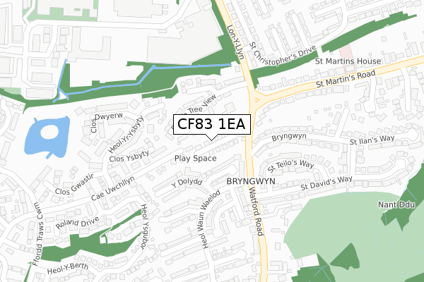
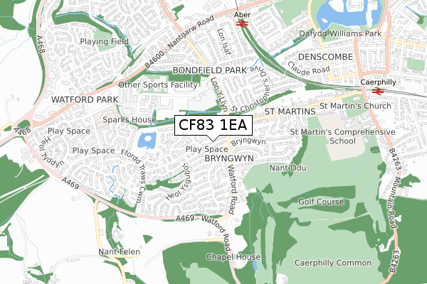
CF83 1EA is located in the St Martins electoral ward, within the unitary authority of Caerphilly and the Welsh Parliamentary constituency of Caerphilly. The Local Health Board is Aneurin Bevan University and the police force is Gwent. This postcode has been in use since December 2017.


GetTheData
Source: OS Open Zoomstack (Ordnance Survey)
Licence: Open Government Licence (requires attribution)
Attribution: Contains OS data © Crown copyright and database right 2025
Source: Open Postcode Geo
Licence: Open Government Licence (requires attribution)
Attribution: Contains OS data © Crown copyright and database right 2025; Contains Royal Mail data © Royal Mail copyright and database right 2025; Source: Office for National Statistics licensed under the Open Government Licence v.3.0
| Easting | 314699 |
| Northing | 186254 |
| Latitude | 51.568683 |
| Longitude | -3.232137 |
GetTheData
Source: Open Postcode Geo
Licence: Open Government Licence
| Country | Wales |
| Postcode District | CF83 |
➜ See where CF83 is on a map ➜ Where is Caerphilly? | |
GetTheData
Source: Land Registry Price Paid Data
Licence: Open Government Licence
| Ward | St Martins |
| Constituency | Caerphilly |
GetTheData
Source: ONS Postcode Database
Licence: Open Government Licence
2, BEECH TREE AVENUE, CAERPHILLY, CF83 1EA 2018 4 MAY £299,950 |
1, BEECH TREE AVENUE, CAERPHILLY, CF83 1EA 2018 30 APR £299,950 |
29, BEECH TREE AVENUE, CAERPHILLY, CF83 1EA 2018 29 JAN £299,950 |
GetTheData
Source: HM Land Registry Price Paid Data
Licence: Contains HM Land Registry data © Crown copyright and database right 2025. This data is licensed under the Open Government Licence v3.0.
| Watford Park (Watford Road) | Watford | 105m |
| Watford Park | Watford | 133m |
| Old Hospital (Lon-y-llyn) | Caerphilly | 154m |
| Old Hospital (Lon-y-llyn) | Caerphilly | 166m |
| Old Hospital (St Martin's Road) | Caerphilly | 186m |
| Aber Station | 0.7km |
| Caerphilly Station | 1km |
| Energlyn & Churchill Park Station | 1.6km |
GetTheData
Source: NaPTAN
Licence: Open Government Licence
| Percentage of properties with Next Generation Access | 100.0% |
| Percentage of properties with Superfast Broadband | 100.0% |
| Percentage of properties with Ultrafast Broadband | 100.0% |
| Percentage of properties with Full Fibre Broadband | 100.0% |
Superfast Broadband is between 30Mbps and 300Mbps
Ultrafast Broadband is > 300Mbps
| Percentage of properties unable to receive 2Mbps | 0.0% |
| Percentage of properties unable to receive 5Mbps | 0.0% |
| Percentage of properties unable to receive 10Mbps | 0.0% |
| Percentage of properties unable to receive 30Mbps | 0.0% |
GetTheData
Source: Ofcom
Licence: Ofcom Terms of Use (requires attribution)
GetTheData
Source: ONS Postcode Database
Licence: Open Government Licence


➜ Get more ratings from the Food Standards Agency
GetTheData
Source: Food Standards Agency
Licence: FSA terms & conditions
| Last Collection | |||
|---|---|---|---|
| Location | Mon-Fri | Sat | Distance |
| St Martins Road | 17:00 | 12:00 | 508m |
| Nantgarw Road | 17:15 | 12:00 | 940m |
| Mill Road | 16:30 | 12:00 | 1,358m |
GetTheData
Source: Dracos
Licence: Creative Commons Attribution-ShareAlike
The below table lists the International Territorial Level (ITL) codes (formerly Nomenclature of Territorial Units for Statistics (NUTS) codes) and Local Administrative Units (LAU) codes for CF83 1EA:
| ITL 1 Code | Name |
|---|---|
| TLL | Wales |
| ITL 2 Code | Name |
| TLL1 | West Wales and The Valleys |
| ITL 3 Code | Name |
| TLL16 | Gwent Valleys |
| LAU 1 Code | Name |
| W06000018 | Caerphilly |
GetTheData
Source: ONS Postcode Directory
Licence: Open Government Licence
The below table lists the Census Output Area (OA), Lower Layer Super Output Area (LSOA), and Middle Layer Super Output Area (MSOA) for CF83 1EA:
| Code | Name | |
|---|---|---|
| OA | W00007454 | |
| LSOA | W01001426 | Caerphilly 024E |
| MSOA | W02000313 | Caerphilly 024 |
GetTheData
Source: ONS Postcode Directory
Licence: Open Government Licence
| CF83 1NS | Plas Grug | 64m |
| CF83 1DX | Beech Tree View | 69m |
| CF83 1TY | Cae Uwchllyn | 132m |
| CF83 1NT | Y Dolydd | 133m |
| CF83 1TB | Clos Ysbyty | 167m |
| CF83 1NQ | Watford Close | 167m |
| CF83 1ES | Bryngwyn | 189m |
| CF83 1ET | Bryngwyn | 193m |
| CF83 1FA | St Teilos Way | 196m |
| CF83 1NR | Lon Hafren | 197m |
GetTheData
Source: Open Postcode Geo; Land Registry Price Paid Data
Licence: Open Government Licence