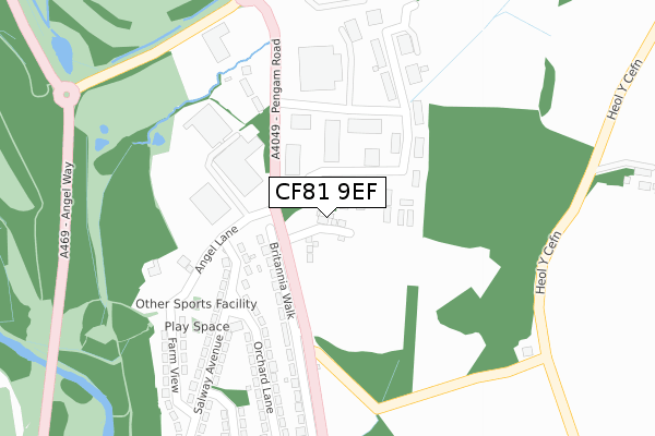
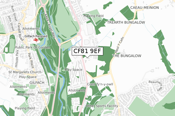
CF81 9EF is located in the Aberbargoed and Bargoed electoral ward, within the unitary authority of Caerphilly and the Welsh Parliamentary constituency of Islwyn. The Local Health Board is Aneurin Bevan University and the police force is Gwent. This postcode has been in use since December 2019.


GetTheData
Source: OS Open Zoomstack (Ordnance Survey)
Licence: Open Government Licence (requires attribution)
Attribution: Contains OS data © Crown copyright and database right 2024
Source: Open Postcode Geo
Licence: Open Government Licence (requires attribution)
Attribution: Contains OS data © Crown copyright and database right 2024; Contains Royal Mail data © Royal Mail copyright and database right 2024; Source: Office for National Statistics licensed under the Open Government Licence v.3.0
| Easting | 316056 |
| Northing | 198773 |
| Latitude | 51.681425 |
| Longitude | -3.215565 |
GetTheData
Source: Open Postcode Geo
Licence: Open Government Licence
| Country | Wales |
| Postcode District | CF81 |
➜ See where CF81 is on a map ➜ Where is Aberbargoed? | |
GetTheData
Source: Land Registry Price Paid Data
Licence: Open Government Licence
| Ward | Aberbargoed And Bargoed |
| Constituency | Islwyn |
GetTheData
Source: ONS Postcode Database
Licence: Open Government Licence
2023 7 SEP £319,000 |
20, BEECH AVENUE, ABERBARGOED, BARGOED, CF81 9EF 2021 9 DEC £255,995 |
22, BEECH AVENUE, ABERBARGOED, BARGOED, CF81 9EF 2021 3 DEC £249,995 |
24, BEECH AVENUE, ABERBARGOED, BARGOED, CF81 9EF 2021 26 NOV £249,995 |
26, BEECH AVENUE, ABERBARGOED, BARGOED, CF81 9EF 2021 21 OCT £280,995 |
28, BEECH AVENUE, ABERBARGOED, BARGOED, CF81 9EF 2021 7 OCT £213,995 |
40, BEECH AVENUE, ABERBARGOED, BARGOED, CF81 9EF 2021 23 AUG £240,995 |
38, BEECH AVENUE, ABERBARGOED, BARGOED, CF81 9EF 2021 30 JUN £237,995 |
36, BEECH AVENUE, ABERBARGOED, BARGOED, CF81 9EF 2021 10 MAY £236,995 |
34, BEECH AVENUE, ABERBARGOED, BARGOED, CF81 9EF 2021 7 MAY £274,995 |
GetTheData
Source: HM Land Registry Price Paid Data
Licence: Contains HM Land Registry data © Crown copyright and database right 2024. This data is licensed under the Open Government Licence v3.0.
| Britannia Walk (Pengam Road) | Britannia | 129m |
| Britannia Walk (Pengam Road) | Britannia | 139m |
| Britannia Terrace (Pengam Road) | Britannia | 266m |
| Britannia Terrace (Pengam Road) | Britannia | 280m |
| Conway Court (Heol Pit-y-ceiliogod) | Grove Park | 643m |
| Gilfach Fargoed Station | 0.8km |
| Bargoed Station | 1.6km |
| Pengam Station | 1.6km |
GetTheData
Source: NaPTAN
Licence: Open Government Licence
GetTheData
Source: ONS Postcode Database
Licence: Open Government Licence


➜ Get more ratings from the Food Standards Agency
GetTheData
Source: Food Standards Agency
Licence: FSA terms & conditions
| Last Collection | |||
|---|---|---|---|
| Location | Mon-Fri | Sat | Distance |
| Argoed Post Office | 17:00 | 12:00 | 636m |
| Cefn Fforest Post Office | 17:00 | 12:00 | 965m |
| Bargoed Post Office | 17:15 | 11:45 | 1,250m |
GetTheData
Source: Dracos
Licence: Creative Commons Attribution-ShareAlike
The below table lists the International Territorial Level (ITL) codes (formerly Nomenclature of Territorial Units for Statistics (NUTS) codes) and Local Administrative Units (LAU) codes for CF81 9EF:
| ITL 1 Code | Name |
|---|---|
| TLL | Wales |
| ITL 2 Code | Name |
| TLL1 | West Wales and The Valleys |
| ITL 3 Code | Name |
| TLL16 | Gwent Valleys |
| LAU 1 Code | Name |
| W06000018 | Caerphilly |
GetTheData
Source: ONS Postcode Directory
Licence: Open Government Licence
The below table lists the Census Output Area (OA), Lower Layer Super Output Area (LSOA), and Middle Layer Super Output Area (MSOA) for CF81 9EF:
| Code | Name | |
|---|---|---|
| OA | W00006949 | |
| LSOA | W01001326 | Caerphilly 003B |
| MSOA | W02000292 | Caerphilly 003 |
GetTheData
Source: ONS Postcode Directory
Licence: Open Government Licence
| CF81 9EP | Bowen Industrial Estate | 146m |
| NP12 3TQ | Britannia Walk | 190m |
| NP12 3TJ | Orchard Lane | 247m |
| NP12 3TH | Salway Avenue | 265m |
| CF81 9FW | Angel Lane | 286m |
| CF81 9FX | Gwaelod Y Waun Villas | 314m |
| NP12 3TL | Hodges Crescent | 351m |
| NP12 3TW | Farm View | 371m |
| NP12 3TN | Salway Avenue | 390m |
| NP12 3TE | Britannia Terrace | 403m |
GetTheData
Source: Open Postcode Geo; Land Registry Price Paid Data
Licence: Open Government Licence