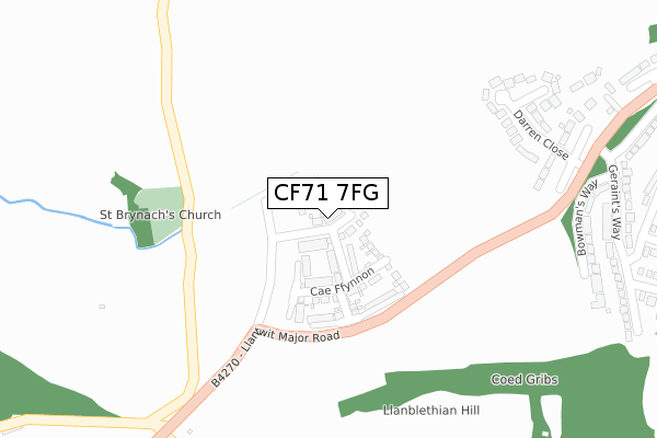
CF71 7FG is located in the Cowbridge electoral ward, within the unitary authority of Vale of Glamorgan and the Welsh Parliamentary constituency of Vale of Glamorgan. The Local Health Board is Cardiff and Vale University and the police force is South Wales. This postcode has been in use since February 2019.


GetTheData
Source: OS Open Zoomstack (Ordnance Survey)
Licence: Open Government Licence (requires attribution)
Attribution: Contains OS data © Crown copyright and database right 2024
Source: Open Postcode Geo
Licence: Open Government Licence (requires attribution)
Attribution: Contains OS data © Crown copyright and database right 2024; Contains Royal Mail data © Royal Mail copyright and database right 2024; Source: Office for National Statistics licensed under the Open Government Licence v.3.0
| Easting | 298269 |
| Northing | 174616 |
| Latitude | 51.461345 |
| Longitude | -3.465753 |
GetTheData
Source: Open Postcode Geo
Licence: Open Government Licence
| Country | Wales |
| Postcode District | CF71 |
➜ See where CF71 is on a map ➜ Where is Cowbridge? | |
GetTheData
Source: Land Registry Price Paid Data
Licence: Open Government Licence
| Ward | Cowbridge |
| Constituency | Vale Of Glamorgan |
GetTheData
Source: ONS Postcode Database
Licence: Open Government Licence
2024 12 JAN £710,000 |
27, DUNRAVEN CLOSE, COWBRIDGE, CF71 7FG 2022 8 DEC £574,995 |
24, DUNRAVEN CLOSE, COWBRIDGE, CF71 7FG 2022 28 NOV £506,995 |
26, DUNRAVEN CLOSE, COWBRIDGE, CF71 7FG 2022 25 NOV £659,995 |
25, DUNRAVEN CLOSE, COWBRIDGE, CF71 7FG 2022 11 NOV £476,995 |
28, DUNRAVEN CLOSE, COWBRIDGE, CF71 7FG 2022 9 NOV £437,995 |
29, DUNRAVEN CLOSE, COWBRIDGE, CF71 7FG 2022 4 NOV £504,995 |
31, DUNRAVEN CLOSE, COWBRIDGE, CF71 7FG 2022 5 JUL £429,995 |
32, DUNRAVEN CLOSE, COWBRIDGE, CF71 7FG 2022 30 JUN £320,995 |
30, DUNRAVEN CLOSE, COWBRIDGE, CF71 7FG 2022 28 JUN £429,995 |
GetTheData
Source: HM Land Registry Price Paid Data
Licence: Contains HM Land Registry data © Crown copyright and database right 2024. This data is licensed under the Open Government Licence v3.0.
| Cross Inn (Llantwit Major Road) | Cowbridge | 521m |
| Cross Inn (Llantwit Major Road) | Llanblethian | 569m |
| Church View (Church Road) | Llanblethian | 585m |
| Church View (Church Road) | Cowbridge | 607m |
| Police Station (Westgate) | Cowbridge | 852m |
GetTheData
Source: NaPTAN
Licence: Open Government Licence
| Percentage of properties with Next Generation Access | 100.0% |
| Percentage of properties with Superfast Broadband | 100.0% |
| Percentage of properties with Ultrafast Broadband | 87.5% |
| Percentage of properties with Full Fibre Broadband | 87.5% |
Superfast Broadband is between 30Mbps and 300Mbps
Ultrafast Broadband is > 300Mbps
| Percentage of properties unable to receive 2Mbps | 0.0% |
| Percentage of properties unable to receive 5Mbps | 0.0% |
| Percentage of properties unable to receive 10Mbps | 0.0% |
| Percentage of properties unable to receive 30Mbps | 0.0% |
GetTheData
Source: Ofcom
Licence: Ofcom Terms of Use (requires attribution)
GetTheData
Source: ONS Postcode Database
Licence: Open Government Licence


➜ Get more ratings from the Food Standards Agency
GetTheData
Source: Food Standards Agency
Licence: FSA terms & conditions
| Last Collection | |||
|---|---|---|---|
| Location | Mon-Fri | Sat | Distance |
| Bowmans Well | 16:30 | 11:15 | 371m |
| Broadway | 16:45 | 11:15 | 925m |
| Llanblethain Hill | 16:15 | 11:15 | 2,402m |
GetTheData
Source: Dracos
Licence: Creative Commons Attribution-ShareAlike
The below table lists the International Territorial Level (ITL) codes (formerly Nomenclature of Territorial Units for Statistics (NUTS) codes) and Local Administrative Units (LAU) codes for CF71 7FG:
| ITL 1 Code | Name |
|---|---|
| TLL | Wales |
| ITL 2 Code | Name |
| TLL2 | East Wales |
| ITL 3 Code | Name |
| TLL22 | Cardiff and Vale of Glamorgan |
| LAU 1 Code | Name |
| W06000014 | Vale of Glamorgan |
GetTheData
Source: ONS Postcode Directory
Licence: Open Government Licence
The below table lists the Census Output Area (OA), Lower Layer Super Output Area (LSOA), and Middle Layer Super Output Area (MSOA) for CF71 7FG:
| Code | Name | |
|---|---|---|
| OA | W00005723 | |
| LSOA | W01001083 | The Vale of Glamorgan 002B |
| MSOA | W02000238 | The Vale of Glamorgan 002 |
GetTheData
Source: ONS Postcode Directory
Licence: Open Government Licence
| CF71 7DE | Darren Close | 288m |
| CF71 7AW | Bowmans Way | 334m |
| CF71 7JP | Llantwit Major Road | 346m |
| CF71 7AY | Geraints Way | 431m |
| CF71 7BT | Geraints Close | 452m |
| CF71 7AX | Bowmans Well | 452m |
| CF71 7AZ | Wolfe Close | 458m |
| CF71 7BA | St Bleddians Close | 480m |
| CF71 7BU | Leoline Close | 508m |
| CF71 7AU | Tyla Rhosyr | 523m |
GetTheData
Source: Open Postcode Geo; Land Registry Price Paid Data
Licence: Open Government Licence