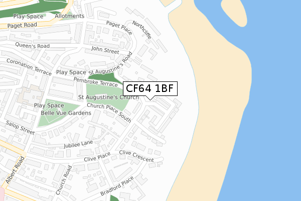
CF64 1BF is located in the St Augustine's electoral ward, within the unitary authority of Vale of Glamorgan and the Welsh Parliamentary constituency of Cardiff South and Penarth. The Local Health Board is Cardiff and Vale University and the police force is South Wales. This postcode has been in use since April 2020.


GetTheData
Source: OS Open Zoomstack (Ordnance Survey)
Licence: Open Government Licence (requires attribution)
Attribution: Contains OS data © Crown copyright and database right 2025
Source: Open Postcode Geo
Licence: Open Government Licence (requires attribution)
Attribution: Contains OS data © Crown copyright and database right 2025; Contains Royal Mail data © Royal Mail copyright and database right 2025; Source: Office for National Statistics licensed under the Open Government Licence v.3.0
| Easting | 318415 |
| Northing | 172120 |
| Latitude | 51.442174 |
| Longitude | -3.175258 |
GetTheData
Source: Open Postcode Geo
Licence: Open Government Licence
| Country | Wales |
| Postcode District | CF64 |
➜ See where CF64 is on a map ➜ Where is Penarth? | |
GetTheData
Source: Land Registry Price Paid Data
Licence: Open Government Licence
| Ward | St Augustine's |
| Constituency | Cardiff South And Penarth |
GetTheData
Source: ONS Postcode Database
Licence: Open Government Licence
| Penarth Heights (Hight Street) | Penarth | 127m |
| Plassey Street | Penarth | 204m |
| Plassey Street | Penarth | 214m |
| Portway (Penarth Portway) | Penarth | 217m |
| Portway (Penarth Portway) | Penarth | 224m |
| Dingle Road Station | 0.4km |
| Penarth Station | 0.7km |
| Cogan Station | 1.1km |
GetTheData
Source: NaPTAN
Licence: Open Government Licence
GetTheData
Source: ONS Postcode Database
Licence: Open Government Licence


➜ Get more ratings from the Food Standards Agency
GetTheData
Source: Food Standards Agency
Licence: FSA terms & conditions
| Last Collection | |||
|---|---|---|---|
| Location | Mon-Fri | Sat | Distance |
| 39 Albert Road | 19:00 | 12:00 | 345m |
| Penarth Marina | 16:00 | 12:00 | 392m |
| Windsor Terrace | 17:30 | 12:00 | 513m |
GetTheData
Source: Dracos
Licence: Creative Commons Attribution-ShareAlike
The below table lists the International Territorial Level (ITL) codes (formerly Nomenclature of Territorial Units for Statistics (NUTS) codes) and Local Administrative Units (LAU) codes for CF64 1BF:
| ITL 1 Code | Name |
|---|---|
| TLL | Wales |
| ITL 2 Code | Name |
| TLL2 | East Wales |
| ITL 3 Code | Name |
| TLL22 | Cardiff and Vale of Glamorgan |
| LAU 1 Code | Name |
| W06000014 | Vale of Glamorgan |
GetTheData
Source: ONS Postcode Directory
Licence: Open Government Licence
The below table lists the Census Output Area (OA), Lower Layer Super Output Area (LSOA), and Middle Layer Super Output Area (MSOA) for CF64 1BF:
| Code | Name | |
|---|---|---|
| OA | W00005940 | |
| LSOA | W01001124 | The Vale of Glamorgan 005C |
| MSOA | W02000241 | The Vale of Glamorgan 005 |
GetTheData
Source: ONS Postcode Directory
Licence: Open Government Licence
| CF64 1EG | Glebe Street | 25m |
| CF64 1EU | Arcot Street | 60m |
| CF64 1BQ | Queens Road | 61m |
| CF64 1EF | Glebe Street | 68m |
| CF64 1DH | Queens Road | 82m |
| CF64 1HQ | King Street | 93m |
| CF64 1HG | Salop Street | 123m |
| CF64 1NQ | Paget Road | 125m |
| CF64 1HP | Salop Place | 125m |
| CF64 1HJ | Salop Street | 130m |
GetTheData
Source: Open Postcode Geo; Land Registry Price Paid Data
Licence: Open Government Licence