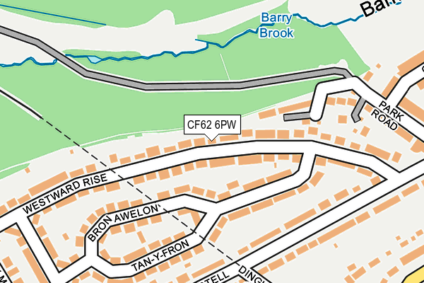
CF62 6PW is located in the Baruc electoral ward, within the unitary authority of Vale of Glamorgan and the Welsh Parliamentary constituency of Vale of Glamorgan. The Local Health Board is Cardiff and Vale University and the police force is South Wales. This postcode has been in use since July 2017.


GetTheData
Source: OS OpenMap – Local (Ordnance Survey)
Source: OS VectorMap District (Ordnance Survey)
Licence: Open Government Licence (requires attribution)
| Easting | 310325 |
| Northing | 167396 |
| Latitude | 51.398483 |
| Longitude | -3.290433 |
GetTheData
Source: Open Postcode Geo
Licence: Open Government Licence
| Country | Wales |
| Postcode District | CF62 |
➜ See where CF62 is on a map | |
GetTheData
Source: Land Registry Price Paid Data
Licence: Open Government Licence
| Ward | Baruc |
| Constituency | Vale Of Glamorgan |
GetTheData
Source: ONS Postcode Database
Licence: Open Government Licence
| All Saints (Park Crescent) | Barry | 120m |
| Park Crescent | Barry | 138m |
| Park Hotel (Park Crescent) | Barry | 250m |
| Castle (Park Road) | Barry | 275m |
| Gorsedd Circle (Romilly Park Road) | Barry | 279m |
| Barry Station | 0.4km |
| Barry Island Station | 1.4km |
| Barry Docks Station | 2.1km |
GetTheData
Source: NaPTAN
Licence: Open Government Licence
GetTheData
Source: ONS Postcode Database
Licence: Open Government Licence


➜ Get more ratings from the Food Standards Agency
GetTheData
Source: Food Standards Agency
Licence: FSA terms & conditions
| Last Collection | |||
|---|---|---|---|
| Location | Mon-Fri | Sat | Distance |
| Park Road | 17:00 | 12:00 | 89m |
| Colcot Road South | 17:00 | 12:00 | 158m |
| Porthkerry Road | 17:00 | 12:00 | 204m |
GetTheData
Source: Dracos
Licence: Creative Commons Attribution-ShareAlike
The below table lists the International Territorial Level (ITL) codes (formerly Nomenclature of Territorial Units for Statistics (NUTS) codes) and Local Administrative Units (LAU) codes for CF62 6PW:
| ITL 1 Code | Name |
|---|---|
| TLL | Wales |
| ITL 2 Code | Name |
| TLL2 | East Wales |
| ITL 3 Code | Name |
| TLL22 | Cardiff and Vale of Glamorgan |
| LAU 1 Code | Name |
| W06000014 | Vale of Glamorgan |
GetTheData
Source: ONS Postcode Directory
Licence: Open Government Licence
The below table lists the Census Output Area (OA), Lower Layer Super Output Area (LSOA), and Middle Layer Super Output Area (MSOA) for CF62 6PW:
| Code | Name | |
|---|---|---|
| OA | W00005620 | |
| LSOA | W01001062 | The Vale of Glamorgan 013A |
| MSOA | W02000249 | The Vale of Glamorgan 013 |
GetTheData
Source: ONS Postcode Directory
Licence: Open Government Licence
| CF62 6JP | Glamorgan Street | 40m |
| CF62 6NU | Park Road | 58m |
| CF62 6JN | Glamorgan Street | 62m |
| CF62 6PF | Dunraven Street | 85m |
| CF62 6JQ | Vale Street | 113m |
| CF62 6NT | Park Road | 129m |
| CF62 6PG | Victoria Road | 130m |
| CF62 6JS | Castle Street | 139m |
| CF62 6PH | Eton Street | 142m |
| CF62 6HD | Park Crescent | 148m |
GetTheData
Source: Open Postcode Geo; Land Registry Price Paid Data
Licence: Open Government Licence