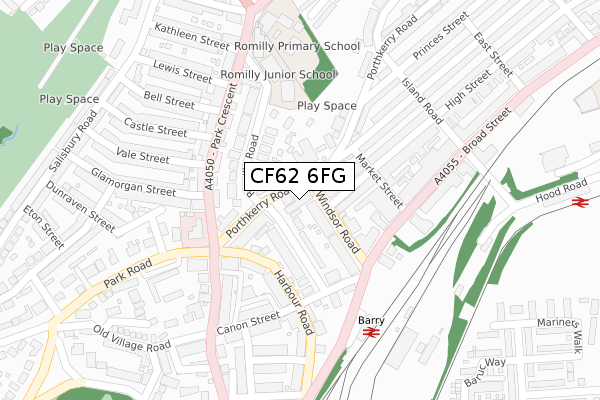
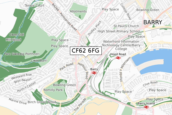
CF62 6FG is located in the Baruc electoral ward, within the unitary authority of Vale of Glamorgan and the Welsh Parliamentary constituency of Vale of Glamorgan. The Local Health Board is Cardiff and Vale University and the police force is South Wales. This postcode has been in use since September 2019.


GetTheData
Source: OS Open Zoomstack (Ordnance Survey)
Licence: Open Government Licence (requires attribution)
Attribution: Contains OS data © Crown copyright and database right 2025
Source: Open Postcode Geo
Licence: Open Government Licence (requires attribution)
Attribution: Contains OS data © Crown copyright and database right 2025; Contains Royal Mail data © Royal Mail copyright and database right 2025; Source: Office for National Statistics licensed under the Open Government Licence v.3.0
| Easting | 310579 |
| Northing | 167410 |
| Latitude | 51.398649 |
| Longitude | -3.286787 |
GetTheData
Source: Open Postcode Geo
Licence: Open Government Licence
| Country | Wales |
| Postcode District | CF62 |
➜ See where CF62 is on a map ➜ Where is Barry? | |
GetTheData
Source: Land Registry Price Paid Data
Licence: Open Government Licence
| Ward | Baruc |
| Constituency | Vale Of Glamorgan |
GetTheData
Source: ONS Postcode Database
Licence: Open Government Licence
| Barry Hotel (Windsor Road) | Barry | 92m |
| Barry Hotel (Windsor Road) | Barry | 122m |
| All Saints (Park Crescent) | Barry | 135m |
| Park Crescent | Barry | 136m |
| Barry Hotel (Broad Street) | Barry | 160m |
| Barry Station | 0.2km |
| Barry Island Station | 1.2km |
| Barry Docks Station | 1.9km |
GetTheData
Source: NaPTAN
Licence: Open Government Licence
GetTheData
Source: ONS Postcode Database
Licence: Open Government Licence


➜ Get more ratings from the Food Standards Agency
GetTheData
Source: Food Standards Agency
Licence: FSA terms & conditions
| Last Collection | |||
|---|---|---|---|
| Location | Mon-Fri | Sat | Distance |
| Porthkerry Road | 17:00 | 12:00 | 104m |
| Colcot Road South | 17:00 | 12:00 | 153m |
| Vale Street | 18:30 | 12:00 | 221m |
GetTheData
Source: Dracos
Licence: Creative Commons Attribution-ShareAlike
The below table lists the International Territorial Level (ITL) codes (formerly Nomenclature of Territorial Units for Statistics (NUTS) codes) and Local Administrative Units (LAU) codes for CF62 6FG:
| ITL 1 Code | Name |
|---|---|
| TLL | Wales |
| ITL 2 Code | Name |
| TLL2 | East Wales |
| ITL 3 Code | Name |
| TLL22 | Cardiff and Vale of Glamorgan |
| LAU 1 Code | Name |
| W06000014 | Vale of Glamorgan |
GetTheData
Source: ONS Postcode Directory
Licence: Open Government Licence
The below table lists the Census Output Area (OA), Lower Layer Super Output Area (LSOA), and Middle Layer Super Output Area (MSOA) for CF62 6FG:
| Code | Name | |
|---|---|---|
| OA | W00005615 | |
| LSOA | W01001062 | The Vale of Glamorgan 013A |
| MSOA | W02000249 | The Vale of Glamorgan 013 |
GetTheData
Source: ONS Postcode Directory
Licence: Open Government Licence
| CF62 6FH | Romilly Road | 26m |
| CF62 7BA | Porthkerry Road | 63m |
| CF62 6BA | Romilly Road | 74m |
| CF62 7AX | Porthkerry Road | 80m |
| CF62 6AZ | Romilly Road | 87m |
| CF62 7AW | Windsor Road | 101m |
| CF62 7AY | Porthkerry Road | 111m |
| CF62 5SA | Harbour Road | 115m |
| CF62 7ED | York Place | 118m |
| CF62 6LF | Romilly Road | 129m |
GetTheData
Source: Open Postcode Geo; Land Registry Price Paid Data
Licence: Open Government Licence