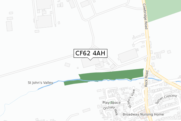
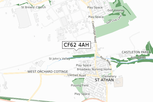
CF62 4AH is located in the St Athan electoral ward, within the unitary authority of Vale of Glamorgan and the Welsh Parliamentary constituency of Vale of Glamorgan. The Local Health Board is Cardiff and Vale University and the police force is South Wales. This postcode has been in use since February 2019.


GetTheData
Source: OS Open Zoomstack (Ordnance Survey)
Licence: Open Government Licence (requires attribution)
Attribution: Contains OS data © Crown copyright and database right 2025
Source: Open Postcode Geo
Licence: Open Government Licence (requires attribution)
Attribution: Contains OS data © Crown copyright and database right 2025; Contains Royal Mail data © Royal Mail copyright and database right 2025; Source: Office for National Statistics licensed under the Open Government Licence v.3.0
| Easting | 301259 |
| Northing | 168415 |
| Latitude | 51.406135 |
| Longitude | -3.420997 |
GetTheData
Source: Open Postcode Geo
Licence: Open Government Licence
| Country | Wales |
| Postcode District | CF62 |
➜ See where CF62 is on a map | |
GetTheData
Source: Land Registry Price Paid Data
Licence: Open Government Licence
| Ward | St Athan |
| Constituency | Vale Of Glamorgan |
GetTheData
Source: ONS Postcode Database
Licence: Open Government Licence
| Pant-yn-awel House (Cowbridge Road) | Beggars Pound | 317m |
| Pant-yn-awel Farm (Cowbridge) | Beggars Pound | 326m |
| Rectory Road | St Athan | 514m |
| Rectory Road | St Athan | 560m |
| East Camp (Cowbridge Road) | Beggars Pound | 625m |
| Llantwit Major Station | 4.2km |
| Rhoose Station | 5.4km |
GetTheData
Source: NaPTAN
Licence: Open Government Licence
GetTheData
Source: ONS Postcode Database
Licence: Open Government Licence


➜ Get more ratings from the Food Standards Agency
GetTheData
Source: Food Standards Agency
Licence: FSA terms & conditions
| Last Collection | |||
|---|---|---|---|
| Location | Mon-Fri | Sat | Distance |
| Boverton Post Office | 16:45 | 11:45 | 2,998m |
| Boverton Road | 16:45 | 11:15 | 4,167m |
| Caer Worgan | 16:15 | 11:15 | 4,434m |
GetTheData
Source: Dracos
Licence: Creative Commons Attribution-ShareAlike
The below table lists the International Territorial Level (ITL) codes (formerly Nomenclature of Territorial Units for Statistics (NUTS) codes) and Local Administrative Units (LAU) codes for CF62 4AH:
| ITL 1 Code | Name |
|---|---|
| TLL | Wales |
| ITL 2 Code | Name |
| TLL2 | East Wales |
| ITL 3 Code | Name |
| TLL22 | Cardiff and Vale of Glamorgan |
| LAU 1 Code | Name |
| W06000014 | Vale of Glamorgan |
GetTheData
Source: ONS Postcode Directory
Licence: Open Government Licence
The below table lists the Census Output Area (OA), Lower Layer Super Output Area (LSOA), and Middle Layer Super Output Area (MSOA) for CF62 4AH:
| Code | Name | |
|---|---|---|
| OA | W00009841 | |
| LSOA | W01001122 | The Vale of Glamorgan 014F |
| MSOA | W02000250 | The Vale of Glamorgan 014 |
GetTheData
Source: ONS Postcode Directory
Licence: Open Government Licence
| CF62 4LH | Bingle Lane | 292m |
| CF62 4NZ | St Johns View | 334m |
| CF62 4LF | St Davids Crescent | 338m |
| CF62 4LE | Cowbridge Road | 340m |
| CF62 4PA | St Johns Hill | 344m |
| CF62 4LX | Higher End | 380m |
| CF62 4LW | Higher End | 387m |
| CF62 4QA | Roberts Close | 402m |
| CF62 4PB | Beggars Pound | 433m |
| CF62 4LU | Llantwit Garden Close | 434m |
GetTheData
Source: Open Postcode Geo; Land Registry Price Paid Data
Licence: Open Government Licence