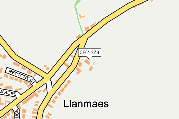
CF61 2ZB is located in the Llantwit Major electoral ward, within the unitary authority of Vale of Glamorgan and the Welsh Parliamentary constituency of Vale of Glamorgan. The Local Health Board is Cardiff and Vale University and the police force is South Wales. This postcode has been in use since June 2016.


GetTheData
Source: OS OpenMap – Local (Ordnance Survey)
Source: OS VectorMap District (Ordnance Survey)
Licence: Open Government Licence (requires attribution)
| Easting | 298223 |
| Northing | 169858 |
| Latitude | 51.418569 |
| Longitude | -3.465046 |
GetTheData
Source: Open Postcode Geo
Licence: Open Government Licence
| Country | Wales |
| Postcode District | CF61 |
➜ See where CF61 is on a map ➜ Where is Llanmaes? | |
GetTheData
Source: Land Registry Price Paid Data
Licence: Open Government Licence
Elevation or altitude of CF61 2ZB as distance above sea level:
| Metres | Feet | |
|---|---|---|
| Elevation | 60m | 197ft |
Elevation is measured from the approximate centre of the postcode, to the nearest point on an OS contour line from OS Terrain 50, which has contour spacing of ten vertical metres.
➜ How high above sea level am I? Find the elevation of your current position using your device's GPS.
GetTheData
Source: Open Postcode Elevation
Licence: Open Government Licence
| Ward | Llantwit Major |
| Constituency | Vale Of Glamorgan |
GetTheData
Source: ONS Postcode Database
Licence: Open Government Licence
2022 9 SEP £575,000 |
MIN-Y-NANT, BROOK FARM, LLANMAES, LLANTWIT MAJOR, CF61 2ZB 2020 28 AUG £605,000 |
2018 21 NOV £449,950 |
ST. GILES HOUSE, BROOK FARM, LLANMAES, LLANTWIT MAJOR, CF61 2ZB 2018 23 MAR £685,000 |
GetTheData
Source: HM Land Registry Price Paid Data
Licence: Contains HM Land Registry data © Crown copyright and database right 2024. This data is licensed under the Open Government Licence v3.0.
| Llanmaes Crossroads (Unclassified) | Llan-maes | 139m |
| Llanmaes Crossroads (Unclassified) | Llan-maes | 152m |
| Monmouth Way (Eagleswell Road) | Llantwit Major | 822m |
| Monmouth Way (Eagleswell Road) | Llantwit Major | 829m |
| Whiteways (Llanmaes Road) | Llantwit Major | 1,000m |
| Llantwit Major Station | 1.5km |
GetTheData
Source: NaPTAN
Licence: Open Government Licence
GetTheData
Source: ONS Postcode Database
Licence: Open Government Licence


➜ Get more ratings from the Food Standards Agency
GetTheData
Source: Food Standards Agency
Licence: FSA terms & conditions
| Last Collection | |||
|---|---|---|---|
| Location | Mon-Fri | Sat | Distance |
| Caer Worgan | 16:15 | 11:15 | 1,376m |
| Boverton Post Office | 16:45 | 11:45 | 1,429m |
| Boverton Road | 16:45 | 11:15 | 1,580m |
GetTheData
Source: Dracos
Licence: Creative Commons Attribution-ShareAlike
The below table lists the International Territorial Level (ITL) codes (formerly Nomenclature of Territorial Units for Statistics (NUTS) codes) and Local Administrative Units (LAU) codes for CF61 2ZB:
| ITL 1 Code | Name |
|---|---|
| TLL | Wales |
| ITL 2 Code | Name |
| TLL2 | East Wales |
| ITL 3 Code | Name |
| TLL22 | Cardiff and Vale of Glamorgan |
| LAU 1 Code | Name |
| W06000014 | Vale of Glamorgan |
GetTheData
Source: ONS Postcode Directory
Licence: Open Government Licence
The below table lists the Census Output Area (OA), Lower Layer Super Output Area (LSOA), and Middle Layer Super Output Area (MSOA) for CF61 2ZB:
| Code | Name | |
|---|---|---|
| OA | W00005843 | |
| LSOA | W01001108 | The Vale of Glamorgan 014A |
| MSOA | W02000250 | The Vale of Glamorgan 014 |
GetTheData
Source: ONS Postcode Directory
Licence: Open Government Licence
| CF61 2XR | 107m | |
| CF61 2WJ | Rectory Court | 260m |
| CF61 2XZ | Tyle House Close | 280m |
| CF61 2XQ | West Acre | 285m |
| CF61 2GU | Monmouth Way | 777m |
| CF61 2GF | Anglesey Close | 811m |
| CF61 2UZ | Frampton Lane | 812m |
| CF61 2GH | Flint Avenue | 848m |
| CF61 2GJ | Brecon Street | 851m |
| CF61 2GG | Glamorgan Close | 871m |
GetTheData
Source: Open Postcode Geo; Land Registry Price Paid Data
Licence: Open Government Licence