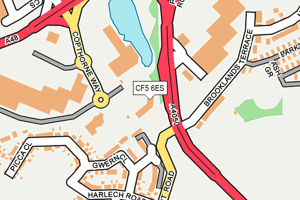
CF5 6ES is located in the Wenvoe electoral ward, within the unitary authority of Vale of Glamorgan and the Welsh Parliamentary constituency of Vale of Glamorgan. The Local Health Board is Cardiff and Vale University and the police force is South Wales. This postcode has been in use since July 1995.


GetTheData
Source: OS OpenMap – Local (Ordnance Survey)
Source: OS VectorMap District (Ordnance Survey)
Licence: Open Government Licence (requires attribution)
| Easting | 311795 |
| Northing | 174562 |
| Latitude | 51.463132 |
| Longitude | -3.271095 |
GetTheData
Source: Open Postcode Geo
Licence: Open Government Licence
| Country | Wales |
| Postcode District | CF5 |
➜ See where CF5 is on a map ➜ Where is Cardiff? | |
GetTheData
Source: Land Registry Price Paid Data
Licence: Open Government Licence
Elevation or altitude of CF5 6ES as distance above sea level:
| Metres | Feet | |
|---|---|---|
| Elevation | 70m | 230ft |
Elevation is measured from the approximate centre of the postcode, to the nearest point on an OS contour line from OS Terrain 50, which has contour spacing of ten vertical metres.
➜ How high above sea level am I? Find the elevation of your current position using your device's GPS.
GetTheData
Source: Open Postcode Elevation
Licence: Open Government Licence
| Ward | Wenvoe |
| Constituency | Vale Of Glamorgan |
GetTheData
Source: ONS Postcode Database
Licence: Open Government Licence
| Vale Gate (Port Road) | Culverhouse Cross | 57m |
| Vale Gate (Port Road) | Culverhouse Cross | 114m |
| Ruhr Cross (Port Road) | Culverhouse Cross | 164m |
| Ruhr Cross (Port Road) | Culverhouse Cross | 179m |
| Culverhouse Cross (A48) | Culverhouse Cross | 269m |
| Waun-gron Park Station | 4km |
| Fairwater Station | 4.3km |
| Danescourt Station | 4.9km |
GetTheData
Source: NaPTAN
Licence: Open Government Licence
GetTheData
Source: ONS Postcode Database
Licence: Open Government Licence


➜ Get more ratings from the Food Standards Agency
GetTheData
Source: Food Standards Agency
Licence: FSA terms & conditions
| Last Collection | |||
|---|---|---|---|
| Location | Mon-Fri | Sat | Distance |
| The Court | 15:30 | 10:30 | 1,656m |
| Caerau Post Office | 17:30 | 12:00 | 2,570m |
| The Tumble | 18:30 | 11:00 | 3,743m |
GetTheData
Source: Dracos
Licence: Creative Commons Attribution-ShareAlike
The below table lists the International Territorial Level (ITL) codes (formerly Nomenclature of Territorial Units for Statistics (NUTS) codes) and Local Administrative Units (LAU) codes for CF5 6ES:
| ITL 1 Code | Name |
|---|---|
| TLL | Wales |
| ITL 2 Code | Name |
| TLL2 | East Wales |
| ITL 3 Code | Name |
| TLL22 | Cardiff and Vale of Glamorgan |
| LAU 1 Code | Name |
| W06000014 | Vale of Glamorgan |
GetTheData
Source: ONS Postcode Directory
Licence: Open Government Licence
The below table lists the Census Output Area (OA), Lower Layer Super Output Area (LSOA), and Middle Layer Super Output Area (MSOA) for CF5 6ES:
| Code | Name | |
|---|---|---|
| OA | W00005990 | |
| LSOA | W01001136 | The Vale of Glamorgan 003D |
| MSOA | W02000239 | The Vale of Glamorgan 003 |
GetTheData
Source: ONS Postcode Directory
Licence: Open Government Licence
| CF5 6EH | Valegate Retail Park | 144m |
| CF5 5TH | Brooklands Terrace | 144m |
| CF5 6XW | Culverhouse Cross | 198m |
| CF5 6XN | Harlech Road | 211m |
| CF5 5TX | Heol Collen | 401m |
| CF5 5TZ | Heol Draenen Wen | 481m |
| CF5 5TY | Heol Collen | 512m |
| CF5 4NB | Sanctuary Court | 544m |
| CF5 4SW | Michaelston Road | 564m |
| CF5 4RX | The Sanctuary | 574m |
GetTheData
Source: Open Postcode Geo; Land Registry Price Paid Data
Licence: Open Government Licence