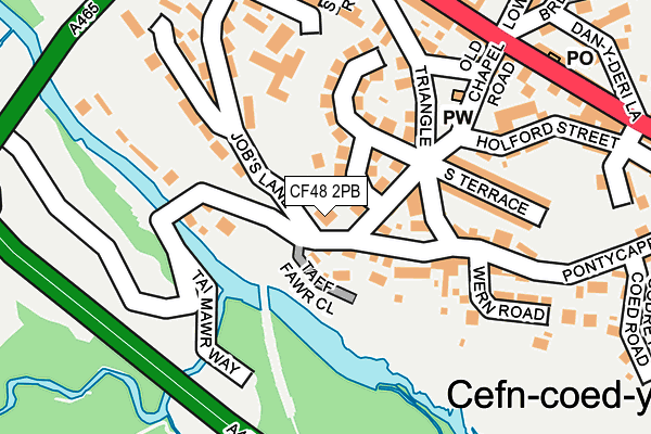
CF48 2PB is located in the Vaynor electoral ward, within the unitary authority of Merthyr Tydfil and the Welsh Parliamentary constituency of Merthyr Tydfil and Rhymney. The Local Health Board is Cwm Taf Morgannwg University and the police force is South Wales. This postcode has been in use since March 2017.


GetTheData
Source: OS OpenMap – Local (Ordnance Survey)
Source: OS VectorMap District (Ordnance Survey)
Licence: Open Government Licence (requires attribution)
| Easting | 303090 |
| Northing | 207750 |
| Latitude | 51.760025 |
| Longitude | -3.405550 |
GetTheData
Source: Open Postcode Geo
Licence: Open Government Licence
| Country | Wales |
| Postcode District | CF48 |
➜ See where CF48 is on a map ➜ Where is Merthyr Tydfil? | |
GetTheData
Source: Land Registry Price Paid Data
Licence: Open Government Licence
| Ward | Vaynor |
| Constituency | Merthyr Tydfil And Rhymney |
GetTheData
Source: ONS Postcode Database
Licence: Open Government Licence
| Post Office (High Street) | Cefn Coed | 229m |
| Drovers Arms (High Street) | Cefn Coed | 245m |
| Post Office (High Street) | Cefn Coed | 253m |
| Drovers Arms (High Street) | Cefn Coed | 275m |
| War Memorial (High Street) | Cefn Coed | 350m |
| Merthyr Tydfil Station | 2.6km |
| Pentre-Bach Station | 4.9km |
| Aberdare Station | 5.6km |
GetTheData
Source: NaPTAN
Licence: Open Government Licence
GetTheData
Source: ONS Postcode Database
Licence: Open Government Licence


➜ Get more ratings from the Food Standards Agency
GetTheData
Source: Food Standards Agency
Licence: FSA terms & conditions
| Last Collection | |||
|---|---|---|---|
| Location | Mon-Fri | Sat | Distance |
| Maple Crescent | 16:45 | 11:30 | 1,372m |
| Pizza Hut | 16:15 | 12:00 | 1,520m |
| Kier Hardie Estate | 17:15 | 11:45 | 2,253m |
GetTheData
Source: Dracos
Licence: Creative Commons Attribution-ShareAlike
The below table lists the International Territorial Level (ITL) codes (formerly Nomenclature of Territorial Units for Statistics (NUTS) codes) and Local Administrative Units (LAU) codes for CF48 2PB:
| ITL 1 Code | Name |
|---|---|
| TLL | Wales |
| ITL 2 Code | Name |
| TLL1 | West Wales and The Valleys |
| ITL 3 Code | Name |
| TLL15 | Central Valleys |
| LAU 1 Code | Name |
| W06000024 | Merthyr Tydfil |
GetTheData
Source: ONS Postcode Directory
Licence: Open Government Licence
The below table lists the Census Output Area (OA), Lower Layer Super Output Area (LSOA), and Middle Layer Super Output Area (MSOA) for CF48 2PB:
| Code | Name | |
|---|---|---|
| OA | W00006935 | |
| LSOA | W01001324 | Merthyr Tydfil 003E |
| MSOA | W02000285 | Merthyr Tydfil 003 |
GetTheData
Source: ONS Postcode Directory
Licence: Open Government Licence
| CF48 2RF | Taff Fawr Close | 55m |
| CF48 2RA | Pontycapel Road | 69m |
| CF48 2RB | Brynhyfryd Terrace | 93m |
| CF48 2PU | Bryntaf | 99m |
| CF48 2PY | Pontycapel Road | 109m |
| CF48 2NH | Jobs Lane | 138m |
| CF48 2NB | Station Road | 152m |
| CF48 2PT | Triangle | 160m |
| CF48 2RL | South Terrace | 163m |
| CF48 2RH | 189m |
GetTheData
Source: Open Postcode Geo; Land Registry Price Paid Data
Licence: Open Government Licence