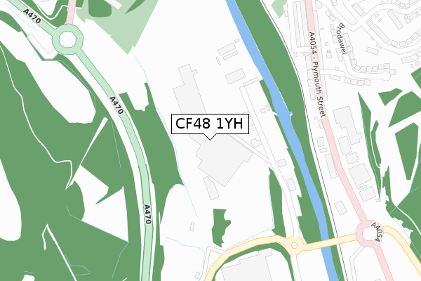
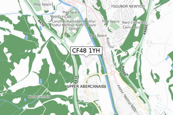
CF48 1YH is located in the Plymouth electoral ward, within the unitary authority of Merthyr Tydfil and the Welsh Parliamentary constituency of Merthyr Tydfil and Rhymney. The Local Health Board is Cwm Taf Morgannwg University and the police force is South Wales. This postcode has been in use since January 1980.


GetTheData
Source: OS Open Zoomstack (Ordnance Survey)
Licence: Open Government Licence (requires attribution)
Attribution: Contains OS data © Crown copyright and database right 2025
Source: Open Postcode Geo
Licence: Open Government Licence (requires attribution)
Attribution: Contains OS data © Crown copyright and database right 2025; Contains Royal Mail data © Royal Mail copyright and database right 2025; Source: Office for National Statistics licensed under the Open Government Licence v.3.0
| Easting | 305190 |
| Northing | 204882 |
| Latitude | 51.734601 |
| Longitude | -3.374339 |
GetTheData
Source: Open Postcode Geo
Licence: Open Government Licence
| Country | Wales |
| Postcode District | CF48 |
➜ See where CF48 is on a map ➜ Where is Merthyr Tydfil? | |
GetTheData
Source: Land Registry Price Paid Data
Licence: Open Government Licence
Elevation or altitude of CF48 1YH as distance above sea level:
| Metres | Feet | |
|---|---|---|
| Elevation | 160m | 525ft |
Elevation is measured from the approximate centre of the postcode, to the nearest point on an OS contour line from OS Terrain 50, which has contour spacing of ten vertical metres.
➜ How high above sea level am I? Find the elevation of your current position using your device's GPS.
GetTheData
Source: Open Postcode Elevation
Licence: Open Government Licence
| Ward | Plymouth |
| Constituency | Merthyr Tydfil And Rhymney |
GetTheData
Source: ONS Postcode Database
Licence: Open Government Licence
| Evans Halshaw (Plymouth Street) | Merthyr Tydfil | 271m |
| Evans Halshaw (Pentrebach Road) | Merthyr Tydfil | 281m |
| Gladstone Terrace (Plymouth Street) | Merthyr Tydfil | 330m |
| Mardy Terrace (Plymouth Street) | Merthyr Tydfil | 346m |
| Mardy (Plymouth Street) | Merthyr Tydfil | 430m |
| Merthyr Tydfil Station | 1.1km |
| Pentre-Bach Station | 1.4km |
| Troed-y-Rhiw Station | 3.1km |
GetTheData
Source: NaPTAN
Licence: Open Government Licence
GetTheData
Source: ONS Postcode Database
Licence: Open Government Licence


➜ Get more ratings from the Food Standards Agency
GetTheData
Source: Food Standards Agency
Licence: FSA terms & conditions
| Last Collection | |||
|---|---|---|---|
| Location | Mon-Fri | Sat | Distance |
| Pentrebach | 16:45 | 12:00 | 847m |
| Twyn Y Rodyn | 17:00 | 12:00 | 1,071m |
| Mountain Air | 17:00 | 11:30 | 1,101m |
GetTheData
Source: Dracos
Licence: Creative Commons Attribution-ShareAlike
The below table lists the International Territorial Level (ITL) codes (formerly Nomenclature of Territorial Units for Statistics (NUTS) codes) and Local Administrative Units (LAU) codes for CF48 1YH:
| ITL 1 Code | Name |
|---|---|
| TLL | Wales |
| ITL 2 Code | Name |
| TLL1 | West Wales and The Valleys |
| ITL 3 Code | Name |
| TLL15 | Central Valleys |
| LAU 1 Code | Name |
| W06000024 | Merthyr Tydfil |
GetTheData
Source: ONS Postcode Directory
Licence: Open Government Licence
The below table lists the Census Output Area (OA), Lower Layer Super Output Area (LSOA), and Middle Layer Super Output Area (MSOA) for CF48 1YH:
| Code | Name | |
|---|---|---|
| OA | W00006884 | |
| LSOA | W01001314 | Merthyr Tydfil 005A |
| MSOA | W02000287 | Merthyr Tydfil 005 |
GetTheData
Source: ONS Postcode Directory
Licence: Open Government Licence
| CF48 1YF | Abercanaid Industrial Estate | 102m |
| CF47 0UP | Eastfield Place | 265m |
| CF47 0UR | Eastfield Terrace | 282m |
| CF47 0UW | Hankey Terrace | 296m |
| CF47 0UT | Gwilym Terrace | 299m |
| CF48 1YA | Pentrebach Road | 323m |
| CF47 0UN | Hankey Place | 335m |
| CF47 0YB | Railway Terrace | 343m |
| CF47 0UU | Gladstone Terrace | 345m |
| CF47 0YA | Mardy Terrace | 357m |
GetTheData
Source: Open Postcode Geo; Land Registry Price Paid Data
Licence: Open Government Licence