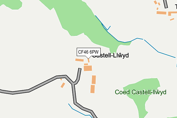
CF46 6PW is in Nelson, Treharris. CF46 6PW is located in the Ystrad Mynach electoral ward, within the unitary authority of Caerphilly and the Welsh Parliamentary constituency of Caerphilly. The Local Health Board is Aneurin Bevan University and the police force is Gwent. This postcode has been in use since January 1980.


GetTheData
Source: OS OpenMap – Local (Ordnance Survey)
Source: OS VectorMap District (Ordnance Survey)
Licence: Open Government Licence (requires attribution)
| Easting | 313402 |
| Northing | 193835 |
| Latitude | 51.636633 |
| Longitude | -3.252719 |
GetTheData
Source: Open Postcode Geo
Licence: Open Government Licence
| Locality | Nelson |
| Town/City | Treharris |
| Country | Wales |
| Postcode District | CF46 |
➜ See where CF46 is on a map | |
GetTheData
Source: Land Registry Price Paid Data
Licence: Open Government Licence
Elevation or altitude of CF46 6PW as distance above sea level:
| Metres | Feet | |
|---|---|---|
| Elevation | 190m | 623ft |
Elevation is measured from the approximate centre of the postcode, to the nearest point on an OS contour line from OS Terrain 50, which has contour spacing of ten vertical metres.
➜ How high above sea level am I? Find the elevation of your current position using your device's GPS.
GetTheData
Source: Open Postcode Elevation
Licence: Open Government Licence
| Ward | Ystrad Mynach |
| Constituency | Caerphilly |
GetTheData
Source: ONS Postcode Database
Licence: Open Government Licence
| Business Park (A472) | Tredomen | 826m |
| Business Park (A472) | Tredomen | 865m |
| Station Approach | Ystrad Mynach | 962m |
| Ty Penallta - Not Yet In Use (Tredomen Park) | Tredomen | 975m |
| Railway Station (Nelson Road) | Ystrad Mynach | 998m |
| Ystrad Mynach Station | 0.9km |
| Hengoed Station | 2.3km |
| Llanbradach Station | 4km |
GetTheData
Source: NaPTAN
Licence: Open Government Licence
| Percentage of properties with Next Generation Access | 100.0% |
| Percentage of properties with Superfast Broadband | 0.0% |
| Percentage of properties with Ultrafast Broadband | 0.0% |
| Percentage of properties with Full Fibre Broadband | 0.0% |
Superfast Broadband is between 30Mbps and 300Mbps
Ultrafast Broadband is > 300Mbps
| Percentage of properties unable to receive 2Mbps | 0.0% |
| Percentage of properties unable to receive 5Mbps | 0.0% |
| Percentage of properties unable to receive 10Mbps | 33.3% |
| Percentage of properties unable to receive 30Mbps | 100.0% |
GetTheData
Source: Ofcom
Licence: Ofcom Terms of Use (requires attribution)
GetTheData
Source: ONS Postcode Database
Licence: Open Government Licence


➜ Get more ratings from the Food Standards Agency
GetTheData
Source: Food Standards Agency
Licence: FSA terms & conditions
| Last Collection | |||
|---|---|---|---|
| Location | Mon-Fri | Sat | Distance |
| Maesycymmer Post Office | 17:00 | 11:15 | 2,351m |
| Fleur De Lys Post Office | 17:00 | 12:00 | 3,500m |
| Bryn Road | 16:15 | 11:15 | 3,725m |
GetTheData
Source: Dracos
Licence: Creative Commons Attribution-ShareAlike
The below table lists the International Territorial Level (ITL) codes (formerly Nomenclature of Territorial Units for Statistics (NUTS) codes) and Local Administrative Units (LAU) codes for CF46 6PW:
| ITL 1 Code | Name |
|---|---|
| TLL | Wales |
| ITL 2 Code | Name |
| TLL1 | West Wales and The Valleys |
| ITL 3 Code | Name |
| TLL16 | Gwent Valleys |
| LAU 1 Code | Name |
| W06000018 | Caerphilly |
GetTheData
Source: ONS Postcode Directory
Licence: Open Government Licence
The below table lists the Census Output Area (OA), Lower Layer Super Output Area (LSOA), and Middle Layer Super Output Area (MSOA) for CF46 6PW:
| Code | Name | |
|---|---|---|
| OA | W00007495 | |
| LSOA | W01001434 | Caerphilly 013F |
| MSOA | W02000302 | Caerphilly 013 |
GetTheData
Source: ONS Postcode Directory
Licence: Open Government Licence
| CF82 7FB | Heol Y Graig | 619m |
| CF82 7BU | Maesycoed Terrace | 629m |
| CF82 7EY | Heol Brynteg | 642m |
| CF82 7DE | Derwen Close | 677m |
| CF82 7FA | Pen Y Cae | 688m |
| CF82 7EW | Twyn Road | 691m |
| CF82 7EZ | Coedcae | 691m |
| CF82 7BW | Tredomen Terrace | 692m |
| CF82 7EX | Troedyrhiw | 705m |
| CF82 7BX | Park Lane | 706m |
GetTheData
Source: Open Postcode Geo; Land Registry Price Paid Data
Licence: Open Government Licence