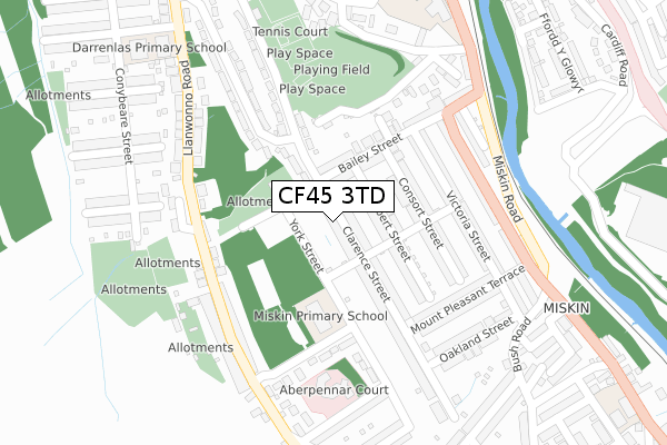
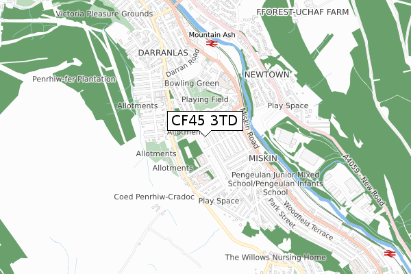
CF45 3TD is located in the Penrhiw-ceibr electoral ward, within the unitary authority of Rhondda Cynon Taf and the Welsh Parliamentary constituency of Cynon Valley. The Local Health Board is Cwm Taf Morgannwg University and the police force is South Wales. This postcode has been in use since May 2018.


GetTheData
Source: OS Open Zoomstack (Ordnance Survey)
Licence: Open Government Licence (requires attribution)
Attribution: Contains OS data © Crown copyright and database right 2025
Source: Open Postcode Geo
Licence: Open Government Licence (requires attribution)
Attribution: Contains OS data © Crown copyright and database right 2025; Contains Royal Mail data © Royal Mail copyright and database right 2025; Source: Office for National Statistics licensed under the Open Government Licence v.3.0
| Easting | 304912 |
| Northing | 198415 |
| Latitude | 51.676430 |
| Longitude | -3.376610 |
GetTheData
Source: Open Postcode Geo
Licence: Open Government Licence
| Country | Wales |
| Postcode District | CF45 |
➜ See where CF45 is on a map | |
GetTheData
Source: Land Registry Price Paid Data
Licence: Open Government Licence
| Ward | Penrhiw-ceibr |
| Constituency | Cynon Valley |
GetTheData
Source: ONS Postcode Database
Licence: Open Government Licence
| Olde Royal Oak (Llanwonno Road) | Miskin | 198m |
| Olde Royal Oak (Llanwonno Road) | Miskin | 206m |
| Cilhaul Terrace (Llanwonno Road) | Miskin | 212m |
| Bailey Street (Glyngwyn Street) | Miskin | 225m |
| Bailey`s Arms (Miskin Road) | Miskin | 285m |
| Mountain Ash Station | 0.5km |
| Penrhiwceiber Station | 1.4km |
| Fernhill Station | 1.7km |
GetTheData
Source: NaPTAN
Licence: Open Government Licence
GetTheData
Source: ONS Postcode Database
Licence: Open Government Licence


➜ Get more ratings from the Food Standards Agency
GetTheData
Source: Food Standards Agency
Licence: FSA terms & conditions
| Last Collection | |||
|---|---|---|---|
| Location | Mon-Fri | Sat | Distance |
| St Winifreds Church | 16:45 | 11:45 | 1,167m |
| Cardiff Road Edwardsville | 17:30 | 12:00 | 3,918m |
| High Street | 17:00 | 11:15 | 5,216m |
GetTheData
Source: Dracos
Licence: Creative Commons Attribution-ShareAlike
The below table lists the International Territorial Level (ITL) codes (formerly Nomenclature of Territorial Units for Statistics (NUTS) codes) and Local Administrative Units (LAU) codes for CF45 3TD:
| ITL 1 Code | Name |
|---|---|
| TLL | Wales |
| ITL 2 Code | Name |
| TLL1 | West Wales and The Valleys |
| ITL 3 Code | Name |
| TLL15 | Central Valleys |
| LAU 1 Code | Name |
| W06000016 | Rhondda Cynon Taf |
GetTheData
Source: ONS Postcode Directory
Licence: Open Government Licence
The below table lists the Census Output Area (OA), Lower Layer Super Output Area (LSOA), and Middle Layer Super Output Area (MSOA) for CF45 3TD:
| Code | Name | |
|---|---|---|
| OA | W00006364 | |
| LSOA | W01001211 | Rhondda Cynon Taf 008C |
| MSOA | W02000259 | Rhondda Cynon Taf 008 |
GetTheData
Source: ONS Postcode Directory
Licence: Open Government Licence
| CF45 3BB | Clarence Street | 16m |
| CF45 3AS | Bailey Street | 76m |
| CF45 3BA | Albert Street | 82m |
| CF45 3AU | Consort Street | 130m |
| CF45 3AD | Police Houses | 156m |
| CF45 3AR | Brook Street | 174m |
| CF45 3BD | Clarence Street | 174m |
| CF45 3AY | Consort Street | 177m |
| CF45 3AP | Victoria Street | 181m |
| CF45 3ND | Cilhaul Terrace | 220m |
GetTheData
Source: Open Postcode Geo; Land Registry Price Paid Data
Licence: Open Government Licence