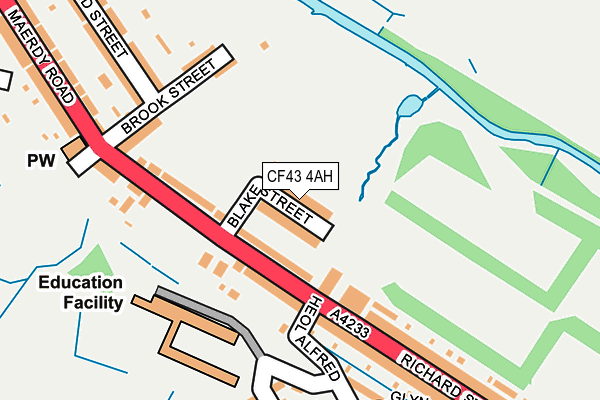
CF43 4AH lies on Blake Street in Maerdy, Ferndale. CF43 4AH is located in the Ferndale and Maerdy electoral ward, within the unitary authority of Rhondda Cynon Taf and the Welsh Parliamentary constituency of Rhondda. The Local Health Board is Cwm Taf Morgannwg University and the police force is South Wales. This postcode has been in use since January 1980.


GetTheData
Source: OS OpenMap – Local (Ordnance Survey)
Source: OS VectorMap District (Ordnance Survey)
Licence: Open Government Licence (requires attribution)
| Easting | 297772 |
| Northing | 198048 |
| Latitude | 51.671871 |
| Longitude | -3.479715 |
GetTheData
Source: Open Postcode Geo
Licence: Open Government Licence
| Street | Blake Street |
| Locality | Maerdy |
| Town/City | Ferndale |
| Country | Wales |
| Postcode District | CF43 |
➜ See where CF43 is on a map ➜ Where is Maerdy? | |
GetTheData
Source: Land Registry Price Paid Data
Licence: Open Government Licence
Elevation or altitude of CF43 4AH as distance above sea level:
| Metres | Feet | |
|---|---|---|
| Elevation | 290m | 951ft |
Elevation is measured from the approximate centre of the postcode, to the nearest point on an OS contour line from OS Terrain 50, which has contour spacing of ten vertical metres.
➜ How high above sea level am I? Find the elevation of your current position using your device's GPS.
GetTheData
Source: Open Postcode Elevation
Licence: Open Government Licence
| Ward | Ferndale And Maerdy |
| Constituency | Rhondda |
GetTheData
Source: ONS Postcode Database
Licence: Open Government Licence
| Conservative Club (Richard Street) | Maerdy | 112m |
| Conservative Club (Richard Street) | Maerdy | 126m |
| Sion Chapel (Maerdy Road) | Maerdy | 185m |
| Sion Chapel (Maerdy Road) | Maerdy | 248m |
| Maerdy Court (Maerdy Road) | Maerdy | 372m |
| Treorchy Station | 2.4km |
| Ton Pentre Station | 2.7km |
| Ynyswen Station | 3km |
GetTheData
Source: NaPTAN
Licence: Open Government Licence
| Percentage of properties with Next Generation Access | 100.0% |
| Percentage of properties with Superfast Broadband | 100.0% |
| Percentage of properties with Ultrafast Broadband | 0.0% |
| Percentage of properties with Full Fibre Broadband | 0.0% |
Superfast Broadband is between 30Mbps and 300Mbps
Ultrafast Broadband is > 300Mbps
| Median download speed | 40.0Mbps |
| Average download speed | 40.2Mbps |
| Maximum download speed | 80.00Mbps |
| Median upload speed | 9.9Mbps |
| Average upload speed | 10.1Mbps |
| Maximum upload speed | 20.00Mbps |
| Percentage of properties unable to receive 2Mbps | 0.0% |
| Percentage of properties unable to receive 5Mbps | 0.0% |
| Percentage of properties unable to receive 10Mbps | 0.0% |
| Percentage of properties unable to receive 30Mbps | 0.0% |
GetTheData
Source: Ofcom
Licence: Ofcom Terms of Use (requires attribution)
Estimated total energy consumption in CF43 4AH by fuel type, 2015.
| Consumption (kWh) | 365,996 |
|---|---|
| Meter count | 27 |
| Mean (kWh/meter) | 13,555 |
| Median (kWh/meter) | 13,900 |
| Consumption (kWh) | 80,811 |
|---|---|
| Meter count | 25 |
| Mean (kWh/meter) | 3,232 |
| Median (kWh/meter) | 3,459 |
GetTheData
Source: Postcode level gas estimates: 2015 (experimental)
Source: Postcode level electricity estimates: 2015 (experimental)
Licence: Open Government Licence
GetTheData
Source: ONS Postcode Database
Licence: Open Government Licence


➜ Get more ratings from the Food Standards Agency
GetTheData
Source: Food Standards Agency
Licence: FSA terms & conditions
| Last Collection | |||
|---|---|---|---|
| Location | Mon-Fri | Sat | Distance |
| Carne Street | 16:45 | 11:45 | 2,046m |
| Llewellyn Street | 16:45 | 11:30 | 2,072m |
| Treorchy Post Office | 18:00 | 12:30 | 2,178m |
GetTheData
Source: Dracos
Licence: Creative Commons Attribution-ShareAlike
The below table lists the International Territorial Level (ITL) codes (formerly Nomenclature of Territorial Units for Statistics (NUTS) codes) and Local Administrative Units (LAU) codes for CF43 4AH:
| ITL 1 Code | Name |
|---|---|
| TLL | Wales |
| ITL 2 Code | Name |
| TLL1 | West Wales and The Valleys |
| ITL 3 Code | Name |
| TLL15 | Central Valleys |
| LAU 1 Code | Name |
| W06000016 | Rhondda Cynon Taf |
GetTheData
Source: ONS Postcode Directory
Licence: Open Government Licence
The below table lists the Census Output Area (OA), Lower Layer Super Output Area (LSOA), and Middle Layer Super Output Area (MSOA) for CF43 4AH:
| Code | Name | |
|---|---|---|
| OA | W00006337 | |
| LSOA | W01001202 | Rhondda Cynon Taf 009C |
| MSOA | W02000260 | Rhondda Cynon Taf 009 |
GetTheData
Source: ONS Postcode Directory
Licence: Open Government Licence
| CF43 4AY | Royal Cottages | 85m |
| CF43 4AG | Maerdy Road | 155m |
| CF43 4BH | Rowley Terrace | 170m |
| CF43 4AF | Brook Street | 176m |
| CF43 4AU | Richard Street | 231m |
| CF43 4TG | Glyncoed | 238m |
| CF43 4AN | Richard Street | 253m |
| CF43 4BG | Oxford Street | 289m |
| CF43 4BL | Oxford Street | 291m |
| CF43 4BA | Maerdy Road | 333m |
GetTheData
Source: Open Postcode Geo; Land Registry Price Paid Data
Licence: Open Government Licence