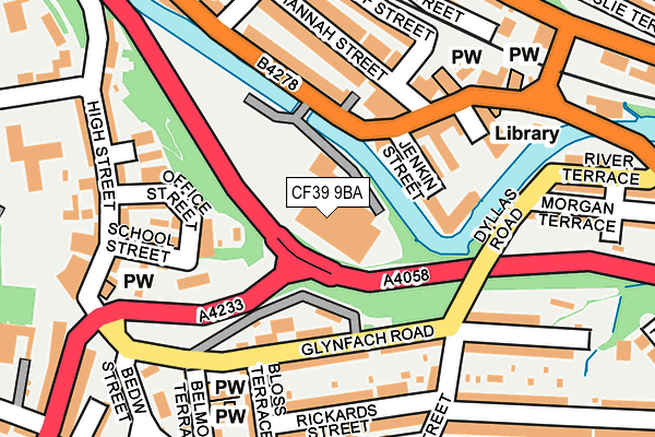
CF39 9BA is located in the Cymer electoral ward, within the unitary authority of Rhondda Cynon Taf and the Welsh Parliamentary constituency of Rhondda. The Local Health Board is Cwm Taf Morgannwg University and the police force is South Wales. This postcode has been in use since February 2017.


GetTheData
Source: OS OpenMap – Local (Ordnance Survey)
Source: OS VectorMap District (Ordnance Survey)
Licence: Open Government Licence (requires attribution)
| Easting | 302728 |
| Northing | 191012 |
| Latitude | 51.609511 |
| Longitude | -3.406123 |
GetTheData
Source: Open Postcode Geo
Licence: Open Government Licence
| Country | Wales |
| Postcode District | CF39 |
➜ See where CF39 is on a map ➜ Where is Porth? | |
GetTheData
Source: Land Registry Price Paid Data
Licence: Open Government Licence
| Ward | Cymer |
| Constituency | Rhondda |
GetTheData
Source: ONS Postcode Database
Licence: Open Government Licence
| Morrisons (Pontypridd Road) | Porth | 79m |
| Dyllas Road | Cymmer | 142m |
| Glynfach Road | Cymmer | 143m |
| Dyllas Road | Cymmer | 147m |
| St John's Church (Glynfach Road) | Cymmer | 163m |
| Porth Station | 0.3km |
| Trehafod Station | 1.7km |
| Dinas (Rhondda) Station | 2.4km |
GetTheData
Source: NaPTAN
Licence: Open Government Licence
GetTheData
Source: ONS Postcode Database
Licence: Open Government Licence


➜ Get more ratings from the Food Standards Agency
GetTheData
Source: Food Standards Agency
Licence: FSA terms & conditions
| Last Collection | |||
|---|---|---|---|
| Location | Mon-Fri | Sat | Distance |
| Leslie Terrace | 17:15 | 11:15 | 562m |
| Brittannia Post Office | 16:30 | 11:00 | 799m |
| Llwyncelyn | 17:15 | 11:00 | 2,228m |
GetTheData
Source: Dracos
Licence: Creative Commons Attribution-ShareAlike
The below table lists the International Territorial Level (ITL) codes (formerly Nomenclature of Territorial Units for Statistics (NUTS) codes) and Local Administrative Units (LAU) codes for CF39 9BA:
| ITL 1 Code | Name |
|---|---|
| TLL | Wales |
| ITL 2 Code | Name |
| TLL1 | West Wales and The Valleys |
| ITL 3 Code | Name |
| TLL15 | Central Valleys |
| LAU 1 Code | Name |
| W06000016 | Rhondda Cynon Taf |
GetTheData
Source: ONS Postcode Directory
Licence: Open Government Licence
The below table lists the Census Output Area (OA), Lower Layer Super Output Area (LSOA), and Middle Layer Super Output Area (MSOA) for CF39 9BA:
| Code | Name | |
|---|---|---|
| OA | W00006187 | |
| LSOA | W01001172 | Rhondda Cynon Taf 020A |
| MSOA | W02000271 | Rhondda Cynon Taf 020 |
GetTheData
Source: ONS Postcode Directory
Licence: Open Government Licence
| CF39 9PP | Jenkin Street | 87m |
| CF39 9AH | Office Street | 113m |
| CF39 9LF | Glynfach Road | 131m |
| CF39 9PN | Foundry Place | 148m |
| CF39 9PG | Pontypridd Road | 149m |
| CF39 9AN | School Street | 159m |
| CF39 9RA | Hannah Street | 160m |
| CF39 9PH | Pontypridd Road | 161m |
| CF39 9LP | Dyllas Road | 162m |
| CF39 9RB | Hannah Street | 164m |
GetTheData
Source: Open Postcode Geo; Land Registry Price Paid Data
Licence: Open Government Licence