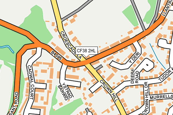
CF38 2HL is in Llantwit Fardre, Pontypridd. CF38 2HL is located in the Llantwit Fardre electoral ward, within the unitary authority of Rhondda Cynon Taf and the Welsh Parliamentary constituency of Pontypridd. The Local Health Board is Cwm Taf Morgannwg University and the police force is South Wales. This postcode has been in use since January 1980.


GetTheData
Source: OS OpenMap – Local (Ordnance Survey)
Source: OS VectorMap District (Ordnance Survey)
Licence: Open Government Licence (requires attribution)
| Easting | 307262 |
| Northing | 184901 |
| Latitude | 51.555344 |
| Longitude | -3.339040 |
GetTheData
Source: Open Postcode Geo
Licence: Open Government Licence
| Locality | Llantwit Fardre |
| Town/City | Pontypridd |
| Country | Wales |
| Postcode District | CF38 |
➜ See where CF38 is on a map ➜ Where is Llantwit Fardre? | |
GetTheData
Source: Land Registry Price Paid Data
Licence: Open Government Licence
Elevation or altitude of CF38 2HL as distance above sea level:
| Metres | Feet | |
|---|---|---|
| Elevation | 100m | 328ft |
Elevation is measured from the approximate centre of the postcode, to the nearest point on an OS contour line from OS Terrain 50, which has contour spacing of ten vertical metres.
➜ How high above sea level am I? Find the elevation of your current position using your device's GPS.
GetTheData
Source: Open Postcode Elevation
Licence: Open Government Licence
| Ward | Llantwit Fardre |
| Constituency | Pontypridd |
GetTheData
Source: ONS Postcode Database
Licence: Open Government Licence
2019 10 JAN £320,000 |
THE CROWN INN, LLANTWIT FARDRE, PONTYPRIDD, CF38 2HL 2007 30 AUG £275,000 |
2002 15 MAR £154,000 |
➜ Llantwit Fardre house prices
GetTheData
Source: HM Land Registry Price Paid Data
Licence: Contains HM Land Registry data © Crown copyright and database right 2025. This data is licensed under the Open Government Licence v3.0.
| Crown Inn (Llantrisant Road) | Llantwit Fardre | 55m |
| Crown Inn (Llantrisant Road) | Llantwit Fardre | 74m |
| Dynasty (Llantrisant Road) | Llantwit Fardre | 348m |
| Dynasty (Llantrisant Roas) | Llantwit Fardre | 351m |
| Aspen Way (Crown Hill) | Llantwit Fardre | 359m |
| Trefforest Estate Station | 3.7km |
| Trefforest Station | 4.1km |
| Pontypridd Station | 4.9km |
GetTheData
Source: NaPTAN
Licence: Open Government Licence
| Percentage of properties with Next Generation Access | 100.0% |
| Percentage of properties with Superfast Broadband | 100.0% |
| Percentage of properties with Ultrafast Broadband | 0.0% |
| Percentage of properties with Full Fibre Broadband | 0.0% |
Superfast Broadband is between 30Mbps and 300Mbps
Ultrafast Broadband is > 300Mbps
| Percentage of properties unable to receive 2Mbps | 0.0% |
| Percentage of properties unable to receive 5Mbps | 0.0% |
| Percentage of properties unable to receive 10Mbps | 0.0% |
| Percentage of properties unable to receive 30Mbps | 0.0% |
GetTheData
Source: Ofcom
Licence: Ofcom Terms of Use (requires attribution)
GetTheData
Source: ONS Postcode Database
Licence: Open Government Licence


➜ Get more ratings from the Food Standards Agency
GetTheData
Source: Food Standards Agency
Licence: FSA terms & conditions
| Last Collection | |||
|---|---|---|---|
| Location | Mon-Fri | Sat | Distance |
| Rowans Gardens | 16:00 | 11:30 | 525m |
| Gwaunmiskin Beddau | 18:00 | 11:45 | 1,018m |
| Treforest | 17:30 | 12:00 | 4,372m |
GetTheData
Source: Dracos
Licence: Creative Commons Attribution-ShareAlike
The below table lists the International Territorial Level (ITL) codes (formerly Nomenclature of Territorial Units for Statistics (NUTS) codes) and Local Administrative Units (LAU) codes for CF38 2HL:
| ITL 1 Code | Name |
|---|---|
| TLL | Wales |
| ITL 2 Code | Name |
| TLL1 | West Wales and The Valleys |
| ITL 3 Code | Name |
| TLL15 | Central Valleys |
| LAU 1 Code | Name |
| W06000016 | Rhondda Cynon Taf |
GetTheData
Source: ONS Postcode Directory
Licence: Open Government Licence
The below table lists the Census Output Area (OA), Lower Layer Super Output Area (LSOA), and Middle Layer Super Output Area (MSOA) for CF38 2HL:
| Code | Name | |
|---|---|---|
| OA | W00006303 | |
| LSOA | W01001196 | Rhondda Cynon Taf 027B |
| MSOA | W02000278 | Rhondda Cynon Taf 027 |
GetTheData
Source: ONS Postcode Directory
Licence: Open Government Licence
| CF38 2HE | Main Road | 33m |
| CF38 2HW | Balmoral Cottages | 51m |
| CF38 2HP | 69m | |
| CF38 2DZ | The Grange | 78m |
| CF38 2HR | Ystradbarwig Terrace | 89m |
| CF38 2HN | Alexandra Terrace | 98m |
| CF38 2HG | Kingsacre | 108m |
| CF38 2HH | Llest Terrace | 108m |
| CF38 2HS | Ystradbarwig | 118m |
| CF38 2PP | Croescade Lane | 137m |
GetTheData
Source: Open Postcode Geo; Land Registry Price Paid Data
Licence: Open Government Licence