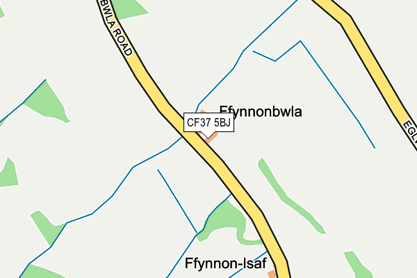
CF37 5BJ is in Upper Boat, Pontypridd. CF37 5BJ is located in the Upper Rhydfelen and Glyn-taf electoral ward, within the unitary authority of Rhondda Cynon Taf and the Welsh Parliamentary constituency of Pontypridd. The Local Health Board is Cwm Taf Morgannwg University and the police force is South Wales. This postcode has been in use since January 1980.


GetTheData
Source: OS OpenMap – Local (Ordnance Survey)
Source: OS VectorMap District (Ordnance Survey)
Licence: Open Government Licence (requires attribution)
| Easting | 310199 |
| Northing | 188777 |
| Latitude | 51.590662 |
| Longitude | -3.297693 |
GetTheData
Source: Open Postcode Geo
Licence: Open Government Licence
| Locality | Upper Boat |
| Town/City | Pontypridd |
| Country | Wales |
| Postcode District | CF37 |
➜ See where CF37 is on a map | |
GetTheData
Source: Land Registry Price Paid Data
Licence: Open Government Licence
Elevation or altitude of CF37 5BJ as distance above sea level:
| Metres | Feet | |
|---|---|---|
| Elevation | 200m | 656ft |
Elevation is measured from the approximate centre of the postcode, to the nearest point on an OS contour line from OS Terrain 50, which has contour spacing of ten vertical metres.
➜ How high above sea level am I? Find the elevation of your current position using your device's GPS.
GetTheData
Source: Open Postcode Elevation
Licence: Open Government Licence
| Ward | Upper Rhydfelen And Glyn-taf |
| Constituency | Pontypridd |
GetTheData
Source: ONS Postcode Database
Licence: Open Government Licence
| Masefield Way Top (Masefield Way) | Rhydyfelin | 531m |
| Masefield Way Top (Masefield Way) | Rhydyfelin | 537m |
| Wordsworth Gardens | Rhydyfelin | 668m |
| Beechwood Street Top (Oak Street) | Rhydyfelin | 682m |
| Dynea Spar (Pinewood Avenue) | Rhydyfelin | 712m |
| Trefforest Station | 1.9km |
| Trefforest Estate Station | 2.5km |
| Pontypridd Station | 3.2km |
GetTheData
Source: NaPTAN
Licence: Open Government Licence
GetTheData
Source: ONS Postcode Database
Licence: Open Government Licence


➜ Get more ratings from the Food Standards Agency
GetTheData
Source: Food Standards Agency
Licence: FSA terms & conditions
| Last Collection | |||
|---|---|---|---|
| Location | Mon-Fri | Sat | Distance |
| Glyntaff | 17:30 | 11:15 | 1,779m |
| Treforest | 17:30 | 12:00 | 1,907m |
| Broadway | 17:45 | 11:15 | 2,198m |
GetTheData
Source: Dracos
Licence: Creative Commons Attribution-ShareAlike
The below table lists the International Territorial Level (ITL) codes (formerly Nomenclature of Territorial Units for Statistics (NUTS) codes) and Local Administrative Units (LAU) codes for CF37 5BJ:
| ITL 1 Code | Name |
|---|---|
| TLL | Wales |
| ITL 2 Code | Name |
| TLL1 | West Wales and The Valleys |
| ITL 3 Code | Name |
| TLL15 | Central Valleys |
| LAU 1 Code | Name |
| W06000016 | Rhondda Cynon Taf |
GetTheData
Source: ONS Postcode Directory
Licence: Open Government Licence
The below table lists the Census Output Area (OA), Lower Layer Super Output Area (LSOA), and Middle Layer Super Output Area (MSOA) for CF37 5BJ:
| Code | Name | |
|---|---|---|
| OA | W00006507 | |
| LSOA | W01001238 | Rhondda Cynon Taf 022C |
| MSOA | W02000273 | Rhondda Cynon Taf 022 |
GetTheData
Source: ONS Postcode Directory
Licence: Open Government Licence
| CF37 5EH | Heol Y Bryn | 370m |
| CF37 5BX | 452m | |
| CF37 5EG | Dynea Close | 483m |
| CF37 5DT | Dynea Road | 501m |
| CF37 5EF | Dan Yr Allt Close | 519m |
| CF37 5HD | Masefield Way | 521m |
| CF37 5HF | Wordsworth Gardens | 561m |
| CF83 4JG | Eglwysilan | 618m |
| CF37 5SD | Oak Street | 619m |
| CF37 5EE | Cedar Lane | 628m |
GetTheData
Source: Open Postcode Geo; Land Registry Price Paid Data
Licence: Open Government Licence