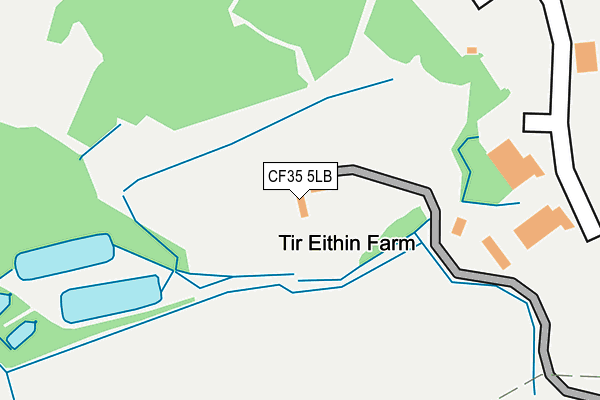
CF35 5LB is located in the Brynna and Llanharan electoral ward, within the unitary authority of Rhondda Cynon Taf and the Welsh Parliamentary constituency of Ogmore. The Local Health Board is Cwm Taf Morgannwg University and the police force is South Wales. This postcode has been in use since May 1994.


GetTheData
Source: OS OpenMap – Local (Ordnance Survey)
Source: OS VectorMap District (Ordnance Survey)
Licence: Open Government Licence (requires attribution)
| Easting | 297748 |
| Northing | 181900 |
| Latitude | 51.526725 |
| Longitude | -3.475363 |
GetTheData
Source: Open Postcode Geo
Licence: Open Government Licence
| Country | Wales |
| Postcode District | CF35 |
➜ See where CF35 is on a map | |
GetTheData
Source: Land Registry Price Paid Data
Licence: Open Government Licence
Elevation or altitude of CF35 5LB as distance above sea level:
| Metres | Feet | |
|---|---|---|
| Elevation | 50m | 164ft |
Elevation is measured from the approximate centre of the postcode, to the nearest point on an OS contour line from OS Terrain 50, which has contour spacing of ten vertical metres.
➜ How high above sea level am I? Find the elevation of your current position using your device's GPS.
GetTheData
Source: Open Postcode Elevation
Licence: Open Government Licence
| Ward | Brynna And Llanharan |
| Constituency | Ogmore |
GetTheData
Source: ONS Postcode Database
Licence: Open Government Licence
| Film Studio (New Road) | Llanilid | 420m |
| Film Studio (New Road) | Llanilid | 518m |
| Mountain Hare (Brynna Road) | Brynna | 686m |
| Mountain Hare (Brynna Road) | Brynna | 726m |
| Ty Merchant (Penybont Road) | Pen-prisk | 908m |
| Pencoed Station | 1.8km |
| Llanharan Station | 2.7km |
GetTheData
Source: NaPTAN
Licence: Open Government Licence
GetTheData
Source: ONS Postcode Database
Licence: Open Government Licence


➜ Get more ratings from the Food Standards Agency
GetTheData
Source: Food Standards Agency
Licence: FSA terms & conditions
| Last Collection | |||
|---|---|---|---|
| Location | Mon-Fri | Sat | Distance |
| Rhiwceiliog | 09:30 | 08:30 | 1,207m |
| City | 16:00 | 08:15 | 3,759m |
| Danygraig Drive | 17:15 | 11:15 | 3,802m |
GetTheData
Source: Dracos
Licence: Creative Commons Attribution-ShareAlike
The below table lists the International Territorial Level (ITL) codes (formerly Nomenclature of Territorial Units for Statistics (NUTS) codes) and Local Administrative Units (LAU) codes for CF35 5LB:
| ITL 1 Code | Name |
|---|---|
| TLL | Wales |
| ITL 2 Code | Name |
| TLL1 | West Wales and The Valleys |
| ITL 3 Code | Name |
| TLL15 | Central Valleys |
| LAU 1 Code | Name |
| W06000016 | Rhondda Cynon Taf |
GetTheData
Source: ONS Postcode Directory
Licence: Open Government Licence
The below table lists the Census Output Area (OA), Lower Layer Super Output Area (LSOA), and Middle Layer Super Output Area (MSOA) for CF35 5LB:
| Code | Name | |
|---|---|---|
| OA | W00006122 | |
| LSOA | W01001160 | Rhondda Cynon Taf 029A |
| MSOA | W02000280 | Rhondda Cynon Taf 029 |
GetTheData
Source: ONS Postcode Directory
Licence: Open Government Licence
| CF35 5LD | New Road | 455m |
| CF35 5LA | 550m | |
| CF35 6PD | Brynna Road | 587m |
| CF35 6PF | Belmont | 619m |
| CF35 6PJ | Emanda Gardens | 629m |
| CF35 6PH | Red Roofs Close | 689m |
| CF35 6PE | Manor Park | 691m |
| CF35 6PG | Brynna Road | 715m |
| CF35 6PL | Red Roofs Close | 740m |
| CF35 5HU | 767m |
GetTheData
Source: Open Postcode Geo; Land Registry Price Paid Data
Licence: Open Government Licence