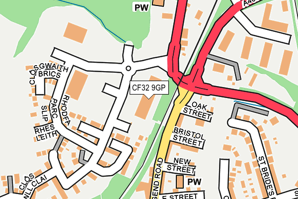
CF32 9GP is located in the Aberkenfig electoral ward, within the unitary authority of Bridgend and the Welsh Parliamentary constituency of Ogmore. The Local Health Board is Cwm Taf Morgannwg University and the police force is South Wales. This postcode has been in use since June 2017.


GetTheData
Source: OS OpenMap – Local (Ordnance Survey)
Source: OS VectorMap District (Ordnance Survey)
Licence: Open Government Licence (requires attribution)
| Easting | 289233 |
| Northing | 183992 |
| Latitude | 51.543920 |
| Longitude | -3.598718 |
GetTheData
Source: Open Postcode Geo
Licence: Open Government Licence
| Country | Wales |
| Postcode District | CF32 |
➜ See where CF32 is on a map ➜ Where is Tondu? | |
GetTheData
Source: Land Registry Price Paid Data
Licence: Open Government Licence
| Ward | Aberkenfig |
| Constituency | Ogmore |
GetTheData
Source: ONS Postcode Database
Licence: Open Government Licence
| Tondu Bridge (Maesteg Road) | Aberkenfig | 69m |
| Tondu Bridge (Maesteg Road) | Tondu | 112m |
| New Street (Bridgend Road) | Aberkenfig | 127m |
| Tondu Bridge (Maesteg Road) | Tondu | 162m |
| Station (Bryn Road) | Tondu | 298m |
| Tondu Station | 0.4km |
| Sarn Station | 0.8km |
| Wildmill Station | 2.9km |
GetTheData
Source: NaPTAN
Licence: Open Government Licence
GetTheData
Source: ONS Postcode Database
Licence: Open Government Licence


➜ Get more ratings from the Food Standards Agency
GetTheData
Source: Food Standards Agency
Licence: FSA terms & conditions
| Last Collection | |||
|---|---|---|---|
| Location | Mon-Fri | Sat | Distance |
| Heol Y Groes | 17:30 | 12:00 | 2,429m |
| Cefn Cross | 17:15 | 11:00 | 3,075m |
| Pendre | 17:15 | 12:00 | 3,353m |
GetTheData
Source: Dracos
Licence: Creative Commons Attribution-ShareAlike
The below table lists the International Territorial Level (ITL) codes (formerly Nomenclature of Territorial Units for Statistics (NUTS) codes) and Local Administrative Units (LAU) codes for CF32 9GP:
| ITL 1 Code | Name |
|---|---|
| TLL | Wales |
| ITL 2 Code | Name |
| TLL1 | West Wales and The Valleys |
| ITL 3 Code | Name |
| TLL17 | Bridgend and Neath Port Talbot |
| LAU 1 Code | Name |
| W06000013 | Bridgend |
GetTheData
Source: ONS Postcode Directory
Licence: Open Government Licence
The below table lists the Census Output Area (OA), Lower Layer Super Output Area (LSOA), and Middle Layer Super Output Area (MSOA) for CF32 9GP:
| Code | Name | |
|---|---|---|
| OA | W00005177 | |
| LSOA | W01000974 | Bridgend 006A |
| MSOA | W02000223 | Bridgend 006 |
GetTheData
Source: ONS Postcode Directory
Licence: Open Government Licence
| CF32 9BP | Oak Street | 110m |
| CF32 9BN | Bridgend Road | 112m |
| CF32 9BW | Bristol Street | 132m |
| CF32 9GE | Cwrt Yr Hen Ysgol | 139m |
| CF32 9BL | New Street | 162m |
| CF32 9BG | Bridgend Road | 207m |
| CF32 9BH | East Street | 207m |
| CF32 9GA | Clos Gwaith Brics | 215m |
| CF32 9BT | Maesteg Road | 223m |
| CF32 9PU | The Crescent | 226m |
GetTheData
Source: Open Postcode Geo; Land Registry Price Paid Data
Licence: Open Government Licence