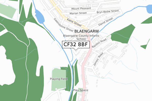
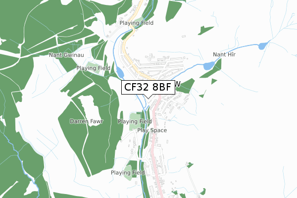
CF32 8BF is located in the Garw Valley electoral ward, within the unitary authority of Bridgend and the Welsh Parliamentary constituency of Ogmore. The Local Health Board is Cwm Taf Morgannwg University and the police force is South Wales. This postcode has been in use since February 2019.


GetTheData
Source: OS Open Zoomstack (Ordnance Survey)
Licence: Open Government Licence (requires attribution)
Attribution: Contains OS data © Crown copyright and database right 2025
Source: Open Postcode Geo
Licence: Open Government Licence (requires attribution)
Attribution: Contains OS data © Crown copyright and database right 2025; Contains Royal Mail data © Royal Mail copyright and database right 2025; Source: Office for National Statistics licensed under the Open Government Licence v.3.0
| Easting | 290142 |
| Northing | 192838 |
| Latitude | 51.623608 |
| Longitude | -3.588384 |
GetTheData
Source: Open Postcode Geo
Licence: Open Government Licence
| Country | Wales |
| Postcode District | CF32 |
➜ See where CF32 is on a map ➜ Where is Blaengarw? | |
GetTheData
Source: Land Registry Price Paid Data
Licence: Open Government Licence
| Ward | Garw Valley |
| Constituency | Ogmore |
GetTheData
Source: ONS Postcode Database
Licence: Open Government Licence
| Nanthir Road | Blaengarw | 80m |
| Nanthir Road | Blaengarw | 89m |
| Community Centre (Bridge Street) | Blaengarw | 95m |
| Community Centre (Bridge Street) | Blaengarw | 113m |
| Blaengarw Hotel (Katie Street) | Blaengarw | 183m |
| Maesteg (Ewenny Road) Station | 4.7km |
| Garth (Bridgend) Station | 4.8km |
| Maesteg Station | 4.8km |
GetTheData
Source: NaPTAN
Licence: Open Government Licence
| Percentage of properties with Next Generation Access | 100.0% |
| Percentage of properties with Superfast Broadband | 100.0% |
| Percentage of properties with Ultrafast Broadband | 0.0% |
| Percentage of properties with Full Fibre Broadband | 0.0% |
Superfast Broadband is between 30Mbps and 300Mbps
Ultrafast Broadband is > 300Mbps
| Percentage of properties unable to receive 2Mbps | 0.0% |
| Percentage of properties unable to receive 5Mbps | 0.0% |
| Percentage of properties unable to receive 10Mbps | 0.0% |
| Percentage of properties unable to receive 30Mbps | 0.0% |
GetTheData
Source: Ofcom
Licence: Ofcom Terms of Use (requires attribution)
GetTheData
Source: ONS Postcode Database
Licence: Open Government Licence


➜ Get more ratings from the Food Standards Agency
GetTheData
Source: Food Standards Agency
Licence: FSA terms & conditions
| Last Collection | |||
|---|---|---|---|
| Location | Mon-Fri | Sat | Distance |
| Castle Street | 16:45 | 10:30 | 5,024m |
| Talbot Street | 17:30 | 12:00 | 5,049m |
GetTheData
Source: Dracos
Licence: Creative Commons Attribution-ShareAlike
The below table lists the International Territorial Level (ITL) codes (formerly Nomenclature of Territorial Units for Statistics (NUTS) codes) and Local Administrative Units (LAU) codes for CF32 8BF:
| ITL 1 Code | Name |
|---|---|
| TLL | Wales |
| ITL 2 Code | Name |
| TLL1 | West Wales and The Valleys |
| ITL 3 Code | Name |
| TLL17 | Bridgend and Neath Port Talbot |
| LAU 1 Code | Name |
| W06000013 | Bridgend |
GetTheData
Source: ONS Postcode Directory
Licence: Open Government Licence
The below table lists the Census Output Area (OA), Lower Layer Super Output Area (LSOA), and Middle Layer Super Output Area (MSOA) for CF32 8BF:
| Code | Name | |
|---|---|---|
| OA | W00005197 | |
| LSOA | W01000978 | Bridgend 004B |
| MSOA | W02000221 | Bridgend 004 |
GetTheData
Source: ONS Postcode Directory
Licence: Open Government Licence
| CF32 8BB | Church Street | 38m |
| CF32 8BE | Church Place | 38m |
| CF32 8BA | Station Street | 52m |
| CF32 8BD | Church Terrace | 80m |
| CF32 8BL | Nanthir Road | 94m |
| CF32 8BN | Convil Road | 159m |
| CF32 8BP | James Road | 163m |
| CF32 8BG | Nanthir Road | 175m |
| CF32 8AA | The Strand | 192m |
| CF32 8AB | Katie Street | 197m |
GetTheData
Source: Open Postcode Geo; Land Registry Price Paid Data
Licence: Open Government Licence