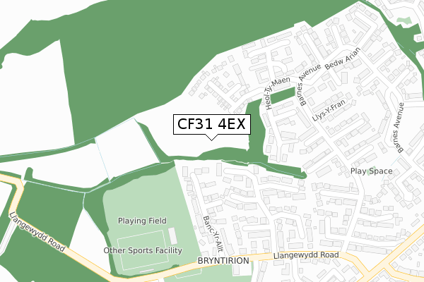
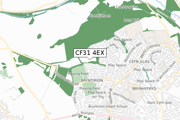
CF31 4EX is located in the Bryntirion, Laleston and Merthyr Mawr electoral ward, within the unitary authority of Bridgend and the Welsh Parliamentary constituency of Bridgend. The Local Health Board is Cwm Taf Morgannwg University and the police force is South Wales. This postcode has been in use since April 2020.


GetTheData
Source: OS Open Zoomstack (Ordnance Survey)
Licence: Open Government Licence (requires attribution)
Attribution: Contains OS data © Crown copyright and database right 2025
Source: Open Postcode Geo
Licence: Open Government Licence (requires attribution)
Attribution: Contains OS data © Crown copyright and database right 2025; Contains Royal Mail data © Royal Mail copyright and database right 2025; Source: Office for National Statistics licensed under the Open Government Licence v.3.0
| Easting | 288630 |
| Northing | 180725 |
| Latitude | 51.514437 |
| Longitude | -3.606377 |
GetTheData
Source: Open Postcode Geo
Licence: Open Government Licence
| Country | Wales |
| Postcode District | CF31 |
➜ See where CF31 is on a map ➜ Where is Bridgend? | |
GetTheData
Source: Land Registry Price Paid Data
Licence: Open Government Licence
| Ward | Bryntirion, Laleston And Merthyr Mawr |
| Constituency | Bridgend |
GetTheData
Source: ONS Postcode Database
Licence: Open Government Licence
2024 12 AUG £265,000 |
2, LLYS HELYG, BRIDGEND, CF31 4EX 2021 7 JUN £282,995 |
3, LLYS HELYG, BRIDGEND, CF31 4EX 2021 28 MAY £284,995 |
4, LLYS HELYG, BRIDGEND, CF31 4EX 2021 21 MAY £228,995 |
5, LLYS HELYG, BRIDGEND, CF31 4EX 2021 21 MAY £263,995 |
6, LLYS HELYG, BRIDGEND, CF31 4EX 2021 30 APR £263,995 |
7, LLYS HELYG, BRIDGEND, CF31 4EX 2021 30 APR £261,995 |
8, LLYS HELYG, BRIDGEND, CF31 4EX 2021 23 APR £279,995 |
2020 7 AUG £211,995 |
GetTheData
Source: HM Land Registry Price Paid Data
Licence: Contains HM Land Registry data © Crown copyright and database right 2025. This data is licensed under the Open Government Licence v3.0.
| Heol-ty-maen (Barnes Avenue) | Cefn Glas | 200m |
| Barnes Avenue | Cefn Glas | 242m |
| Coed Caer Odin (Barnes Avenue) | Cefn Glas | 269m |
| Westward Place (Llangewydd Road) | Bryntirion | 297m |
| Westward Place (Llangewydd Road) | Bryntirion | 316m |
| Wildmill Station | 2km |
| Bridgend Station | 2.3km |
| Sarn Station | 2.9km |
GetTheData
Source: NaPTAN
Licence: Open Government Licence
GetTheData
Source: ONS Postcode Database
Licence: Open Government Licence


➜ Get more ratings from the Food Standards Agency
GetTheData
Source: Food Standards Agency
Licence: FSA terms & conditions
| Last Collection | |||
|---|---|---|---|
| Location | Mon-Fri | Sat | Distance |
| Bryntirion Hill | 17:00 | 12:00 | 992m |
| Broadlands North | 17:00 | 11:30 | 1,101m |
| Shopping Centre Broadlands | 17:15 | 11:45 | 1,366m |
GetTheData
Source: Dracos
Licence: Creative Commons Attribution-ShareAlike
The below table lists the International Territorial Level (ITL) codes (formerly Nomenclature of Territorial Units for Statistics (NUTS) codes) and Local Administrative Units (LAU) codes for CF31 4EX:
| ITL 1 Code | Name |
|---|---|
| TLL | Wales |
| ITL 2 Code | Name |
| TLL1 | West Wales and The Valleys |
| ITL 3 Code | Name |
| TLL17 | Bridgend and Neath Port Talbot |
| LAU 1 Code | Name |
| W06000013 | Bridgend |
GetTheData
Source: ONS Postcode Directory
Licence: Open Government Licence
The below table lists the Census Output Area (OA), Lower Layer Super Output Area (LSOA), and Middle Layer Super Output Area (MSOA) for CF31 4EX:
| Code | Name | |
|---|---|---|
| OA | W00005246 | |
| LSOA | W01000989 | Bridgend 013A |
| MSOA | W02000230 | Bridgend 013 |
GetTheData
Source: ONS Postcode Directory
Licence: Open Government Licence
| CF31 4XD | Westward Close | 101m |
| CF31 4RH | Banc Yr Allt | 175m |
| CF31 4XA | Westward Place | 210m |
| CF31 4TX | Maes Bryn | 220m |
| CF31 4XB | Westward Place | 228m |
| CF31 4TZ | Heol Y Dail | 233m |
| CF31 4TS | Barnes Avenue | 250m |
| CF31 4TT | Barnes Avenue | 273m |
| CF31 4TU | Llys Y Fran | 278m |
| CF31 4TP | Bedw Arian | 288m |
GetTheData
Source: Open Postcode Geo; Land Registry Price Paid Data
Licence: Open Government Licence