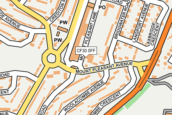
CF30 0FF is located in the Llanrumney electoral ward, within the unitary authority of Cardiff and the Welsh Parliamentary constituency of Cardiff South and Penarth. The Local Health Board is Cardiff and Vale University and the police force is South Wales. This postcode has been in use since September 2016.


GetTheData
Source: OS OpenMap – Local (Ordnance Survey)
Source: OS VectorMap District (Ordnance Survey)
Licence: Open Government Licence (requires attribution)
| Easting | 322417 |
| Northing | 180673 |
| Latitude | 51.519627 |
| Longitude | -3.119571 |
GetTheData
Source: Open Postcode Geo
Licence: Open Government Licence
| Country | Wales |
| Postcode District | CF30 |
➜ Where is Cardiff? | |
GetTheData
Source: Land Registry Price Paid Data
Licence: Open Government Licence
Elevation or altitude of CF30 0FF as distance above sea level:
| Metres | Feet | |
|---|---|---|
| Elevation | 50m | 164ft |
Elevation is measured from the approximate centre of the postcode, to the nearest point on an OS contour line from OS Terrain 50, which has contour spacing of ten vertical metres.
➜ How high above sea level am I? Find the elevation of your current position using your device's GPS.
GetTheData
Source: Open Postcode Elevation
Licence: Open Government Licence
| Ward | Llanrumney |
| Constituency | Cardiff South And Penarth |
GetTheData
Source: ONS Postcode Database
Licence: Open Government Licence
| Bideford Road (Mount Pleasant Avenue) | Llanrumney | 51m |
| Mount Pleasant Ave (Mount Pleasant Avenue) | Llanrumney | 74m |
| Countisbury Shops (Countisburyy Avenue) | Llanrumney | 92m |
| Countisbury Avenue (Burnham Avenue) | Llanrumney | 141m |
| Countisbury Avenue (Burnham Avenue) | Llanrumney | 150m |
| Heath High Level Station | 4.3km |
| Heath Low Level Station | 4.4km |
| Llanishen Station | 4.6km |
GetTheData
Source: NaPTAN
Licence: Open Government Licence
GetTheData
Source: ONS Postcode Database
Licence: Open Government Licence


➜ Get more ratings from the Food Standards Agency
GetTheData
Source: Food Standards Agency
Licence: FSA terms & conditions
| Last Collection | |||
|---|---|---|---|
| Location | Mon-Fri | Sat | Distance |
| Ball Road | 17:15 | 11:00 | 855m |
| Coed Y Gores | 17:30 | 11:45 | 1,101m |
| Nedo Springmeadow Estate | 18:30 | 1,222m | |
GetTheData
Source: Dracos
Licence: Creative Commons Attribution-ShareAlike
The below table lists the International Territorial Level (ITL) codes (formerly Nomenclature of Territorial Units for Statistics (NUTS) codes) and Local Administrative Units (LAU) codes for CF30 0FF:
| ITL 1 Code | Name |
|---|---|
| TLL | Wales |
| ITL 2 Code | Name |
| TLL2 | East Wales |
| ITL 3 Code | Name |
| TLL22 | Cardiff and Vale of Glamorgan |
| LAU 1 Code | Name |
| W06000015 | Cardiff |
GetTheData
Source: ONS Postcode Directory
Licence: Open Government Licence
The below table lists the Census Output Area (OA), Lower Layer Super Output Area (LSOA), and Middle Layer Super Output Area (MSOA) for CF30 0FF:
| Code | Name | |
|---|---|---|
| OA | W00009299 | |
| LSOA | W01001802 | Cardiff 007A |
| MSOA | W02000373 | Cardiff 007 |
GetTheData
Source: ONS Postcode Directory
Licence: Open Government Licence
| CF3 5SJ | Countisbury Avenue | 58m |
| CF3 5SZ | Mount Pleasant Avenue | 59m |
| CF3 5SX | Mount Pleasant Avenue | 75m |
| CF3 5SP | Countisbury Avenue | 100m |
| CF3 5SL | Countisbury Avenue | 105m |
| CF3 5SY | Mount Pleasant Avenue | 110m |
| CF3 5RN | Countisbury Avenue | 144m |
| CF3 4TD | Woolacombe Avenue | 145m |
| CF3 4TE | Woolacombe Avenue | 145m |
| CF3 5TF | Bridgwater Road | 149m |
GetTheData
Source: Open Postcode Geo; Land Registry Price Paid Data
Licence: Open Government Licence