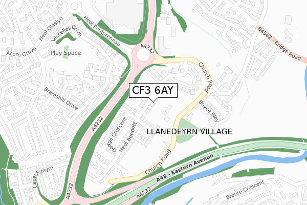
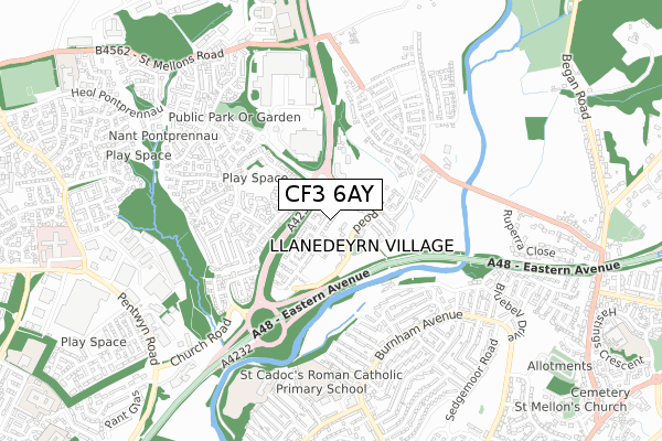
CF3 6AY is located in the Pontprennau and Old St Mellons electoral ward, within the unitary authority of Cardiff and the Welsh Parliamentary constituency of Cardiff North. The Local Health Board is Cardiff and Vale University and the police force is South Wales. This postcode has been in use since November 2019.


GetTheData
Source: OS Open Zoomstack (Ordnance Survey)
Licence: Open Government Licence (requires attribution)
Attribution: Contains OS data © Crown copyright and database right 2025
Source: Open Postcode Geo
Licence: Open Government Licence (requires attribution)
Attribution: Contains OS data © Crown copyright and database right 2025; Contains Royal Mail data © Royal Mail copyright and database right 2025; Source: Office for National Statistics licensed under the Open Government Licence v.3.0
| Easting | 321945 |
| Northing | 182088 |
| Latitude | 51.532282 |
| Longitude | -3.126686 |
GetTheData
Source: Open Postcode Geo
Licence: Open Government Licence
| Country | Wales |
| Postcode District | CF3 |
➜ See where CF3 is on a map ➜ Where is Cardiff? | |
GetTheData
Source: Land Registry Price Paid Data
Licence: Open Government Licence
| Ward | Pontprennau And Old St Mellons |
| Constituency | Cardiff North |
GetTheData
Source: ONS Postcode Database
Licence: Open Government Licence
MEADOW VIEW, HEOL BENNETT, OLD ST MELLONS, CARDIFF, CF3 6AY 2020 17 DEC £449,995 |
THE WILLOWS, HEOL BENNETT, OLD ST MELLONS, CARDIFF, CF3 6AY 2020 28 FEB £479,995 |
THE HOLLIES, HEOL BENNETT, OLD ST MELLONS, CARDIFF, CF3 6AY 2020 31 JAN £479,995 |
HONEYSUCKLE HOUSE, HEOL BENNETT, OLD ST MELLONS, CARDIFF, CF3 6AY 2020 17 JAN £479,995 |
ORCHARD HOUSE, HEOL BENNETT, OLD ST MELLONS, CARDIFF, CF3 6AY 2020 16 JAN £439,995 |
FAIRVIEW, HEOL BENNETT, OLD ST MELLONS, CARDIFF, CF3 6AY 2019 20 NOV £429,995 |
GetTheData
Source: HM Land Registry Price Paid Data
Licence: Contains HM Land Registry data © Crown copyright and database right 2025. This data is licensed under the Open Government Licence v3.0.
| Asda (Heol Pontprennau) | Pontprennau | 264m |
| Asda (Heol Pontprennau) | Pontprennau | 315m |
| Heol Pontprennau | Pontprennau | 501m |
| Hazlitt Close (Burnham Avenue) | Llanrumney | 514m |
| Heol Pontprennau | Pontprennau | 550m |
| Llanishen Station | 3.8km |
| Heath High Level Station | 4.2km |
| Heath Low Level Station | 4.3km |
GetTheData
Source: NaPTAN
Licence: Open Government Licence
GetTheData
Source: ONS Postcode Database
Licence: Open Government Licence


➜ Get more ratings from the Food Standards Agency
GetTheData
Source: Food Standards Agency
Licence: FSA terms & conditions
| Last Collection | |||
|---|---|---|---|
| Location | Mon-Fri | Sat | Distance |
| Ball Road | 17:15 | 11:00 | 1,016m |
| Coed Y Gores | 17:30 | 11:45 | 1,477m |
| Bryn Celyn | 17:30 | 11:30 | 1,751m |
GetTheData
Source: Dracos
Licence: Creative Commons Attribution-ShareAlike
The below table lists the International Territorial Level (ITL) codes (formerly Nomenclature of Territorial Units for Statistics (NUTS) codes) and Local Administrative Units (LAU) codes for CF3 6AY:
| ITL 1 Code | Name |
|---|---|
| TLL | Wales |
| ITL 2 Code | Name |
| TLL2 | East Wales |
| ITL 3 Code | Name |
| TLL22 | Cardiff and Vale of Glamorgan |
| LAU 1 Code | Name |
| W06000015 | Cardiff |
GetTheData
Source: ONS Postcode Directory
Licence: Open Government Licence
The below table lists the Census Output Area (OA), Lower Layer Super Output Area (LSOA), and Middle Layer Super Output Area (MSOA) for CF3 6AY:
| Code | Name | |
|---|---|---|
| OA | W00009479 | |
| LSOA | W01001843 | Cardiff 003C |
| MSOA | W02000369 | Cardiff 003 |
GetTheData
Source: ONS Postcode Directory
Licence: Open Government Licence
| CF23 8PE | Shields Close | 225m |
| CF23 8NP | Lascelles Drive | 230m |
| CF3 6YA | Church Road | 234m |
| CF23 8PF | Liddell Close | 242m |
| CF23 8NQ | Lascelles Drive | 250m |
| CF23 8NZ | Lascelles Drive | 253m |
| CF23 8PP | Grangewood Close | 285m |
| CF23 8NW | Wain Close | 320m |
| CF23 8NX | Bramshill Drive | 326m |
| CF23 8NY | Harefield Close | 355m |
GetTheData
Source: Open Postcode Geo; Land Registry Price Paid Data
Licence: Open Government Licence