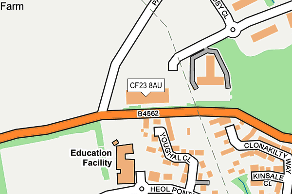
CF23 8AU is located in the Pontprennau and Old St Mellons electoral ward, within the unitary authority of Cardiff and the Welsh Parliamentary constituency of Cardiff North. The Local Health Board is Cardiff and Vale University and the police force is South Wales. This postcode has been in use since December 2001.


GetTheData
Source: OS OpenMap – Local (Ordnance Survey)
Source: OS VectorMap District (Ordnance Survey)
Licence: Open Government Licence (requires attribution)
| Easting | 320988 |
| Northing | 182757 |
| Latitude | 51.538162 |
| Longitude | -3.140621 |
GetTheData
Source: Open Postcode Geo
Licence: Open Government Licence
| Country | Wales |
| Postcode District | CF23 |
➜ See where CF23 is on a map ➜ Where is Cardiff? | |
GetTheData
Source: Land Registry Price Paid Data
Licence: Open Government Licence
Elevation or altitude of CF23 8AU as distance above sea level:
| Metres | Feet | |
|---|---|---|
| Elevation | 70m | 230ft |
Elevation is measured from the approximate centre of the postcode, to the nearest point on an OS contour line from OS Terrain 50, which has contour spacing of ten vertical metres.
➜ How high above sea level am I? Find the elevation of your current position using your device's GPS.
GetTheData
Source: Open Postcode Elevation
Licence: Open Government Licence
| Ward | Pontprennau And Old St Mellons |
| Constituency | Cardiff North |
GetTheData
Source: ONS Postcode Database
Licence: Open Government Licence
| Youghal Close (Heol Pontprennau) | Pontprennau | 194m |
| Youghal Close (Heol Pontprennau) | Pontprennau | 212m |
| Community Centre (Heol Pontprennau) | Pontprennau | 259m |
| Malthouse Avenue | Pontprennau | 272m |
| Community Centre (Heol Pontprennau) | Pontprennau | 282m |
| Llanishen Station | 2.9km |
| Lisvane & Thornhill Station | 3.2km |
| Heath High Level Station | 3.7km |
GetTheData
Source: NaPTAN
Licence: Open Government Licence
GetTheData
Source: ONS Postcode Database
Licence: Open Government Licence


➜ Get more ratings from the Food Standards Agency
GetTheData
Source: Food Standards Agency
Licence: FSA terms & conditions
| Last Collection | |||
|---|---|---|---|
| Location | Mon-Fri | Sat | Distance |
| Llandennis Avennue | 17:30 | 12:30 | 1,252m |
| Ball Road | 17:15 | 11:00 | 1,789m |
| Bryn Celyn | 17:30 | 11:30 | 1,889m |
GetTheData
Source: Dracos
Licence: Creative Commons Attribution-ShareAlike
The below table lists the International Territorial Level (ITL) codes (formerly Nomenclature of Territorial Units for Statistics (NUTS) codes) and Local Administrative Units (LAU) codes for CF23 8AU:
| ITL 1 Code | Name |
|---|---|
| TLL | Wales |
| ITL 2 Code | Name |
| TLL2 | East Wales |
| ITL 3 Code | Name |
| TLL22 | Cardiff and Vale of Glamorgan |
| LAU 1 Code | Name |
| W06000015 | Cardiff |
GetTheData
Source: ONS Postcode Directory
Licence: Open Government Licence
The below table lists the Census Output Area (OA), Lower Layer Super Output Area (LSOA), and Middle Layer Super Output Area (MSOA) for CF23 8AU:
| Code | Name | |
|---|---|---|
| OA | W00009501 | |
| LSOA | W01001842 | Cardiff 003B |
| MSOA | W02000369 | Cardiff 003 |
GetTheData
Source: ONS Postcode Directory
Licence: Open Government Licence
| CF23 8RN | Youghal Close | 154m |
| CF23 8RG | Kenmare Mews | 211m |
| CF23 8PR | Clonakilty Way | 232m |
| CF23 8PY | Dungarvan Drive | 265m |
| CF23 8PS | Clonakilty Way | 279m |
| CF23 8PQ | Kinsale Close | 297m |
| CF23 8LA | Clos Cwm Creunant | 322m |
| CF23 8RW | Woodsy Close | 328m |
| CF23 8LF | Clos Nant Ddu | 338m |
| CF23 8PZ | Tramore Way | 339m |
GetTheData
Source: Open Postcode Geo; Land Registry Price Paid Data
Licence: Open Government Licence