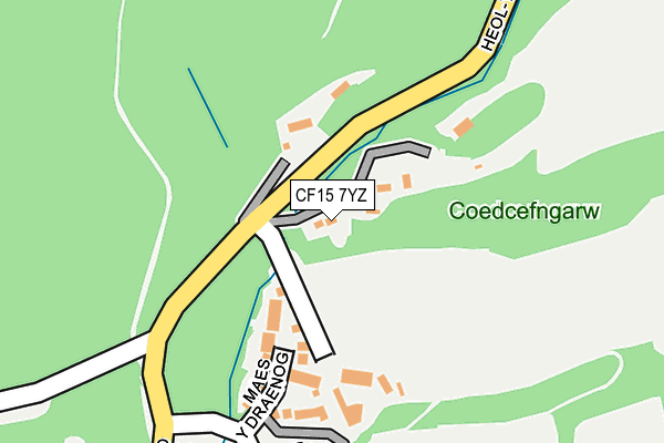
CF15 7YZ is located in the Whitchurch and Tongwynlais electoral ward, within the unitary authority of Cardiff and the Welsh Parliamentary constituency of Cardiff North. The Local Health Board is Cardiff and Vale University and the police force is South Wales. This postcode has been in use since June 1999.


GetTheData
Source: OS OpenMap – Local (Ordnance Survey)
Source: OS VectorMap District (Ordnance Survey)
Licence: Open Government Licence (requires attribution)
| Easting | 313608 |
| Northing | 182859 |
| Latitude | 51.537997 |
| Longitude | -3.247028 |
GetTheData
Source: Open Postcode Geo
Licence: Open Government Licence
| Country | Wales |
| Postcode District | CF15 |
➜ See where CF15 is on a map ➜ Where is Tongwynlais? | |
GetTheData
Source: Land Registry Price Paid Data
Licence: Open Government Licence
Elevation or altitude of CF15 7YZ as distance above sea level:
| Metres | Feet | |
|---|---|---|
| Elevation | 70m | 230ft |
Elevation is measured from the approximate centre of the postcode, to the nearest point on an OS contour line from OS Terrain 50, which has contour spacing of ten vertical metres.
➜ How high above sea level am I? Find the elevation of your current position using your device's GPS.
GetTheData
Source: Open Postcode Elevation
Licence: Open Government Licence
| Ward | Whitchurch And Tongwynlais |
| Constituency | Cardiff North |
GetTheData
Source: ONS Postcode Database
Licence: Open Government Licence
| Catherine Drive (Castle Road) | Tongwynlais | 253m |
| Castell Coch View (Mill Road) | Tongwynlais | 539m |
| Castell Coch View (Mill Road) | Tongwynlais | 549m |
| Lewis Arms (Mill Road) | Tongwynlais | 684m |
| Wyndham Street (Merthyr Road) | Tongwynlais | 731m |
| Taffs Well Station | 1.1km |
| Coryton Station | 2.2km |
| Radyr Station | 2.4km |
GetTheData
Source: NaPTAN
Licence: Open Government Licence
GetTheData
Source: ONS Postcode Database
Licence: Open Government Licence


➜ Get more ratings from the Food Standards Agency
GetTheData
Source: Food Standards Agency
Licence: FSA terms & conditions
| Last Collection | |||
|---|---|---|---|
| Location | Mon-Fri | Sat | Distance |
| Tongwynlais Post Office | 17:15 | 12:00 | 769m |
| Taffs Well Post Office | 17:00 | 12:00 | 1,387m |
| Capel Gwyliam | 16:45 | 12:00 | 1,728m |
GetTheData
Source: Dracos
Licence: Creative Commons Attribution-ShareAlike
The below table lists the International Territorial Level (ITL) codes (formerly Nomenclature of Territorial Units for Statistics (NUTS) codes) and Local Administrative Units (LAU) codes for CF15 7YZ:
| ITL 1 Code | Name |
|---|---|
| TLL | Wales |
| ITL 2 Code | Name |
| TLL2 | East Wales |
| ITL 3 Code | Name |
| TLL22 | Cardiff and Vale of Glamorgan |
| LAU 1 Code | Name |
| W06000015 | Cardiff |
GetTheData
Source: ONS Postcode Directory
Licence: Open Government Licence
The below table lists the Census Output Area (OA), Lower Layer Super Output Area (LSOA), and Middle Layer Super Output Area (MSOA) for CF15 7YZ:
| Code | Name | |
|---|---|---|
| OA | W00009719 | |
| LSOA | W01001893 | Cardiff 010B |
| MSOA | W02000376 | Cardiff 010 |
GetTheData
Source: ONS Postcode Directory
Licence: Open Government Licence
| CF15 7JR | Castle Road | 94m |
| CF15 7JL | Maes Y Draenog | 145m |
| CF15 7JU | Catherine Drive | 209m |
| CF15 7JT | Catherine Drive | 312m |
| CF15 7JQ | Castle Road | 325m |
| CF15 7JZ | Catherine Drive | 325m |
| CF15 7JY | Catherine Drive | 377m |
| CF15 7JX | Catherine Drive | 406m |
| CF15 7JW | Catherine Drive | 415m |
| CF15 7LA | Castell Coch View | 533m |
GetTheData
Source: Open Postcode Geo; Land Registry Price Paid Data
Licence: Open Government Licence