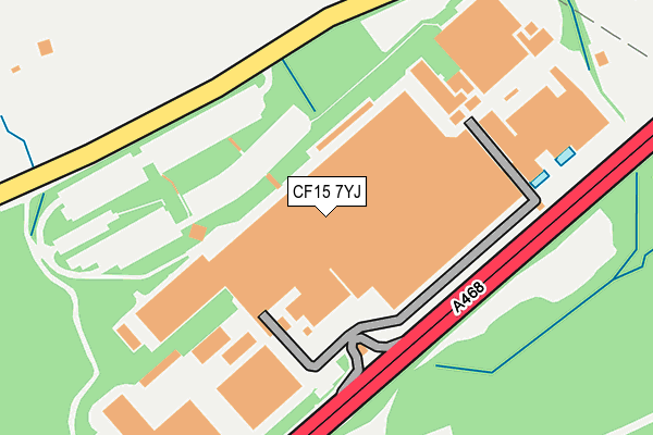
CF15 7YJ is located in the Taff's Well electoral ward, within the unitary authority of Rhondda Cynon Taf and the Welsh Parliamentary constituency of Pontypridd. The Local Health Board is Cwm Taf Morgannwg University and the police force is South Wales. This postcode has been in use since June 1999.


GetTheData
Source: OS OpenMap – Local (Ordnance Survey)
Source: OS VectorMap District (Ordnance Survey)
Licence: Open Government Licence (requires attribution)
| Easting | 312962 |
| Northing | 186023 |
| Latitude | 51.566339 |
| Longitude | -3.257124 |
GetTheData
Source: Open Postcode Geo
Licence: Open Government Licence
| Country | Wales |
| Postcode District | CF15 |
➜ See where CF15 is on a map ➜ Where is Nantgarw? | |
GetTheData
Source: Land Registry Price Paid Data
Licence: Open Government Licence
Elevation or altitude of CF15 7YJ as distance above sea level:
| Metres | Feet | |
|---|---|---|
| Elevation | 120m | 394ft |
Elevation is measured from the approximate centre of the postcode, to the nearest point on an OS contour line from OS Terrain 50, which has contour spacing of ten vertical metres.
➜ How high above sea level am I? Find the elevation of your current position using your device's GPS.
GetTheData
Source: Open Postcode Elevation
Licence: Open Government Licence
| Ward | Taff's Well |
| Constituency | Pontypridd |
GetTheData
Source: ONS Postcode Database
Licence: Open Government Licence
| Aero Engine Works (Caerphilly Road) | Nantgarw | 135m |
| Aero Engine Works (Caerphilly Works) | Nantgarw | 191m |
| Tawelfryn (Caerphilly Road) | Nantgarw | 539m |
| Heol-y-dderwen | Nantgarw | 547m |
| Tawelfryn (Caerphilly Road) | Nantgarw | 582m |
| Aber Station | 2.1km |
| Trefforest Estate Station | 2.3km |
| Energlyn & Churchill Park Station | 2.7km |
GetTheData
Source: NaPTAN
Licence: Open Government Licence
GetTheData
Source: ONS Postcode Database
Licence: Open Government Licence


➜ Get more ratings from the Food Standards Agency
GetTheData
Source: Food Standards Agency
Licence: FSA terms & conditions
| Last Collection | |||
|---|---|---|---|
| Location | Mon-Fri | Sat | Distance |
| St Martins Road | 17:00 | 12:00 | 2,253m |
| Nantgarw Road | 17:15 | 12:00 | 2,371m |
| Taffs Well Post Office | 17:00 | 12:00 | 2,578m |
GetTheData
Source: Dracos
Licence: Creative Commons Attribution-ShareAlike
The below table lists the International Territorial Level (ITL) codes (formerly Nomenclature of Territorial Units for Statistics (NUTS) codes) and Local Administrative Units (LAU) codes for CF15 7YJ:
| ITL 1 Code | Name |
|---|---|
| TLL | Wales |
| ITL 2 Code | Name |
| TLL1 | West Wales and The Valleys |
| ITL 3 Code | Name |
| TLL15 | Central Valleys |
| LAU 1 Code | Name |
| W06000016 | Rhondda Cynon Taf |
GetTheData
Source: ONS Postcode Directory
Licence: Open Government Licence
The below table lists the Census Output Area (OA), Lower Layer Super Output Area (LSOA), and Middle Layer Super Output Area (MSOA) for CF15 7YJ:
| Code | Name | |
|---|---|---|
| OA | W00006520 | |
| LSOA | W01001240 | Rhondda Cynon Taf 026C |
| MSOA | W02000277 | Rhondda Cynon Taf 026 |
GetTheData
Source: ONS Postcode Directory
Licence: Open Government Licence
| CF15 7UN | 364m | |
| CF15 7UH | Heol Y Gors | 481m |
| CF15 7UX | Graig View | 482m |
| CF15 7UJ | Heol Y Dderwen | 539m |
| CF15 7QH | Garth View | 582m |
| CF15 7UL | Garth View | 598m |
| CF15 7UF | Heol Fach | 602m |
| CF15 7UE | Heol Y Coed | 645m |
| CF15 7UD | Heol Edwards | 716m |
| CF83 1TJ | Gwaun Y Cwrt | 727m |
GetTheData
Source: Open Postcode Geo; Land Registry Price Paid Data
Licence: Open Government Licence