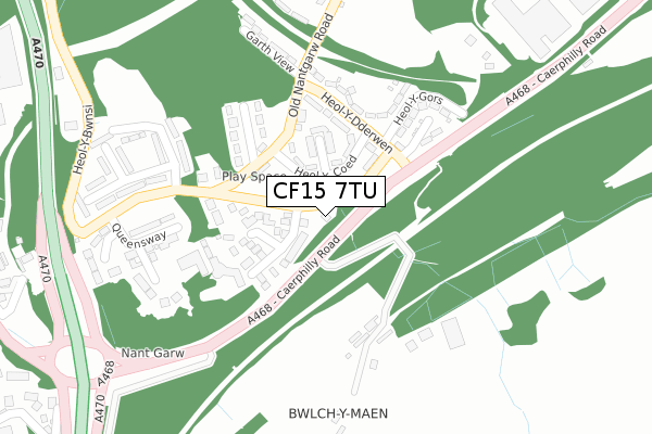
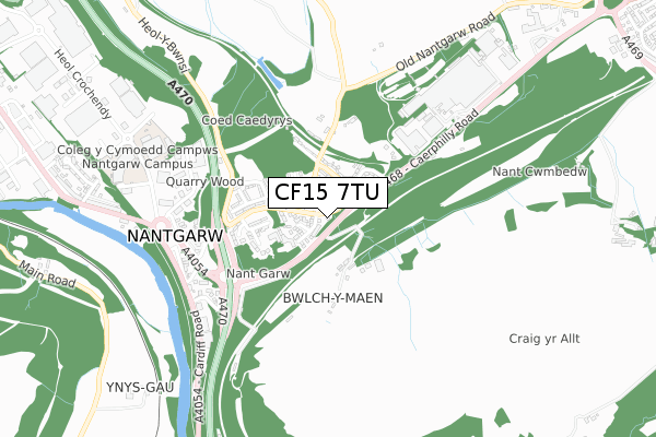
CF15 7TU is located in the Taff's Well electoral ward, within the unitary authority of Rhondda Cynon Taf and the Welsh Parliamentary constituency of Pontypridd. The Local Health Board is Cwm Taf Morgannwg University and the police force is South Wales. This postcode has been in use since October 2017.


GetTheData
Source: OS Open Zoomstack (Ordnance Survey)
Licence: Open Government Licence (requires attribution)
Attribution: Contains OS data © Crown copyright and database right 2025
Source: Open Postcode Geo
Licence: Open Government Licence (requires attribution)
Attribution: Contains OS data © Crown copyright and database right 2025; Contains Royal Mail data © Royal Mail copyright and database right 2025; Source: Office for National Statistics licensed under the Open Government Licence v.3.0
| Easting | 312499 |
| Northing | 185517 |
| Latitude | 51.561720 |
| Longitude | -3.263686 |
GetTheData
Source: Open Postcode Geo
Licence: Open Government Licence
| Country | Wales |
| Postcode District | CF15 |
➜ See where CF15 is on a map ➜ Where is Nantgarw? | |
GetTheData
Source: Land Registry Price Paid Data
Licence: Open Government Licence
| Ward | Taff's Well |
| Constituency | Pontypridd |
GetTheData
Source: ONS Postcode Database
Licence: Open Government Licence
| Parc-y-nant (Ty`r Waun) | Nantgarw | 73m |
| Tawelfryn (Caerphilly Road) | Nantgarw | 107m |
| Heol Edwards (Old Nantgarw Road) | Nantgarw | 141m |
| Heol-y-dderwen | Nantgarw | 156m |
| Tawelfryn (Caerphilly Road) | Nantgarw | 164m |
| Trefforest Estate Station | 2km |
| Taffs Well Station | 2.3km |
| Aber Station | 2.8km |
GetTheData
Source: NaPTAN
Licence: Open Government Licence
| Percentage of properties with Next Generation Access | 100.0% |
| Percentage of properties with Superfast Broadband | 100.0% |
| Percentage of properties with Ultrafast Broadband | 0.0% |
| Percentage of properties with Full Fibre Broadband | 0.0% |
Superfast Broadband is between 30Mbps and 300Mbps
Ultrafast Broadband is > 300Mbps
| Percentage of properties unable to receive 2Mbps | 0.0% |
| Percentage of properties unable to receive 5Mbps | 0.0% |
| Percentage of properties unable to receive 10Mbps | 0.0% |
| Percentage of properties unable to receive 30Mbps | 0.0% |
GetTheData
Source: Ofcom
Licence: Ofcom Terms of Use (requires attribution)
GetTheData
Source: ONS Postcode Database
Licence: Open Government Licence


➜ Get more ratings from the Food Standards Agency
GetTheData
Source: Food Standards Agency
Licence: FSA terms & conditions
| Last Collection | |||
|---|---|---|---|
| Location | Mon-Fri | Sat | Distance |
| Taffs Well Post Office | 17:00 | 12:00 | 2,009m |
| St Martins Road | 17:00 | 12:00 | 2,828m |
| Nantgarw Road | 17:15 | 12:00 | 3,024m |
GetTheData
Source: Dracos
Licence: Creative Commons Attribution-ShareAlike
The below table lists the International Territorial Level (ITL) codes (formerly Nomenclature of Territorial Units for Statistics (NUTS) codes) and Local Administrative Units (LAU) codes for CF15 7TU:
| ITL 1 Code | Name |
|---|---|
| TLL | Wales |
| ITL 2 Code | Name |
| TLL1 | West Wales and The Valleys |
| ITL 3 Code | Name |
| TLL15 | Central Valleys |
| LAU 1 Code | Name |
| W06000016 | Rhondda Cynon Taf |
GetTheData
Source: ONS Postcode Directory
Licence: Open Government Licence
The below table lists the Census Output Area (OA), Lower Layer Super Output Area (LSOA), and Middle Layer Super Output Area (MSOA) for CF15 7TU:
| Code | Name | |
|---|---|---|
| OA | W00006516 | |
| LSOA | W01001240 | Rhondda Cynon Taf 026C |
| MSOA | W02000277 | Rhondda Cynon Taf 026 |
GetTheData
Source: ONS Postcode Directory
Licence: Open Government Licence
| CF15 7UE | Heol Y Coed | 79m |
| CF15 7TJ | Parc Y Nant | 117m |
| CF15 7UF | Heol Fach | 118m |
| CF15 7UJ | Heol Y Dderwen | 181m |
| CF15 7UD | Heol Edwards | 192m |
| CF15 7UH | Heol Y Gors | 205m |
| CF15 7UX | Graig View | 208m |
| CF15 7QH | Garth View | 248m |
| CF15 7TH | Queensway | 264m |
| CF15 7UL | Garth View | 277m |
GetTheData
Source: Open Postcode Geo; Land Registry Price Paid Data
Licence: Open Government Licence