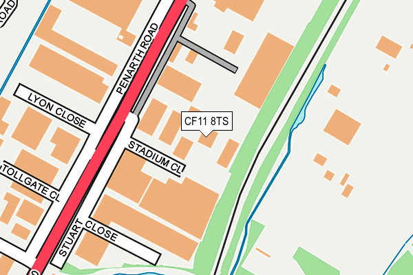
CF11 8TS lies on Stadium Close in Cardiff. CF11 8TS is located in the Grangetown electoral ward, within the unitary authority of Cardiff and the Welsh Parliamentary constituency of Cardiff South and Penarth. The Local Health Board is Cardiff and Vale University and the police force is South Wales. This postcode has been in use since June 1999.


GetTheData
Source: OS OpenMap – Local (Ordnance Survey)
Source: OS VectorMap District (Ordnance Survey)
Licence: Open Government Licence (requires attribution)
| Easting | 317106 |
| Northing | 174140 |
| Latitude | 51.460142 |
| Longitude | -3.194553 |
GetTheData
Source: Open Postcode Geo
Licence: Open Government Licence
| Street | Stadium Close |
| Town/City | Cardiff |
| Country | Wales |
| Postcode District | CF11 |
➜ See where CF11 is on a map ➜ Where is Cardiff? | |
GetTheData
Source: Land Registry Price Paid Data
Licence: Open Government Licence
Elevation or altitude of CF11 8TS as distance above sea level:
| Metres | Feet | |
|---|---|---|
| Elevation | 10m | 33ft |
Elevation is measured from the approximate centre of the postcode, to the nearest point on an OS contour line from OS Terrain 50, which has contour spacing of ten vertical metres.
➜ How high above sea level am I? Find the elevation of your current position using your device's GPS.
GetTheData
Source: Open Postcode Elevation
Licence: Open Government Licence
| Ward | Grangetown |
| Constituency | Cardiff South And Penarth |
GetTheData
Source: ONS Postcode Database
Licence: Open Government Licence
| Freemans (Penarth Road) | Penarth Moors | 160m |
| Freemans (Penarth Road) | Penarth Moors | 208m |
| Brindley Road (Penarth Road) | Penarth Moors | 299m |
| Brindley Road (Penarth Road) | Penarth Moors | 334m |
| Glynstell Close (Hadfield Road) | Leckwith | 495m |
| Grangetown (Cardiff) Station | 0.9km |
| Cogan Station | 1.6km |
| Ninian Park Station | 1.9km |
GetTheData
Source: NaPTAN
Licence: Open Government Licence
| Median download speed | 40.0Mbps |
| Average download speed | 41.1Mbps |
| Maximum download speed | 80.00Mbps |
| Median upload speed | 10.0Mbps |
| Average upload speed | 10.4Mbps |
| Maximum upload speed | 20.00Mbps |
GetTheData
Source: Ofcom
Licence: Ofcom Terms of Use (requires attribution)
GetTheData
Source: ONS Postcode Database
Licence: Open Government Licence


➜ Get more ratings from the Food Standards Agency
GetTheData
Source: Food Standards Agency
Licence: FSA terms & conditions
| Last Collection | |||
|---|---|---|---|
| Location | Mon-Fri | Sat | Distance |
| Penarth Post Office | 19:00 | 12:00 | 248m |
| 220-228 Penarth Road | 19:30 | 14:00 | 254m |
| Albert Street | 17:30 | 13:00 | 498m |
GetTheData
Source: Dracos
Licence: Creative Commons Attribution-ShareAlike
The below table lists the International Territorial Level (ITL) codes (formerly Nomenclature of Territorial Units for Statistics (NUTS) codes) and Local Administrative Units (LAU) codes for CF11 8TS:
| ITL 1 Code | Name |
|---|---|
| TLL | Wales |
| ITL 2 Code | Name |
| TLL2 | East Wales |
| ITL 3 Code | Name |
| TLL22 | Cardiff and Vale of Glamorgan |
| LAU 1 Code | Name |
| W06000015 | Cardiff |
GetTheData
Source: ONS Postcode Directory
Licence: Open Government Licence
The below table lists the Census Output Area (OA), Lower Layer Super Output Area (LSOA), and Middle Layer Super Output Area (MSOA) for CF11 8TS:
| Code | Name | |
|---|---|---|
| OA | W00010173 | |
| LSOA | W01001947 | Cardiff 048E |
| MSOA | W02000422 | Cardiff 048 |
GetTheData
Source: ONS Postcode Directory
Licence: Open Government Licence
| CF11 8TT | Penarth Road | 86m |
| CF11 8TU | Penarth Road | 226m |
| CF11 8TX | Brindley Road | 396m |
| CF11 8TL | Brindley Road | 436m |
| CF11 8JQ | West Point Industrial Estate | 596m |
| CF11 7JH | Clive Street Lane | 623m |
| CF11 7JG | Clive Street | 641m |
| CF11 0JL | Ferry Road | 647m |
| CF11 7EE | South Clive Street | 648m |
| CF11 8RR | Llandough Trading Estate | 674m |
GetTheData
Source: Open Postcode Geo; Land Registry Price Paid Data
Licence: Open Government Licence