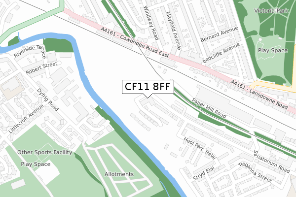
CF11 8FF is located in the Canton electoral ward, within the unitary authority of Cardiff and the Welsh Parliamentary constituency of Cardiff West. The Local Health Board is Cardiff and Vale University and the police force is South Wales. This postcode has been in use since October 2019.


GetTheData
Source: OS Open Zoomstack (Ordnance Survey)
Licence: Open Government Licence (requires attribution)
Attribution: Contains OS data © Crown copyright and database right 2025
Source: Open Postcode Geo
Licence: Open Government Licence (requires attribution)
Attribution: Contains OS data © Crown copyright and database right 2025; Contains Royal Mail data © Royal Mail copyright and database right 2025; Source: Office for National Statistics licensed under the Open Government Licence v.3.0
| Easting | 315070 |
| Northing | 176654 |
| Latitude | 51.482440 |
| Longitude | -3.224466 |
GetTheData
Source: Open Postcode Geo
Licence: Open Government Licence
| Country | Wales |
| Postcode District | CF11 |
➜ See where CF11 is on a map ➜ Where is Cardiff? | |
GetTheData
Source: Land Registry Price Paid Data
Licence: Open Government Licence
| Ward | Canton |
| Constituency | Cardiff West |
GetTheData
Source: ONS Postcode Database
Licence: Open Government Licence
| Windway Road (Cowbridge Road East) | Canton | 154m |
| Windway Road (Cowbridge Road East) | Canton | 175m |
| Ely Bridge (Cowbridge Road East) | Canton | 247m |
| Victoria Park (Cowbridge Road East) | Victoria Park | 298m |
| Ely Bridge (Cowbridge Road East) | Canton | 335m |
| Waun-gron Park Station | 0.7km |
| Fairwater Station | 1.4km |
| Ninian Park Station | 1.7km |
GetTheData
Source: NaPTAN
Licence: Open Government Licence
GetTheData
Source: ONS Postcode Database
Licence: Open Government Licence


➜ Get more ratings from the Food Standards Agency
GetTheData
Source: Food Standards Agency
Licence: FSA terms & conditions
| Last Collection | |||
|---|---|---|---|
| Location | Mon-Fri | Sat | Distance |
| Western Delivery Office | 18:30 | 12:00 | 152m |
| Victoria Park Road East | 17:30 | 11:30 | 699m |
| Bonvilston Park View | 18:30 | 12:00 | 700m |
GetTheData
Source: Dracos
Licence: Creative Commons Attribution-ShareAlike
The below table lists the International Territorial Level (ITL) codes (formerly Nomenclature of Territorial Units for Statistics (NUTS) codes) and Local Administrative Units (LAU) codes for CF11 8FF:
| ITL 1 Code | Name |
|---|---|
| TLL | Wales |
| ITL 2 Code | Name |
| TLL2 | East Wales |
| ITL 3 Code | Name |
| TLL22 | Cardiff and Vale of Glamorgan |
| LAU 1 Code | Name |
| W06000015 | Cardiff |
GetTheData
Source: ONS Postcode Directory
Licence: Open Government Licence
The below table lists the Census Output Area (OA), Lower Layer Super Output Area (LSOA), and Middle Layer Super Output Area (MSOA) for CF11 8FF:
| Code | Name | |
|---|---|---|
| OA | W00010209 | |
| LSOA | W01001709 | Cardiff 040A |
| MSOA | W02000406 | Cardiff 040 |
GetTheData
Source: ONS Postcode Directory
Licence: Open Government Licence
| CF5 1BL | Cowbridge Road East | 198m |
| CF5 1BN | Cowbridge Road East | 200m |
| CF5 1BG | Cowbridge Road East | 214m |
| CF5 1AF | Windway Road | 241m |
| CF5 1AL | Mayfield Avenue | 259m |
| CF5 1AN | Mayfield Avenue | 266m |
| CF5 1BR | Fairfield Avenue | 277m |
| CF5 1BQ | Redcliffe Avenue | 287m |
| CF5 1BJ | Cowbridge Road East | 288m |
| CF5 1BS | Fairfield Avenue | 291m |
GetTheData
Source: Open Postcode Geo; Land Registry Price Paid Data
Licence: Open Government Licence