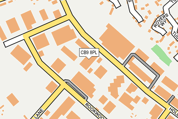
CB9 8PL is located in the Haverhill South electoral ward, within the local authority district of West Suffolk and the English Parliamentary constituency of West Suffolk. The Sub Integrated Care Board (ICB) Location is NHS Suffolk and North East Essex ICB - 07K and the police force is Suffolk. This postcode has been in use since January 1980.


GetTheData
Source: OS OpenMap – Local (Ordnance Survey)
Source: OS VectorMap District (Ordnance Survey)
Licence: Open Government Licence (requires attribution)
| Easting | 567277 |
| Northing | 244813 |
| Latitude | 52.076411 |
| Longitude | 0.439497 |
GetTheData
Source: Open Postcode Geo
Licence: Open Government Licence
| Country | England |
| Postcode District | CB9 |
➜ See where CB9 is on a map ➜ Where is Haverhill? | |
GetTheData
Source: Land Registry Price Paid Data
Licence: Open Government Licence
Elevation or altitude of CB9 8PL as distance above sea level:
| Metres | Feet | |
|---|---|---|
| Elevation | 80m | 262ft |
Elevation is measured from the approximate centre of the postcode, to the nearest point on an OS contour line from OS Terrain 50, which has contour spacing of ten vertical metres.
➜ How high above sea level am I? Find the elevation of your current position using your device's GPS.
GetTheData
Source: Open Postcode Elevation
Licence: Open Government Licence
| Ward | Haverhill South |
| Constituency | West Suffolk |
GetTheData
Source: ONS Postcode Database
Licence: Open Government Licence
| Travis Perkins (Hollands Road) | Haverhill | 313m |
| Travis Perkins (Hollands Road) | Haverhill | 321m |
| Mill Hill (Duddery Hill) | Haverhill | 335m |
| Mill Hill (Duddery Hill) | Haverhill | 341m |
| Helions Walk (Duddery Hill) | Haverhill | 363m |
GetTheData
Source: NaPTAN
Licence: Open Government Licence
GetTheData
Source: ONS Postcode Database
Licence: Open Government Licence


➜ Get more ratings from the Food Standards Agency
GetTheData
Source: Food Standards Agency
Licence: FSA terms & conditions
| Last Collection | |||
|---|---|---|---|
| Location | Mon-Fri | Sat | Distance |
| Rookwood Way | 17:45 | 11:30 | 154m |
| Hollands Road | 17:45 | 11:30 | 217m |
| Mount Road | 17:45 | 11:15 | 422m |
GetTheData
Source: Dracos
Licence: Creative Commons Attribution-ShareAlike
The below table lists the International Territorial Level (ITL) codes (formerly Nomenclature of Territorial Units for Statistics (NUTS) codes) and Local Administrative Units (LAU) codes for CB9 8PL:
| ITL 1 Code | Name |
|---|---|
| TLH | East |
| ITL 2 Code | Name |
| TLH1 | East Anglia |
| ITL 3 Code | Name |
| TLH14 | Suffolk CC |
| LAU 1 Code | Name |
| E07000245 | West Suffolk |
GetTheData
Source: ONS Postcode Directory
Licence: Open Government Licence
The below table lists the Census Output Area (OA), Lower Layer Super Output Area (LSOA), and Middle Layer Super Output Area (MSOA) for CB9 8PL:
| Code | Name | |
|---|---|---|
| OA | E00153526 | |
| LSOA | E01030113 | St Edmundsbury 014E |
| MSOA | E02006286 | St Edmundsbury 014 |
GetTheData
Source: ONS Postcode Directory
Licence: Open Government Licence
| CB9 8NP | Fennels Close | 209m |
| CB9 8NR | Vanners Road | 240m |
| CB9 8NU | Rovers Way | 246m |
| CB9 8NW | Lee Walk | 259m |
| CB9 8QT | Moon Hall Lane | 265m |
| CB9 8NX | Thompson Close | 288m |
| CB9 8NS | Tudor Close | 326m |
| CB9 8DS | Duddery Hill | 328m |
| CB9 8DP | Duddery Hill | 329m |
| CB9 8PH | Piperell Way | 365m |
GetTheData
Source: Open Postcode Geo; Land Registry Price Paid Data
Licence: Open Government Licence