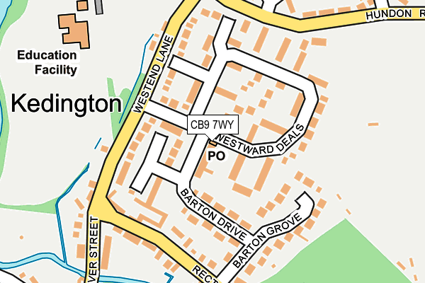
CB9 7WY is located in the Haverhill East electoral ward, within the local authority district of West Suffolk and the English Parliamentary constituency of West Suffolk. The Sub Integrated Care Board (ICB) Location is NHS Suffolk and North East Essex ICB - 07K and the police force is Suffolk. This postcode has been in use since August 2022.


GetTheData
Source: OS OpenMap – Local (Ordnance Survey)
Source: OS VectorMap District (Ordnance Survey)
Licence: Open Government Licence (requires attribution)
| Easting | 568110 |
| Northing | 245841 |
| Latitude | 52.085405 |
| Longitude | 0.452177 |
GetTheData
Source: Open Postcode Geo
Licence: Open Government Licence
| Country | England |
| Postcode District | CB9 |
➜ See where CB9 is on a map ➜ Where is Haverhill? | |
GetTheData
Source: Land Registry Price Paid Data
Licence: Open Government Licence
| Ward | Haverhill East |
| Constituency | West Suffolk |
GetTheData
Source: ONS Postcode Database
Licence: Open Government Licence
41, DONOVAN WAY, HAVERHILL, CB9 7WY 2024 14 JUN £415,000 |
43, DONOVAN WAY, HAVERHILL, CB9 7WY 2024 23 FEB £400,000 |
37, DONOVAN WAY, HAVERHILL, CB9 7WY 2023 24 NOV £410,000 |
39, DONOVAN WAY, HAVERHILL, CB9 7WY 2023 6 OCT £424,995 |
20, DONOVAN WAY, HAVERHILL, CB9 7WY 2023 16 JUN £324,995 |
22, DONOVAN WAY, HAVERHILL, CB9 7WY 2023 16 JUN £369,995 |
33, DONOVAN WAY, HAVERHILL, CB9 7WY 2023 26 MAY £400,000 |
16, DONOVAN WAY, HAVERHILL, CB9 7WY 2023 28 APR £399,995 |
31, DONOVAN WAY, HAVERHILL, CB9 7WY 2023 31 MAR £407,400 |
35, DONOVAN WAY, HAVERHILL, CB9 7WY 2023 3 MAR £407,400 |
GetTheData
Source: HM Land Registry Price Paid Data
Licence: Contains HM Land Registry data © Crown copyright and database right 2025. This data is licensed under the Open Government Licence v3.0.
| Mildenhall Place (Chalkstone Way) | Haverhill | 134m |
| Mildenhall Place (Chalkstone Way) | Haverhill | 134m |
| Kingfisher Close (Chalkstone Way) | Haverhill | 253m |
| Kingfisher Close (Chalkstone Way) | Haverhill | 260m |
| Deben Road (Chalkstone Way) | Haverhill | 288m |
GetTheData
Source: NaPTAN
Licence: Open Government Licence
GetTheData
Source: ONS Postcode Database
Licence: Open Government Licence


➜ Get more ratings from the Food Standards Agency
GetTheData
Source: Food Standards Agency
Licence: FSA terms & conditions
| Last Collection | |||
|---|---|---|---|
| Location | Mon-Fri | Sat | Distance |
| Gannett Close | 17:45 | 11:45 | 235m |
| Chelmer Road | 17:45 | 11:45 | 261m |
| Quendon Place | 17:45 | 11:45 | 419m |
GetTheData
Source: Dracos
Licence: Creative Commons Attribution-ShareAlike
The below table lists the International Territorial Level (ITL) codes (formerly Nomenclature of Territorial Units for Statistics (NUTS) codes) and Local Administrative Units (LAU) codes for CB9 7WY:
| ITL 1 Code | Name |
|---|---|
| TLH | East |
| ITL 2 Code | Name |
| TLH1 | East Anglia |
| ITL 3 Code | Name |
| TLH14 | Suffolk CC |
| LAU 1 Code | Name |
| E07000245 | West Suffolk |
GetTheData
Source: ONS Postcode Directory
Licence: Open Government Licence
The below table lists the Census Output Area (OA), Lower Layer Super Output Area (LSOA), and Middle Layer Super Output Area (MSOA) for CB9 7WY:
| Code | Name | |
|---|---|---|
| OA | E00169952 | |
| LSOA | E01030106 | St Edmundsbury 014B |
| MSOA | E02006286 | St Edmundsbury 014 |
GetTheData
Source: ONS Postcode Directory
Licence: Open Government Licence
| CB9 0AY | Mildenhall Place | 186m |
| CB9 0JJ | Falcon Close | 202m |
| CB9 0JL | Gannet Close | 237m |
| CB9 0AZ | Newton Place | 257m |
| CB9 0AT | Kirtling Place | 264m |
| CB9 0AX | Linton Place | 270m |
| CB9 0JW | Kingfisher Close | 305m |
| CB9 0JH | Sandpiper Close | 309m |
| CB9 0BA | Ovington Place | 329m |
| CB9 0AW | Glemsford Place | 340m |
GetTheData
Source: Open Postcode Geo; Land Registry Price Paid Data
Licence: Open Government Licence