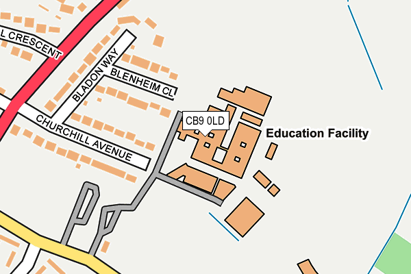
CB9 0LD is located in the Haverhill East electoral ward, within the local authority district of West Suffolk and the English Parliamentary constituency of West Suffolk. The Sub Integrated Care Board (ICB) Location is NHS Suffolk and North East Essex ICB - 07K and the police force is Suffolk. This postcode has been in use since September 1991.


GetTheData
Source: OS OpenMap – Local (Ordnance Survey)
Source: OS VectorMap District (Ordnance Survey)
Licence: Open Government Licence (requires attribution)
| Easting | 567770 |
| Northing | 246274 |
| Latitude | 52.089385 |
| Longitude | 0.447402 |
GetTheData
Source: Open Postcode Geo
Licence: Open Government Licence
| Country | England |
| Postcode District | CB9 |
➜ See where CB9 is on a map ➜ Where is Haverhill? | |
GetTheData
Source: Land Registry Price Paid Data
Licence: Open Government Licence
Elevation or altitude of CB9 0LD as distance above sea level:
| Metres | Feet | |
|---|---|---|
| Elevation | 100m | 328ft |
Elevation is measured from the approximate centre of the postcode, to the nearest point on an OS contour line from OS Terrain 50, which has contour spacing of ten vertical metres.
➜ How high above sea level am I? Find the elevation of your current position using your device's GPS.
GetTheData
Source: Open Postcode Elevation
Licence: Open Government Licence
| Ward | Haverhill East |
| Constituency | West Suffolk |
GetTheData
Source: ONS Postcode Database
Licence: Open Government Licence
| Samuel Ward School (On Site) | Haverhill | 181m |
| Samuel Ward School (Chalkstone Way) | Haverhill | 230m |
| Ann Suckling Road (Wratting Road) | Haverhill | 239m |
| Ann Suckling Road (Wratting Road) | Haverhill | 266m |
| Samuel Ward School (Chalkstone Way) | Haverhill | 272m |
GetTheData
Source: NaPTAN
Licence: Open Government Licence
GetTheData
Source: ONS Postcode Database
Licence: Open Government Licence


➜ Get more ratings from the Food Standards Agency
GetTheData
Source: Food Standards Agency
Licence: FSA terms & conditions
| Last Collection | |||
|---|---|---|---|
| Location | Mon-Fri | Sat | Distance |
| Ann Suckling Lane | 17:45 | 11:45 | 358m |
| Wratting Road | 17:45 | 11:30 | 431m |
| Chelmer Road | 17:45 | 11:45 | 460m |
GetTheData
Source: Dracos
Licence: Creative Commons Attribution-ShareAlike
The below table lists the International Territorial Level (ITL) codes (formerly Nomenclature of Territorial Units for Statistics (NUTS) codes) and Local Administrative Units (LAU) codes for CB9 0LD:
| ITL 1 Code | Name |
|---|---|
| TLH | East |
| ITL 2 Code | Name |
| TLH1 | East Anglia |
| ITL 3 Code | Name |
| TLH14 | Suffolk CC |
| LAU 1 Code | Name |
| E07000245 | West Suffolk |
GetTheData
Source: ONS Postcode Directory
Licence: Open Government Licence
The below table lists the Census Output Area (OA), Lower Layer Super Output Area (LSOA), and Middle Layer Super Output Area (MSOA) for CB9 0LD:
| Code | Name | |
|---|---|---|
| OA | E00153491 | |
| LSOA | E01030108 | St Edmundsbury 014D |
| MSOA | E02006286 | St Edmundsbury 014 |
GetTheData
Source: ONS Postcode Directory
Licence: Open Government Licence
| CB9 0AD | Blenheim Close | 120m |
| CB9 0AA | Churchill Avenue | 179m |
| CB9 0AB | Bladon Way | 205m |
| CB9 0AG | Bartlow Place | 306m |
| CB9 0AQ | Elmdon Place | 319m |
| CB9 0DF | Hill Crescent | 343m |
| CB9 0DE | Wratting Road | 352m |
| CB9 0AE | Abington Place | 372m |
| CB9 0AJ | Chedburgh Place | 378m |
| CB9 0DZ | Boyton Close | 388m |
GetTheData
Source: Open Postcode Geo; Land Registry Price Paid Data
Licence: Open Government Licence