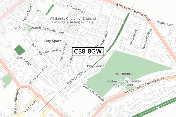
CB8 8GW is located in the Whepstead & Wickhambrook electoral ward, within the local authority district of West Suffolk and the English Parliamentary constituency of West Suffolk. The Sub Integrated Care Board (ICB) Location is NHS Suffolk and North East Essex ICB - 07K and the police force is Suffolk. This postcode has been in use since February 2020.


GetTheData
Source: OS Open Zoomstack (Ordnance Survey)
Licence: Open Government Licence (requires attribution)
Attribution: Contains OS data © Crown copyright and database right 2024
Source: Open Postcode Geo
Licence: Open Government Licence (requires attribution)
Attribution: Contains OS data © Crown copyright and database right 2024; Contains Royal Mail data © Royal Mail copyright and database right 2024; Source: Office for National Statistics licensed under the Open Government Licence v.3.0
| Easting | 574464 |
| Northing | 255475 |
| Latitude | 52.169971 |
| Longitude | 0.549752 |
GetTheData
Source: Open Postcode Geo
Licence: Open Government Licence
| Country | England |
| Postcode District | CB8 |
➜ See where CB8 is on a map ➜ Where is Wickhambrook? | |
GetTheData
Source: Land Registry Price Paid Data
Licence: Open Government Licence
| Ward | Whepstead & Wickhambrook |
| Constituency | West Suffolk |
GetTheData
Source: ONS Postcode Database
Licence: Open Government Licence
2024 25 APR £475,000 |
2023 23 FEB £455,000 |
20, THE MEADOWS, WICKHAMBROOK, NEWMARKET, CB8 8GW 2022 4 APR £487,500 |
21, THE MEADOWS, WICKHAMBROOK, NEWMARKET, CB8 8GW 2022 29 MAR £550,000 |
19, THE MEADOWS, WICKHAMBROOK, NEWMARKET, CB8 8GW 2022 25 MAR £545,000 |
2022 25 FEB £415,000 |
2021 17 DEC £464,500 |
15, THE MEADOWS, WICKHAMBROOK, NEWMARKET, CB8 8GW 2021 15 NOV £275,000 |
16, THE MEADOWS, WICKHAMBROOK, NEWMARKET, CB8 8GW 2021 15 NOV £275,000 |
14, THE MEADOWS, WICKHAMBROOK, NEWMARKET, CB8 8GW 2021 7 JUN £350,000 |
GetTheData
Source: HM Land Registry Price Paid Data
Licence: Contains HM Land Registry data © Crown copyright and database right 2024. This data is licensed under the Open Government Licence v3.0.
| Thorns Close (Cemetery Road) | Wickhambrook | 169m |
| Thorns Close (Cemetery Road) | Wickhambrook | 177m |
| Thorns Corner (B1063) | Wickhambrook | 244m |
| Thorns Corner (B1063) | Wickhambrook | 271m |
| Coltsfoot Close (Fullers Hill) | Wickhambrook | 497m |
GetTheData
Source: NaPTAN
Licence: Open Government Licence
GetTheData
Source: ONS Postcode Database
Licence: Open Government Licence


➜ Get more ratings from the Food Standards Agency
GetTheData
Source: Food Standards Agency
Licence: FSA terms & conditions
| Last Collection | |||
|---|---|---|---|
| Location | Mon-Fri | Sat | Distance |
| Wickhambrook Post Office | 16:00 | 10:00 | 313m |
| Meeting Green | 16:30 | 09:15 | 603m |
| Attleton Green | 16:00 | 09:15 | 711m |
GetTheData
Source: Dracos
Licence: Creative Commons Attribution-ShareAlike
The below table lists the International Territorial Level (ITL) codes (formerly Nomenclature of Territorial Units for Statistics (NUTS) codes) and Local Administrative Units (LAU) codes for CB8 8GW:
| ITL 1 Code | Name |
|---|---|
| TLH | East |
| ITL 2 Code | Name |
| TLH1 | East Anglia |
| ITL 3 Code | Name |
| TLH14 | Suffolk CC |
| LAU 1 Code | Name |
| E07000245 | West Suffolk |
GetTheData
Source: ONS Postcode Directory
Licence: Open Government Licence
The below table lists the Census Output Area (OA), Lower Layer Super Output Area (LSOA), and Middle Layer Super Output Area (MSOA) for CB8 8GW:
| Code | Name | |
|---|---|---|
| OA | E00153713 | |
| LSOA | E01030150 | St Edmundsbury 010C |
| MSOA | E02006282 | St Edmundsbury 010 |
GetTheData
Source: ONS Postcode Directory
Licence: Open Government Licence
| CB8 8XR | Cemetery Road | 71m |
| CB8 8YF | Browns Close | 93m |
| CB8 8YE | Victoria Cottages | 128m |
| CB8 8YG | Croft Close | 145m |
| CB8 8XT | Nunnery Green | 167m |
| CB8 8XY | Bunters Road | 170m |
| CB8 8WR | Moor Green Close | 207m |
| CB8 8XU | Boyden Close | 213m |
| CB8 8XW | Thorns Corner | 237m |
| CB8 8YD | Thorns Close | 258m |
GetTheData
Source: Open Postcode Geo; Land Registry Price Paid Data
Licence: Open Government Licence