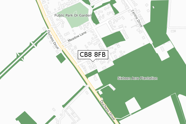
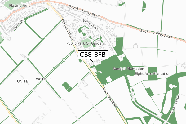
CB8 8FB is located in the Woodditton electoral ward, within the local authority district of East Cambridgeshire and the English Parliamentary constituency of South East Cambridgeshire. The Sub Integrated Care Board (ICB) Location is NHS Cambridgeshire and Peterborough ICB - 06H and the police force is Cambridgeshire. This postcode has been in use since October 2017.


GetTheData
Source: OS Open Zoomstack (Ordnance Survey)
Licence: Open Government Licence (requires attribution)
Attribution: Contains OS data © Crown copyright and database right 2024
Source: Open Postcode Geo
Licence: Open Government Licence (requires attribution)
Attribution: Contains OS data © Crown copyright and database right 2024; Contains Royal Mail data © Royal Mail copyright and database right 2024; Source: Office for National Statistics licensed under the Open Government Licence v.3.0
| Easting | 565978 |
| Northing | 262177 |
| Latitude | 52.232787 |
| Longitude | 0.429067 |
GetTheData
Source: Open Postcode Geo
Licence: Open Government Licence
| Country | England |
| Postcode District | CB8 |
➜ See where CB8 is on a map ➜ Where is Newmarket? | |
GetTheData
Source: Land Registry Price Paid Data
Licence: Open Government Licence
| Ward | Woodditton |
| Constituency | South East Cambridgeshire |
GetTheData
Source: ONS Postcode Database
Licence: Open Government Licence
| Mccalmont Way (Ashley Road) | Newmarket | 597m |
| Mccalmont Way (Ashley Road) | Newmarket | 608m |
| Ashley Road | Newmarket | 644m |
| Ashley Road | Newmarket | 653m |
| Barry Lynham Drive (New Cheveley Road) | Newmarket | 1,082m |
| Newmarket Station | 1.7km |
| Dullingham Station | 5.5km |
GetTheData
Source: NaPTAN
Licence: Open Government Licence
| Percentage of properties with Next Generation Access | 100.0% |
| Percentage of properties with Superfast Broadband | 100.0% |
| Percentage of properties with Ultrafast Broadband | 0.0% |
| Percentage of properties with Full Fibre Broadband | 0.0% |
Superfast Broadband is between 30Mbps and 300Mbps
Ultrafast Broadband is > 300Mbps
| Percentage of properties unable to receive 2Mbps | 0.0% |
| Percentage of properties unable to receive 5Mbps | 0.0% |
| Percentage of properties unable to receive 10Mbps | 0.0% |
| Percentage of properties unable to receive 30Mbps | 0.0% |
GetTheData
Source: Ofcom
Licence: Ofcom Terms of Use (requires attribution)
GetTheData
Source: ONS Postcode Database
Licence: Open Government Licence


➜ Get more ratings from the Food Standards Agency
GetTheData
Source: Food Standards Agency
Licence: FSA terms & conditions
| Last Collection | |||
|---|---|---|---|
| Location | Mon-Fri | Sat | Distance |
| Duchess Drive | 17:30 | 11:30 | 516m |
| Centre Drive | 17:30 | 11:30 | 519m |
| Ashley Road | 17:30 | 11:30 | 645m |
GetTheData
Source: Dracos
Licence: Creative Commons Attribution-ShareAlike
The below table lists the International Territorial Level (ITL) codes (formerly Nomenclature of Territorial Units for Statistics (NUTS) codes) and Local Administrative Units (LAU) codes for CB8 8FB:
| ITL 1 Code | Name |
|---|---|
| TLH | East |
| ITL 2 Code | Name |
| TLH1 | East Anglia |
| ITL 3 Code | Name |
| TLH12 | Cambridgeshire CC |
| LAU 1 Code | Name |
| E07000009 | East Cambridgeshire |
GetTheData
Source: ONS Postcode Directory
Licence: Open Government Licence
The below table lists the Census Output Area (OA), Lower Layer Super Output Area (LSOA), and Middle Layer Super Output Area (MSOA) for CB8 8FB:
| Code | Name | |
|---|---|---|
| OA | E00090889 | |
| LSOA | E01032611 | East Cambridgeshire 011D |
| MSOA | E02006825 | East Cambridgeshire 011 |
GetTheData
Source: ONS Postcode Directory
Licence: Open Government Licence
| CB8 8AL | Duchess Drive | 70m |
| CB8 9HB | Duchess Drive | 167m |
| CB8 8FZ | Meadow Lane | 229m |
| CB8 8AP | Centre Drive | 337m |
| CB8 8JD | The Shrubberies | 347m |
| CB8 8AJ | Duchess Drive | 394m |
| CB8 8HX | Isinglass Close | 479m |
| CB8 8HU | Mccalmont Way | 490m |
| CB8 8AW | Centre Drive | 520m |
| CB8 8AH | The Dip | 557m |
GetTheData
Source: Open Postcode Geo; Land Registry Price Paid Data
Licence: Open Government Licence