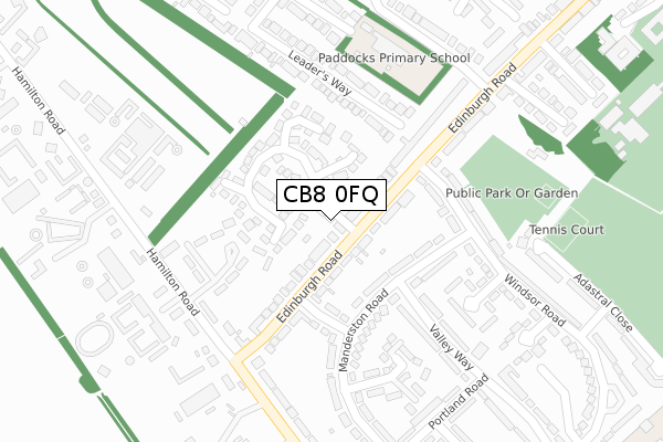
CB8 0FQ is located in the Newmarket West electoral ward, within the local authority district of West Suffolk and the English Parliamentary constituency of West Suffolk. The Sub Integrated Care Board (ICB) Location is NHS Suffolk and North East Essex ICB - 07K and the police force is Suffolk. This postcode has been in use since January 2020.


GetTheData
Source: OS Open Zoomstack (Ordnance Survey)
Licence: Open Government Licence (requires attribution)
Attribution: Contains OS data © Crown copyright and database right 2025
Source: Open Postcode Geo
Licence: Open Government Licence (requires attribution)
Attribution: Contains OS data © Crown copyright and database right 2025; Contains Royal Mail data © Royal Mail copyright and database right 2025; Source: Office for National Statistics licensed under the Open Government Licence v.3.0
| Easting | 563149 |
| Northing | 263724 |
| Latitude | 52.247528 |
| Longitude | 0.388427 |
GetTheData
Source: Open Postcode Geo
Licence: Open Government Licence
| Country | England |
| Postcode District | CB8 |
➜ See where CB8 is on a map ➜ Where is Newmarket? | |
GetTheData
Source: Land Registry Price Paid Data
Licence: Open Government Licence
| Ward | Newmarket West |
| Constituency | West Suffolk |
GetTheData
Source: ONS Postcode Database
Licence: Open Government Licence
2, MANDERSTON COTTAGES, DRINKWATER CLOSE, NEWMARKET, CB8 0FQ 2020 16 JAN £280,000 |
1, MANDERSTON COTTAGES, DRINKWATER CLOSE, NEWMARKET, CB8 0FQ 2019 18 DEC £300,000 |
2016 18 MAR £380,000 |
GetTheData
Source: HM Land Registry Price Paid Data
Licence: Contains HM Land Registry data © Crown copyright and database right 2025. This data is licensed under the Open Government Licence v3.0.
| Drinkwater Close (Edinburgh Road) | Newmarket | 68m |
| Drinkwater Close (Edinburgh Road) | Newmarket | 69m |
| Princess Way | Newmarket | 139m |
| Princess Way | Newmarket | 149m |
| Windsor Road (Edinburgh Road) | Newmarket | 186m |
| Newmarket Station | 1.6km |
GetTheData
Source: NaPTAN
Licence: Open Government Licence
GetTheData
Source: ONS Postcode Database
Licence: Open Government Licence


➜ Get more ratings from the Food Standards Agency
GetTheData
Source: Food Standards Agency
Licence: FSA terms & conditions
| Last Collection | |||
|---|---|---|---|
| Location | Mon-Fri | Sat | Distance |
| Edinburgh Road | 17:30 | 11:30 | 156m |
| Hamilton Road | 17:30 | 11:30 | 276m |
| Valley Way Post Office | 17:30 | 11:30 | 337m |
GetTheData
Source: Dracos
Licence: Creative Commons Attribution-ShareAlike
The below table lists the International Territorial Level (ITL) codes (formerly Nomenclature of Territorial Units for Statistics (NUTS) codes) and Local Administrative Units (LAU) codes for CB8 0FQ:
| ITL 1 Code | Name |
|---|---|
| TLH | East |
| ITL 2 Code | Name |
| TLH1 | East Anglia |
| ITL 3 Code | Name |
| TLH14 | Suffolk CC |
| LAU 1 Code | Name |
| E07000245 | West Suffolk |
GetTheData
Source: ONS Postcode Directory
Licence: Open Government Licence
The below table lists the Census Output Area (OA), Lower Layer Super Output Area (LSOA), and Middle Layer Super Output Area (MSOA) for CB8 0FQ:
| Code | Name | |
|---|---|---|
| OA | E00152651 | |
| LSOA | E01029951 | Forest Heath 008D |
| MSOA | E02006826 | Forest Heath 008 |
GetTheData
Source: ONS Postcode Directory
Licence: Open Government Licence
| CB8 0QE | Edinburgh Road | 24m |
| CB8 0QF | Edinburgh Road | 67m |
| CB8 0QN | Drinkwater Close | 100m |
| CB8 0QW | Drinkwater Close | 114m |
| CB8 0NX | Princess Way | 137m |
| CB8 0NU | Manderston Road | 161m |
| CB8 0QG | Manderston Road | 168m |
| CB8 0DP | Leaders Way | 207m |
| CB8 0QD | Edinburgh Road | 227m |
| CB8 0QQ | Valley Way | 250m |
GetTheData
Source: Open Postcode Geo; Land Registry Price Paid Data
Licence: Open Government Licence