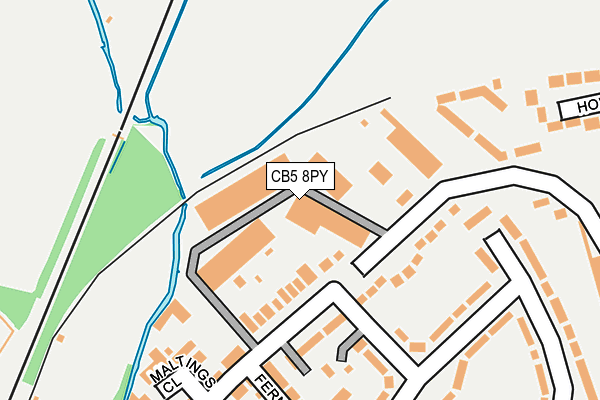
CB5 8PY is located in the Abbey electoral ward, within the local authority district of Cambridge and the English Parliamentary constituency of Cambridge. The Sub Integrated Care Board (ICB) Location is NHS Cambridgeshire and Peterborough ICB - 06H and the police force is Cambridgeshire. This postcode has been in use since December 1994.


GetTheData
Source: OS OpenMap – Local (Ordnance Survey)
Source: OS VectorMap District (Ordnance Survey)
Licence: Open Government Licence (requires attribution)
| Easting | 547479 |
| Northing | 259829 |
| Latitude | 52.216952 |
| Longitude | 0.157380 |
GetTheData
Source: Open Postcode Geo
Licence: Open Government Licence
| Country | England |
| Postcode District | CB5 |
➜ See where CB5 is on a map ➜ Where is Cambridge? | |
GetTheData
Source: Land Registry Price Paid Data
Licence: Open Government Licence
Elevation or altitude of CB5 8PY as distance above sea level:
| Metres | Feet | |
|---|---|---|
| Elevation | 10m | 33ft |
Elevation is measured from the approximate centre of the postcode, to the nearest point on an OS contour line from OS Terrain 50, which has contour spacing of ten vertical metres.
➜ How high above sea level am I? Find the elevation of your current position using your device's GPS.
GetTheData
Source: Open Postcode Elevation
Licence: Open Government Licence
| Ward | Abbey |
| Constituency | Cambridge |
GetTheData
Source: ONS Postcode Database
Licence: Open Government Licence
| Keynes Road (Dudley Road) | Cambridge | 403m |
| Izaak Walton Way (Fen Road) | Chesterton | 422m |
| Izaak Walton Way (Fen Road) | Chesterton | 427m |
| Ditton Walk (Newmarket Road) | Cambridge | 429m |
| Ditton Walk (Newmarket Road) | Cambridge | 442m |
| Cambridge Station | 2.9km |
GetTheData
Source: NaPTAN
Licence: Open Government Licence
GetTheData
Source: ONS Postcode Database
Licence: Open Government Licence


➜ Get more ratings from the Food Standards Agency
GetTheData
Source: Food Standards Agency
Licence: FSA terms & conditions
| Last Collection | |||
|---|---|---|---|
| Location | Mon-Fri | Sat | Distance |
| Ditton Walk | 18:15 | 12:00 | 395m |
| Fen Road | 18:00 | 12:15 | 445m |
| Fairbairns Road | 18:00 | 12:15 | 551m |
GetTheData
Source: Dracos
Licence: Creative Commons Attribution-ShareAlike
The below table lists the International Territorial Level (ITL) codes (formerly Nomenclature of Territorial Units for Statistics (NUTS) codes) and Local Administrative Units (LAU) codes for CB5 8PY:
| ITL 1 Code | Name |
|---|---|
| TLH | East |
| ITL 2 Code | Name |
| TLH1 | East Anglia |
| ITL 3 Code | Name |
| TLH12 | Cambridgeshire CC |
| LAU 1 Code | Name |
| E07000008 | Cambridge |
GetTheData
Source: ONS Postcode Directory
Licence: Open Government Licence
The below table lists the Census Output Area (OA), Lower Layer Super Output Area (LSOA), and Middle Layer Super Output Area (MSOA) for CB5 8PY:
| Code | Name | |
|---|---|---|
| OA | E00090520 | |
| LSOA | E01017945 | Cambridge 006C |
| MSOA | E02003724 | Cambridge 006 |
GetTheData
Source: ONS Postcode Directory
Licence: Open Government Licence
| CB5 8WT | Ditton Walk | 188m |
| CB5 8QE | Ditton Walk | 189m |
| CB5 8QG | Ferndale Rise | 192m |
| CB5 8EL | Century Close | 203m |
| CB5 8QQ | Ditton Fields | 214m |
| CB5 8EB | Maltings Close | 220m |
| CB5 8QD | Ditton Walk | 241m |
| CB5 8ET | Ferndale Rise | 244m |
| CB5 8QL | Ditton Fields | 252m |
| CB5 8EH | Abbey Gardens | 271m |
GetTheData
Source: Open Postcode Geo; Land Registry Price Paid Data
Licence: Open Government Licence