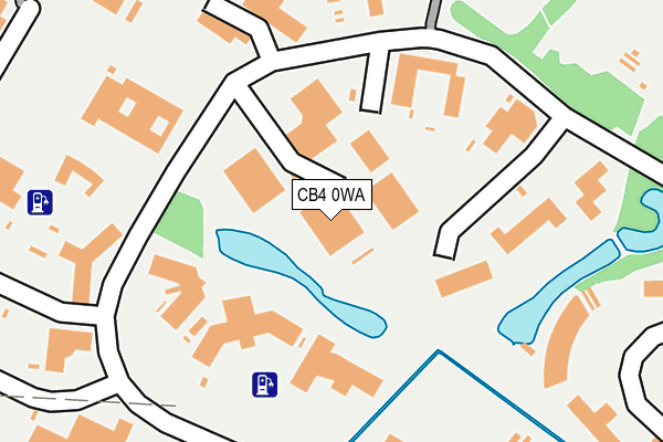
CB4 0WA is located in the Milton & Waterbeach electoral ward, within the local authority district of South Cambridgeshire and the English Parliamentary constituency of South East Cambridgeshire. The Sub Integrated Care Board (ICB) Location is NHS Cambridgeshire and Peterborough ICB - 06H and the police force is Cambridgeshire. This postcode has been in use since December 1998.


GetTheData
Source: OS OpenMap – Local (Ordnance Survey)
Source: OS VectorMap District (Ordnance Survey)
Licence: Open Government Licence (requires attribution)
| Easting | 546503 |
| Northing | 261800 |
| Latitude | 52.234920 |
| Longitude | 0.143958 |
GetTheData
Source: Open Postcode Geo
Licence: Open Government Licence
| Country | England |
| Postcode District | CB4 |
➜ See where CB4 is on a map ➜ Where is Cambridge? | |
GetTheData
Source: Land Registry Price Paid Data
Licence: Open Government Licence
Elevation or altitude of CB4 0WA as distance above sea level:
| Metres | Feet | |
|---|---|---|
| Elevation | 10m | 33ft |
Elevation is measured from the approximate centre of the postcode, to the nearest point on an OS contour line from OS Terrain 50, which has contour spacing of ten vertical metres.
➜ How high above sea level am I? Find the elevation of your current position using your device's GPS.
GetTheData
Source: Open Postcode Elevation
Licence: Open Government Licence
| Ward | Milton & Waterbeach |
| Constituency | South East Cambridgeshire |
GetTheData
Source: ONS Postcode Database
Licence: Open Government Licence
| The Busway Regional College (Cambridgeshire Guided Busway) | Cambridge | 505m |
| Science Park (Science Park Entrance) | Cambridge | 511m |
| Kirkwood Road (King's Hedges Road) | Kings Hedges | 513m |
| Kirkwood Road (King's Hedges Road) | Kings Hedges | 523m |
| Lovell Road (King's Hedges Road) | Kings Hedges | 530m |
| Cambridge Station | 4.6km |
| Waterbeach Station | 4.7km |
GetTheData
Source: NaPTAN
Licence: Open Government Licence
GetTheData
Source: ONS Postcode Database
Licence: Open Government Licence


➜ Get more ratings from the Food Standards Agency
GetTheData
Source: Food Standards Agency
Licence: FSA terms & conditions
| Last Collection | |||
|---|---|---|---|
| Location | Mon-Fri | Sat | Distance |
| Trinity Centre | 340m | ||
| Campkin Road | 18:00 | 12:45 | 756m |
| Kings Hedges Road Post Office | 17:30 | 12:00 | 783m |
GetTheData
Source: Dracos
Licence: Creative Commons Attribution-ShareAlike
The below table lists the International Territorial Level (ITL) codes (formerly Nomenclature of Territorial Units for Statistics (NUTS) codes) and Local Administrative Units (LAU) codes for CB4 0WA:
| ITL 1 Code | Name |
|---|---|
| TLH | East |
| ITL 2 Code | Name |
| TLH1 | East Anglia |
| ITL 3 Code | Name |
| TLH12 | Cambridgeshire CC |
| LAU 1 Code | Name |
| E07000012 | South Cambridgeshire |
GetTheData
Source: ONS Postcode Directory
Licence: Open Government Licence
The below table lists the Census Output Area (OA), Lower Layer Super Output Area (LSOA), and Middle Layer Super Output Area (MSOA) for CB4 0WA:
| Code | Name | |
|---|---|---|
| OA | E00092161 | |
| LSOA | E01018274 | South Cambridgeshire 007C |
| MSOA | E02003781 | South Cambridgeshire 007 |
GetTheData
Source: ONS Postcode Directory
Licence: Open Government Licence
| CB4 0WE | Science Park | 218m |
| CB4 2PD | Garry Drive | 418m |
| CB4 2QP | Lovell Road | 444m |
| CB4 2PB | Kings Hedges Road | 469m |
| CB4 2QW | Lovell Road | 488m |
| CB4 2PL | Kings Hedges Road | 514m |
| CB4 2PU | Lavender Road | 550m |
| CB4 2QD | Kings Hedges Road | 553m |
| CB4 2PN | St Kilda Avenue | 588m |
| CB4 2PY | Lavender Road | 595m |
GetTheData
Source: Open Postcode Geo; Land Registry Price Paid Data
Licence: Open Government Licence