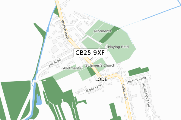
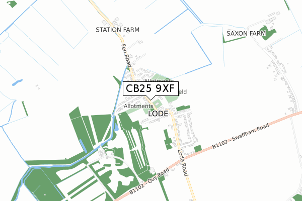
CB25 9XF is located in the Bottisham electoral ward, within the local authority district of East Cambridgeshire and the English Parliamentary constituency of South East Cambridgeshire. The Sub Integrated Care Board (ICB) Location is NHS Cambridgeshire and Peterborough ICB - 06H and the police force is Cambridgeshire. This postcode has been in use since November 2019.


GetTheData
Source: OS Open Zoomstack (Ordnance Survey)
Licence: Open Government Licence (requires attribution)
Attribution: Contains OS data © Crown copyright and database right 2025
Source: Open Postcode Geo
Licence: Open Government Licence (requires attribution)
Attribution: Contains OS data © Crown copyright and database right 2025; Contains Royal Mail data © Royal Mail copyright and database right 2025; Source: Office for National Statistics licensed under the Open Government Licence v.3.0
| Easting | 553344 |
| Northing | 262722 |
| Latitude | 52.241342 |
| Longitude | 0.244472 |
GetTheData
Source: Open Postcode Geo
Licence: Open Government Licence
| Country | England |
| Postcode District | CB25 |
➜ See where CB25 is on a map ➜ Where is Lode? | |
GetTheData
Source: Land Registry Price Paid Data
Licence: Open Government Licence
| Ward | Bottisham |
| Constituency | South East Cambridgeshire |
GetTheData
Source: ONS Postcode Database
Licence: Open Government Licence
| Fassage Close (High Street) | Lode | 65m |
| Fassage Close (High Street) | Lode | 65m |
| Anglesey Abbey (Quy Road) | Lode | 553m |
| Anglesey Abbey (Quy Road) | Lode | 570m |
| Quy Road (Lode Road) | Lode | 600m |
| Waterbeach Station | 4km |
GetTheData
Source: NaPTAN
Licence: Open Government Licence
GetTheData
Source: ONS Postcode Database
Licence: Open Government Licence


➜ Get more ratings from the Food Standards Agency
GetTheData
Source: Food Standards Agency
Licence: FSA terms & conditions
| Last Collection | |||
|---|---|---|---|
| Location | Mon-Fri | Sat | Distance |
| Lode Post Office | 17:30 | 11:15 | 6m |
| Northfields | 17:30 | 11:15 | 437m |
| Longmeadow | 17:30 | 11:15 | 1,134m |
GetTheData
Source: Dracos
Licence: Creative Commons Attribution-ShareAlike
The below table lists the International Territorial Level (ITL) codes (formerly Nomenclature of Territorial Units for Statistics (NUTS) codes) and Local Administrative Units (LAU) codes for CB25 9XF:
| ITL 1 Code | Name |
|---|---|
| TLH | East |
| ITL 2 Code | Name |
| TLH1 | East Anglia |
| ITL 3 Code | Name |
| TLH12 | Cambridgeshire CC |
| LAU 1 Code | Name |
| E07000009 | East Cambridgeshire |
GetTheData
Source: ONS Postcode Directory
Licence: Open Government Licence
The below table lists the Census Output Area (OA), Lower Layer Super Output Area (LSOA), and Middle Layer Super Output Area (MSOA) for CB25 9XF:
| Code | Name | |
|---|---|---|
| OA | E00090863 | |
| LSOA | E01018011 | East Cambridgeshire 009A |
| MSOA | E02003740 | East Cambridgeshire 009 |
GetTheData
Source: ONS Postcode Directory
Licence: Open Government Licence
| CB25 9EW | High Street | 28m |
| CB25 9EH | Fassage Close | 56m |
| CB25 9FW | High Street | 109m |
| CB25 9EX | Church Walk | 156m |
| CB25 9ER | Lode Road | 166m |
| CB25 9EP | Abbey Lane | 177m |
| CB25 9EN | Mill Road | 181m |
| CB25 9HG | Fairhaven Close | 183m |
| CB25 9HH | Fairhaven Close | 248m |
| CB25 9HB | Station Road | 255m |
GetTheData
Source: Open Postcode Geo; Land Registry Price Paid Data
Licence: Open Government Licence