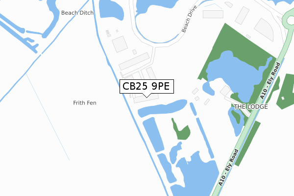
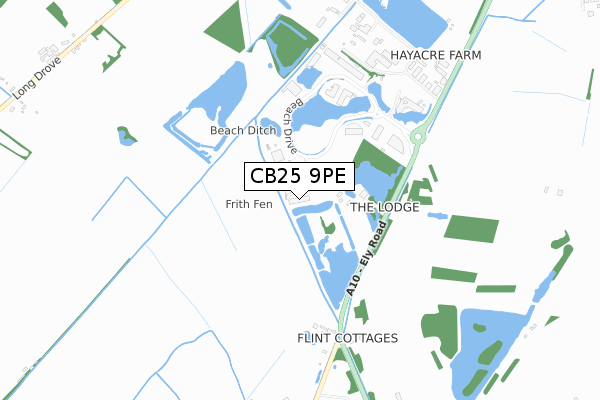
CB25 9PE is located in the Milton & Waterbeach electoral ward, within the local authority district of South Cambridgeshire and the English Parliamentary constituency of South East Cambridgeshire. The Sub Integrated Care Board (ICB) Location is NHS Cambridgeshire and Peterborough ICB - 06H and the police force is Cambridgeshire. This postcode has been in use since October 2018.


GetTheData
Source: OS Open Zoomstack (Ordnance Survey)
Licence: Open Government Licence (requires attribution)
Attribution: Contains OS data © Crown copyright and database right 2025
Source: Open Postcode Geo
Licence: Open Government Licence (requires attribution)
Attribution: Contains OS data © Crown copyright and database right 2025; Contains Royal Mail data © Royal Mail copyright and database right 2025; Source: Office for National Statistics licensed under the Open Government Licence v.3.0
| Easting | 547947 |
| Northing | 267687 |
| Latitude | 52.287423 |
| Longitude | 0.167664 |
GetTheData
Source: Open Postcode Geo
Licence: Open Government Licence
| Country | England |
| Postcode District | CB25 |
➜ See where CB25 is on a map | |
GetTheData
Source: Land Registry Price Paid Data
Licence: Open Government Licence
| Ward | Milton & Waterbeach |
| Constituency | South East Cambridgeshire |
GetTheData
Source: ONS Postcode Database
Licence: Open Government Licence
| Research Park Entrance (Cambridge Research Park Entrance) | Landbeach | 495m |
| Waterbeach Station | 3.4km |
GetTheData
Source: NaPTAN
Licence: Open Government Licence
GetTheData
Source: ONS Postcode Database
Licence: Open Government Licence


➜ Get more ratings from the Food Standards Agency
GetTheData
Source: Food Standards Agency
Licence: FSA terms & conditions
| Last Collection | |||
|---|---|---|---|
| Location | Mon-Fri | Sat | Distance |
| Cambridge Research Park | 17:45 | 560m | |
| Cambridge Research Park | 17:45 | 10:30 | 562m |
| Denny End | 17:15 | 11:15 | 2,084m |
GetTheData
Source: Dracos
Licence: Creative Commons Attribution-ShareAlike
The below table lists the International Territorial Level (ITL) codes (formerly Nomenclature of Territorial Units for Statistics (NUTS) codes) and Local Administrative Units (LAU) codes for CB25 9PE:
| ITL 1 Code | Name |
|---|---|
| TLH | East |
| ITL 2 Code | Name |
| TLH1 | East Anglia |
| ITL 3 Code | Name |
| TLH12 | Cambridgeshire CC |
| LAU 1 Code | Name |
| E07000012 | South Cambridgeshire |
GetTheData
Source: ONS Postcode Directory
Licence: Open Government Licence
The below table lists the Census Output Area (OA), Lower Layer Super Output Area (LSOA), and Middle Layer Super Output Area (MSOA) for CB25 9PE:
| Code | Name | |
|---|---|---|
| OA | E00092288 | |
| LSOA | E01018300 | South Cambridgeshire 004C |
| MSOA | E02003778 | South Cambridgeshire 004 |
GetTheData
Source: ONS Postcode Directory
Licence: Open Government Licence
| CB25 9PG | Ely Road | 656m |
| CB25 9QZ | Flint Lane | 698m |
| CB25 9FX | Glenmore Business Park | 723m |
| CB24 8RL | Long Drove | 1271m |
| CB25 9PQ | Ely Road | 1362m |
| CB24 8BW | Beach Road | 2062m |
| CB25 9FD | Green End | 2085m |
| CB25 9PB | Denny End Road | 2088m |
| CB25 9QH | Providence Way | 2114m |
| CB25 9QP | Pembroke Avenue | 2129m |
GetTheData
Source: Open Postcode Geo; Land Registry Price Paid Data
Licence: Open Government Licence