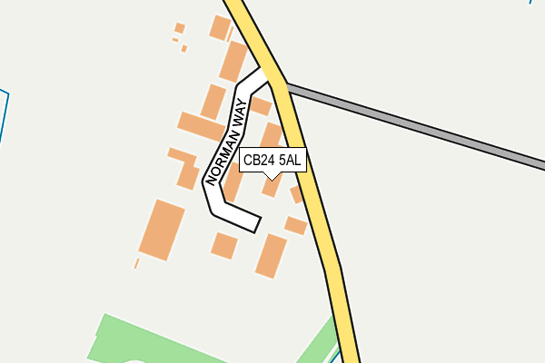
CB24 5AL is located in the Over & Willingham electoral ward, within the local authority district of South Cambridgeshire and the English Parliamentary constituency of South East Cambridgeshire. The Sub Integrated Care Board (ICB) Location is NHS Cambridgeshire and Peterborough ICB - 06H and the police force is Cambridgeshire. This postcode has been in use since June 2017.


GetTheData
Source: OS OpenMap – Local (Ordnance Survey)
Source: OS VectorMap District (Ordnance Survey)
Licence: Open Government Licence (requires attribution)
| Easting | 537895 |
| Northing | 269318 |
| Latitude | 52.304690 |
| Longitude | 0.021060 |
GetTheData
Source: Open Postcode Geo
Licence: Open Government Licence
| Country | England |
| Postcode District | CB24 |
➜ See where CB24 is on a map ➜ Where is Over? | |
GetTheData
Source: Land Registry Price Paid Data
Licence: Open Government Licence
| Ward | Over & Willingham |
| Constituency | South East Cambridgeshire |
GetTheData
Source: ONS Postcode Database
Licence: Open Government Licence
| Cromwell Park (Hill Road) | Over | 725m |
| Cromwell Park (Hill Road) | Over | 735m |
| Glover Street (Hilton Street) | Over | 934m |
| Glover Street (Hilton Street) | Over | 941m |
| Cox's End (Hill Road) | Over | 973m |
GetTheData
Source: NaPTAN
Licence: Open Government Licence
GetTheData
Source: ONS Postcode Database
Licence: Open Government Licence


➜ Get more ratings from the Food Standards Agency
GetTheData
Source: Food Standards Agency
Licence: FSA terms & conditions
| Last Collection | |||
|---|---|---|---|
| Location | Mon-Fri | Sat | Distance |
| West Street | 17:00 | 10:15 | 730m |
| Mill Road | 17:00 | 10:15 | 757m |
| Over Post Office | 17:00 | 10:00 | 1,364m |
GetTheData
Source: Dracos
Licence: Creative Commons Attribution-ShareAlike
The below table lists the International Territorial Level (ITL) codes (formerly Nomenclature of Territorial Units for Statistics (NUTS) codes) and Local Administrative Units (LAU) codes for CB24 5AL:
| ITL 1 Code | Name |
|---|---|
| TLH | East |
| ITL 2 Code | Name |
| TLH1 | East Anglia |
| ITL 3 Code | Name |
| TLH12 | Cambridgeshire CC |
| LAU 1 Code | Name |
| E07000012 | South Cambridgeshire |
GetTheData
Source: ONS Postcode Directory
Licence: Open Government Licence
The below table lists the Census Output Area (OA), Lower Layer Super Output Area (LSOA), and Middle Layer Super Output Area (MSOA) for CB24 5AL:
| Code | Name | |
|---|---|---|
| OA | E00092319 | |
| LSOA | E01018306 | South Cambridgeshire 001C |
| MSOA | E02003775 | South Cambridgeshire 001 |
GetTheData
Source: ONS Postcode Directory
Licence: Open Government Licence
| CB24 5QE | Norman Way Industrial Estate | 95m |
| CB24 5PP | Longstanton Road | 350m |
| CB24 5PW | Mustills Lane | 519m |
| CB24 5PT | Whines Lane | 597m |
| CB24 5PS | King Street | 665m |
| CB24 5PL | West Street | 676m |
| CB24 5PN | Unwins Lane | 767m |
| CB24 5PY | Mill Road | 771m |
| CB24 5PH | Tower Close | 814m |
| CB24 5PU | Hilton Street | 845m |
GetTheData
Source: Open Postcode Geo; Land Registry Price Paid Data
Licence: Open Government Licence