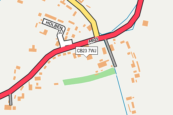
CB23 7WJ is located in the Harston & Comberton electoral ward, within the local authority district of South Cambridgeshire and the English Parliamentary constituency of South Cambridgeshire. The Sub Integrated Care Board (ICB) Location is NHS Cambridgeshire and Peterborough ICB - 06H and the police force is Cambridgeshire. This postcode has been in use since September 2006.


GetTheData
Source: OS OpenMap – Local (Ordnance Survey)
Source: OS VectorMap District (Ordnance Survey)
Licence: Open Government Licence (requires attribution)
| Easting | 541105 |
| Northing | 255263 |
| Latitude | 52.177583 |
| Longitude | 0.062217 |
GetTheData
Source: Open Postcode Geo
Licence: Open Government Licence
| Country | England |
| Postcode District | CB23 |
➜ See where CB23 is on a map ➜ Where is Barton? | |
GetTheData
Source: Land Registry Price Paid Data
Licence: Open Government Licence
Elevation or altitude of CB23 7WJ as distance above sea level:
| Metres | Feet | |
|---|---|---|
| Elevation | 20m | 66ft |
Elevation is measured from the approximate centre of the postcode, to the nearest point on an OS contour line from OS Terrain 50, which has contour spacing of ten vertical metres.
➜ How high above sea level am I? Find the elevation of your current position using your device's GPS.
GetTheData
Source: Open Postcode Elevation
Licence: Open Government Licence
| Ward | Harston & Comberton |
| Constituency | South Cambridgeshire |
GetTheData
Source: ONS Postcode Database
Licence: Open Government Licence
| Holben Close (Wimpole Road) | Barton | 64m |
| Holben Close (Wimpole Road) | Barton | 69m |
| Haslingfield Road (Wimpole Road) | Barton | 276m |
| Haslingfield Road (Wimpole Road) | Barton | 282m |
| Kings Grove (New Road) | Barton | 619m |
GetTheData
Source: NaPTAN
Licence: Open Government Licence
GetTheData
Source: ONS Postcode Database
Licence: Open Government Licence


➜ Get more ratings from the Food Standards Agency
GetTheData
Source: Food Standards Agency
Licence: FSA terms & conditions
| Last Collection | |||
|---|---|---|---|
| Location | Mon-Fri | Sat | Distance |
| Wimpole Road | 17:15 | 10:45 | 162m |
| Cambridge Road | 17:15 | 10:45 | 220m |
| Roman Hill | 17:15 | 10:45 | 507m |
GetTheData
Source: Dracos
Licence: Creative Commons Attribution-ShareAlike
The below table lists the International Territorial Level (ITL) codes (formerly Nomenclature of Territorial Units for Statistics (NUTS) codes) and Local Administrative Units (LAU) codes for CB23 7WJ:
| ITL 1 Code | Name |
|---|---|
| TLH | East |
| ITL 2 Code | Name |
| TLH1 | East Anglia |
| ITL 3 Code | Name |
| TLH12 | Cambridgeshire CC |
| LAU 1 Code | Name |
| E07000012 | South Cambridgeshire |
GetTheData
Source: ONS Postcode Directory
Licence: Open Government Licence
The below table lists the Census Output Area (OA), Lower Layer Super Output Area (LSOA), and Middle Layer Super Output Area (MSOA) for CB23 7WJ:
| Code | Name | |
|---|---|---|
| OA | E00091929 | |
| LSOA | E01018224 | South Cambridgeshire 009A |
| MSOA | E02003783 | South Cambridgeshire 009 |
GetTheData
Source: ONS Postcode Directory
Licence: Open Government Licence
| CB23 7AQ | Holben Close | 159m |
| CB23 7AB | Wimpole Road | 189m |
| CB23 7AL | College Farm Court | 223m |
| CB23 7BQ | Mailes Close | 346m |
| CB23 7BG | High Street | 371m |
| CB23 7AD | Wimpole Road | 424m |
| CB23 7BL | Allens Close | 427m |
| CB23 7AX | Roman Hill | 502m |
| CB23 7BH | Great Close | 518m |
| CB23 7AG | Haslingfield Road | 533m |
GetTheData
Source: Open Postcode Geo; Land Registry Price Paid Data
Licence: Open Government Licence