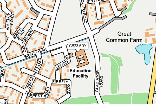
CB23 6DY is located in the Cambourne electoral ward, within the local authority district of South Cambridgeshire and the English Parliamentary constituency of South Cambridgeshire. The Sub Integrated Care Board (ICB) Location is NHS Cambridgeshire and Peterborough ICB - 06H and the police force is Cambridgeshire. This postcode has been in use since September 2006.


GetTheData
Source: OS OpenMap – Local (Ordnance Survey)
Source: OS VectorMap District (Ordnance Survey)
Licence: Open Government Licence (requires attribution)
| Easting | 533111 |
| Northing | 259242 |
| Latitude | 52.215320 |
| Longitude | -0.053056 |
GetTheData
Source: Open Postcode Geo
Licence: Open Government Licence
| Country | England |
| Postcode District | CB23 |
➜ See where CB23 is on a map ➜ Where is Cambourne? | |
GetTheData
Source: Land Registry Price Paid Data
Licence: Open Government Licence
Elevation or altitude of CB23 6DY as distance above sea level:
| Metres | Feet | |
|---|---|---|
| Elevation | 70m | 230ft |
Elevation is measured from the approximate centre of the postcode, to the nearest point on an OS contour line from OS Terrain 50, which has contour spacing of ten vertical metres.
➜ How high above sea level am I? Find the elevation of your current position using your device's GPS.
GetTheData
Source: Open Postcode Elevation
Licence: Open Government Licence
| Ward | Cambourne |
| Constituency | South Cambridgeshire |
GetTheData
Source: ONS Postcode Database
Licence: Open Government Licence
| Lysander Close (Sterling Way) | Upper Cambourne | 315m |
| Whitley Road (Lancaster Gate) | Upper Cambourne | 409m |
| Hampden Close (Sterling Way) | Upper Cambourne | 515m |
| Hurricane Way (Sterling Way) | Upper Cambourne | 538m |
| Play Area (Back Lane) | Upper Cambourne | 715m |
GetTheData
Source: NaPTAN
Licence: Open Government Licence
GetTheData
Source: ONS Postcode Database
Licence: Open Government Licence


➜ Get more ratings from the Food Standards Agency
GetTheData
Source: Food Standards Agency
Licence: FSA terms & conditions
| Last Collection | |||
|---|---|---|---|
| Location | Mon-Fri | Sat | Distance |
| Monkfield Lane | 17:00 | 10:30 | 1,079m |
| Monks Drive | 17:30 | 11:00 | 1,202m |
| Broadway | 16:00 | 09:45 | 1,507m |
GetTheData
Source: Dracos
Licence: Creative Commons Attribution-ShareAlike
The below table lists the International Territorial Level (ITL) codes (formerly Nomenclature of Territorial Units for Statistics (NUTS) codes) and Local Administrative Units (LAU) codes for CB23 6DY:
| ITL 1 Code | Name |
|---|---|
| TLH | East |
| ITL 2 Code | Name |
| TLH1 | East Anglia |
| ITL 3 Code | Name |
| TLH12 | Cambridgeshire CC |
| LAU 1 Code | Name |
| E07000012 | South Cambridgeshire |
GetTheData
Source: ONS Postcode Directory
Licence: Open Government Licence
The below table lists the Census Output Area (OA), Lower Layer Super Output Area (LSOA), and Middle Layer Super Output Area (MSOA) for CB23 6DY:
| Code | Name | |
|---|---|---|
| OA | E00170812 | |
| LSOA | E01033119 | South Cambridgeshire 020E |
| MSOA | E02006873 | South Cambridgeshire 020 |
GetTheData
Source: ONS Postcode Directory
Licence: Open Government Licence
| CB23 6FS | Welkin Way | 95m |
| CB23 6FW | Firefly Road | 160m |
| CB23 6FJ | Mosquito Road | 168m |
| CB23 6FU | Westland Close | 204m |
| CB23 6HW | Tempest Road | 209m |
| CB23 6DU | Oxford Way | 213m |
| CB23 6FN | Spitfire Road | 216m |
| CB23 6HU | Siskin Road | 252m |
| CB23 6HT | Brace Dein | 270m |
| CB23 6HS | Whitley Road | 288m |
GetTheData
Source: Open Postcode Geo; Land Registry Price Paid Data
Licence: Open Government Licence