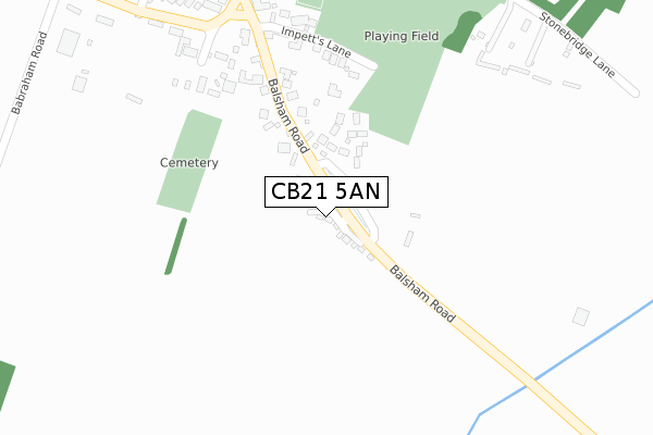
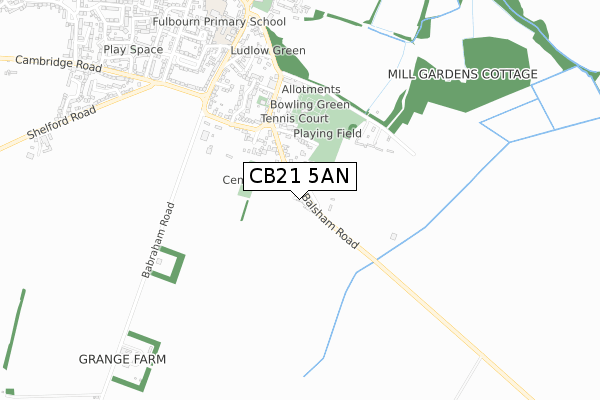
CB21 5AN is located in the Fen Ditton & Fulbourn electoral ward, within the local authority district of South Cambridgeshire and the English Parliamentary constituency of South East Cambridgeshire. The Sub Integrated Care Board (ICB) Location is NHS Cambridgeshire and Peterborough ICB - 06H and the police force is Cambridgeshire. This postcode has been in use since January 2020.


GetTheData
Source: OS Open Zoomstack (Ordnance Survey)
Licence: Open Government Licence (requires attribution)
Attribution: Contains OS data © Crown copyright and database right 2024
Source: Open Postcode Geo
Licence: Open Government Licence (requires attribution)
Attribution: Contains OS data © Crown copyright and database right 2024; Contains Royal Mail data © Royal Mail copyright and database right 2024; Source: Office for National Statistics licensed under the Open Government Licence v.3.0
| Easting | 552255 |
| Northing | 255382 |
| Latitude | 52.175704 |
| Longitude | 0.225238 |
GetTheData
Source: Open Postcode Geo
Licence: Open Government Licence
| Country | England |
| Postcode District | CB21 |
➜ See where CB21 is on a map | |
GetTheData
Source: Land Registry Price Paid Data
Licence: Open Government Licence
| Ward | Fen Ditton & Fulbourn |
| Constituency | South East Cambridgeshire |
GetTheData
Source: ONS Postcode Database
Licence: Open Government Licence
| Impetts Lane (Balsham Road) | Fulbourn | 293m |
| Impetts Lane (Balsham Road) | Fulbourn | 297m |
| Babraham Road (Cambridge Road) | Fulbourn | 658m |
| Babraham Road (Cambridge Road) | Fulbourn | 688m |
| Six Bells (High Street) | Fulbourn | 877m |
GetTheData
Source: NaPTAN
Licence: Open Government Licence
GetTheData
Source: ONS Postcode Database
Licence: Open Government Licence


➜ Get more ratings from the Food Standards Agency
GetTheData
Source: Food Standards Agency
Licence: FSA terms & conditions
| Last Collection | |||
|---|---|---|---|
| Location | Mon-Fri | Sat | Distance |
| Home End | 17:30 | 11:45 | 385m |
| Mill Hill | 17:30 | 11:45 | 821m |
| Fulbourn Post Office | 17:45 | 11:30 | 840m |
GetTheData
Source: Dracos
Licence: Creative Commons Attribution-ShareAlike
The below table lists the International Territorial Level (ITL) codes (formerly Nomenclature of Territorial Units for Statistics (NUTS) codes) and Local Administrative Units (LAU) codes for CB21 5AN:
| ITL 1 Code | Name |
|---|---|
| TLH | East |
| ITL 2 Code | Name |
| TLH1 | East Anglia |
| ITL 3 Code | Name |
| TLH12 | Cambridgeshire CC |
| LAU 1 Code | Name |
| E07000012 | South Cambridgeshire |
GetTheData
Source: ONS Postcode Directory
Licence: Open Government Licence
The below table lists the Census Output Area (OA), Lower Layer Super Output Area (LSOA), and Middle Layer Super Output Area (MSOA) for CB21 5AN:
| Code | Name | |
|---|---|---|
| OA | E00092017 | |
| LSOA | E01018244 | South Cambridgeshire 011C |
| MSOA | E02003785 | South Cambridgeshire 011 |
GetTheData
Source: ONS Postcode Directory
Licence: Open Government Licence
| CB21 5DD | Barnsfield | 121m |
| CB21 5DB | Jeeves Acre | 147m |
| CB21 5BZ | Balsham Road | 183m |
| CB21 5BX | Sanders Lane | 275m |
| CB21 5BY | Impetts Lane | 292m |
| CB21 5BS | Home End | 415m |
| CB21 5BT | Doggets Lane | 417m |
| CB21 5BW | Stonebridge Lane | 421m |
| CB21 5AF | Rushden Close | 485m |
| CB21 5BU | Geoffrey Bishop Avenue | 494m |
GetTheData
Source: Open Postcode Geo; Land Registry Price Paid Data
Licence: Open Government Licence