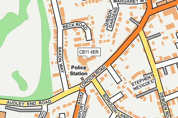
CB11 4ER is located in the Saffron Walden Audley electoral ward, within the local authority district of Uttlesford and the English Parliamentary constituency of Saffron Walden. The Sub Integrated Care Board (ICB) Location is NHS Hertfordshire and West Essex ICB - 07H and the police force is Essex. This postcode has been in use since February 1990.


GetTheData
Source: OS OpenMap – Local (Ordnance Survey)
Source: OS VectorMap District (Ordnance Survey)
Licence: Open Government Licence (requires attribution)
| Easting | 553590 |
| Northing | 237983 |
| Latitude | 52.019014 |
| Longitude | 0.236882 |
GetTheData
Source: Open Postcode Geo
Licence: Open Government Licence
| Country | England |
| Postcode District | CB11 |
➜ See where CB11 is on a map ➜ Where is Saffron Walden? | |
GetTheData
Source: Land Registry Price Paid Data
Licence: Open Government Licence
Elevation or altitude of CB11 4ER as distance above sea level:
| Metres | Feet | |
|---|---|---|
| Elevation | 60m | 197ft |
Elevation is measured from the approximate centre of the postcode, to the nearest point on an OS contour line from OS Terrain 50, which has contour spacing of ten vertical metres.
➜ How high above sea level am I? Find the elevation of your current position using your device's GPS.
GetTheData
Source: Open Postcode Elevation
Licence: Open Government Licence
| Ward | Saffron Walden Audley |
| Constituency | Saffron Walden |
GetTheData
Source: ONS Postcode Database
Licence: Open Government Licence
| Council Offices (London Road) | Saffron Walden | 56m |
| Council Offices (London Road) | Saffron Walden | 61m |
| Lower School Gate (Audley End Road) | Saffron Walden | 220m |
| Station Road (Debden Road) | Saffron Walden | 237m |
| Lower School Gate (Audley End Road) | Saffron Walden | 238m |
| Audley End Station | 2.6km |
| Newport (Essex) Station | 4.6km |
| Great Chesterford Station | 5.4km |
GetTheData
Source: NaPTAN
Licence: Open Government Licence
GetTheData
Source: ONS Postcode Database
Licence: Open Government Licence


➜ Get more ratings from the Food Standards Agency
GetTheData
Source: Food Standards Agency
Licence: FSA terms & conditions
| Last Collection | |||
|---|---|---|---|
| Location | Mon-Fri | Sat | Distance |
| Borough Lane | 17:45 | 12:00 | 71m |
| High Street | 17:30 | 12:00 | 289m |
| Station Street | 17:30 | 12:00 | 369m |
GetTheData
Source: Dracos
Licence: Creative Commons Attribution-ShareAlike
The below table lists the International Territorial Level (ITL) codes (formerly Nomenclature of Territorial Units for Statistics (NUTS) codes) and Local Administrative Units (LAU) codes for CB11 4ER:
| ITL 1 Code | Name |
|---|---|
| TLH | East |
| ITL 2 Code | Name |
| TLH3 | Essex |
| ITL 3 Code | Name |
| TLH35 | West Essex |
| LAU 1 Code | Name |
| E07000077 | Uttlesford |
GetTheData
Source: ONS Postcode Directory
Licence: Open Government Licence
The below table lists the Census Output Area (OA), Lower Layer Super Output Area (LSOA), and Middle Layer Super Output Area (MSOA) for CB11 4ER:
| Code | Name | |
|---|---|---|
| OA | E00112168 | |
| LSOA | E01022075 | Uttlesford 001B |
| MSOA | E02004591 | Uttlesford 001 |
GetTheData
Source: ONS Postcode Directory
Licence: Open Government Licence
| CB11 4EG | Saxon Way | 96m |
| CB11 4EH | Beck Road | 96m |
| CB11 4EF | Little Larchmount | 119m |
| CB11 4EQ | Saxon Way | 129m |
| CB11 4ED | London Road | 129m |
| CB11 4AF | Borough Lane | 135m |
| CB10 1AW | Gibson Gardens | 137m |
| CB11 4FS | Boytons Acre | 172m |
| CB11 4DX | Stephen Neville Court | 184m |
| CB11 4EB | Barnards Yard | 200m |
GetTheData
Source: Open Postcode Geo; Land Registry Price Paid Data
Licence: Open Government Licence